Mercy Tillinghast Brown
| Birth | : | 1706 East Greenwich, Kent County, Rhode Island, USA |
| Death | : | 17 Oct 1761 Providence, Providence County, Rhode Island, USA |
| Burial | : | Locust Grove Cemetery, Quakertown, Hunterdon County, USA |
| Coordinate | : | 40.5695469, -74.9490572 |
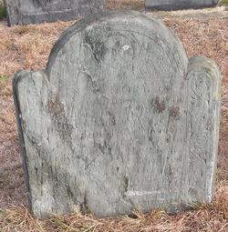
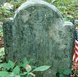
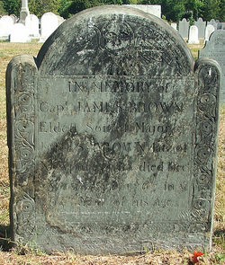
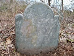
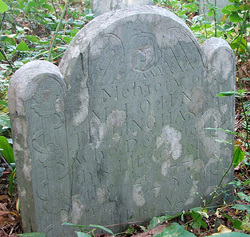
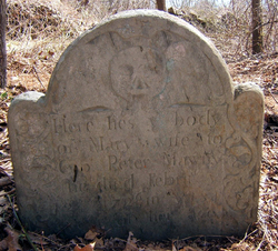
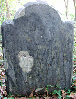
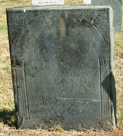
| Inscription | : | aged 55 |
| Description | : | Mercy was the daughter of Pardon Tillinghast and Mary Keech of East Greenwich, Rhode Island. Since she died in October 1761 "in her 55th year", she was born between October 1706 and October 1707. Since her brother Philip was born 5 November 1707, her birth year was most likely 1706. Mercy was married first in East Greenwich on 14 February 1728/9 to Peter Mawney, the son of Moses LeMoine, an original proprietor of the French Huguenot settlement in East Greenwich. Peter had previously married Mercy's older sister, Mary, who died at an early age. Mercy and Peter... Read More |
frequently asked questions (FAQ):
-
Where is Mercy Tillinghast Brown's memorial?
Mercy Tillinghast Brown's memorial is located at: Locust Grove Cemetery, Quakertown, Hunterdon County, USA.
-
When did Mercy Tillinghast Brown death?
Mercy Tillinghast Brown death on 17 Oct 1761 in Providence, Providence County, Rhode Island, USA
-
Where are the coordinates of the Mercy Tillinghast Brown's memorial?
Latitude: 40.5695469
Longitude: -74.9490572
Family Members:
Parent
Spouse
Siblings
Children
Flowers:
Nearby Cemetories:
1. Locust Grove Cemetery
Quakertown, Hunterdon County, USA
Coordinate: 40.5695469, -74.9490572
2. Friends Cemetery
Pittstown, Hunterdon County, USA
Coordinate: 40.5667700, -74.9437100
3. Nixon Cemetery
Quakertown, Hunterdon County, USA
Coordinate: 40.5517650, -74.9413490
4. Saint Thomas Episcopal Church Cemetery
Pittstown, Hunterdon County, USA
Coordinate: 40.5606900, -74.9890000
5. Cherryville Mountainview Cemetery
Flemington, Hunterdon County, USA
Coordinate: 40.5632629, -74.9038925
6. Mount Salem Methodist Cemetery
Mount Salem, Hunterdon County, USA
Coordinate: 40.6057200, -74.9831300
7. Old Bethlehem Presbyterian Churchyard
Grandin, Hunterdon County, USA
Coordinate: 40.6178130, -74.9357160
8. Bethlehem Cemetery
Union, Hunterdon County, USA
Coordinate: 40.6180573, -74.9341660
9. Union Cemetery
Grandin, Hunterdon County, USA
Coordinate: 40.6185417, -74.9362488
10. Oak Summit Cemetery
Kingwood, Hunterdon County, USA
Coordinate: 40.5419000, -75.0051000
11. Everittstown Methodist Cemetery
Everittstown, Hunterdon County, USA
Coordinate: 40.5655823, -75.0279922
12. Baptistown Cemetery
Baptistown, Hunterdon County, USA
Coordinate: 40.5240100, -75.0061190
13. Slacktown Cemetery
Kingwood, Hunterdon County, USA
Coordinate: 40.5102778, -74.9797222
14. Allerton Methodist Cemetery
Annandale, Hunterdon County, USA
Coordinate: 40.6111107, -74.8797226
15. Newell Cemetery
Stanton, Hunterdon County, USA
Coordinate: 40.5718994, -74.8582993
16. Clinton Baptist Church Cemetery
Clinton, Hunterdon County, USA
Coordinate: 40.6335030, -74.9071198
17. Clinton Presbyterian Churchyard
Clinton, Hunterdon County, USA
Coordinate: 40.6393000, -74.9076500
18. Riverside Cemetery
Clinton, Hunterdon County, USA
Coordinate: 40.6395800, -74.9067700
19. Old Saint Mary Cemetery
Clinton, Hunterdon County, USA
Coordinate: 40.6440964, -74.9116669
20. Bethlehem Baptist Cemetery
Pattenburg, Hunterdon County, USA
Coordinate: 40.6418076, -74.9937515
21. Mount Pleasant Cemetery
Mount Pleasant, Hunterdon County, USA
Coordinate: 40.5835267, -75.0536867
22. Evergreen Cemetery
Clinton, Hunterdon County, USA
Coordinate: 40.6451378, -74.9116669
23. Saint Magdalen Cemetery
Flemington, Hunterdon County, USA
Coordinate: 40.5174500, -74.8668250
24. Carmelite Monastery Cemetery
Flemington, Hunterdon County, USA
Coordinate: 40.4976610, -74.8980680

