| Memorials | : | 0 |
| Location | : | Baptistown, Hunterdon County, USA |
| Coordinate | : | 40.5240100, -75.0061190 |
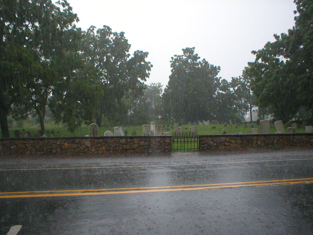
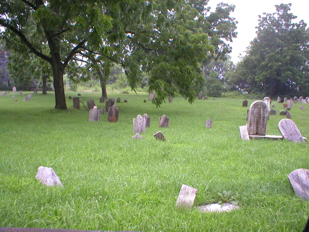
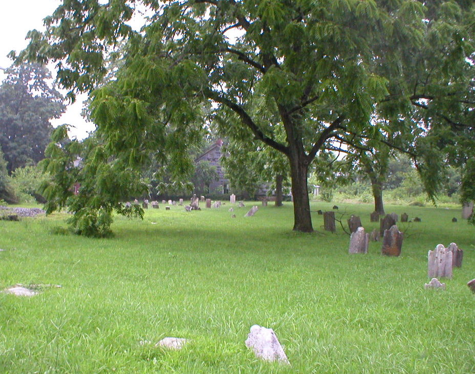
| Description | : | The old cemetery is in very poor condition with many stones broken or indecipherable. It is located next to the Baptistown post office on Rt. 519 a few hundred yards from the traffic light in the center of Baptistown. The old church was located there before relocating to the other side of Route 519 down the road a bit where the newer cemetery is located. |
frequently asked questions (FAQ):
-
Where is Baptistown Cemetery?
Baptistown Cemetery is located at Baptistown, Hunterdon County ,New Jersey ,USA.
-
Baptistown Cemetery cemetery's updated grave count on graveviews.com?
0 memorials
-
Where are the coordinates of the Baptistown Cemetery?
Latitude: 40.5240100
Longitude: -75.0061190
Nearby Cemetories:
1. Oak Summit Cemetery
Kingwood, Hunterdon County, USA
Coordinate: 40.5419000, -75.0051000
2. Slacktown Cemetery
Kingwood, Hunterdon County, USA
Coordinate: 40.5102778, -74.9797222
3. Saint Thomas Episcopal Church Cemetery
Pittstown, Hunterdon County, USA
Coordinate: 40.5606900, -74.9890000
4. Frenchtown Cemetery
Frenchtown, Hunterdon County, USA
Coordinate: 40.5237503, -75.0605545
5. Everittstown Methodist Cemetery
Everittstown, Hunterdon County, USA
Coordinate: 40.5655823, -75.0279922
6. Erwin Family Cemetery
Erwinna, Bucks County, USA
Coordinate: 40.5279105, -75.0674030
7. Old School Baptist Cemetery
Locktown, Hunterdon County, USA
Coordinate: 40.4844290, -74.9725060
8. Locktown Christian Cemetery
Locktown, Hunterdon County, USA
Coordinate: 40.4820137, -74.9694443
9. Nixon Cemetery
Quakertown, Hunterdon County, USA
Coordinate: 40.5517650, -74.9413490
10. Upper Tinicum Cemetery
Upper Black Eddy, Bucks County, USA
Coordinate: 40.5292650, -75.0822933
11. Locust Grove Cemetery
Quakertown, Hunterdon County, USA
Coordinate: 40.5695469, -74.9490572
12. Friends Cemetery
Pittstown, Hunterdon County, USA
Coordinate: 40.5667700, -74.9437100
13. Mount Pleasant Cemetery
Mount Pleasant, Hunterdon County, USA
Coordinate: 40.5835267, -75.0536867
14. Marshall-Cooper-Ridge Cemetery
Tinicum, Bucks County, USA
Coordinate: 40.4890160, -75.0906330
15. Methodist Episcopal Church Cemetery
Kingwood, Hunterdon County, USA
Coordinate: 40.4508800, -75.0097800
16. Pine Hill Cemetery
Sergeantsville, Hunterdon County, USA
Coordinate: 40.4580498, -74.9622192
17. Pursell Burying Ground
Upper Black Eddy, Bucks County, USA
Coordinate: 40.5584410, -75.0933950
18. Milford Union Cemetery
Milford, Hunterdon County, USA
Coordinate: 40.5667000, -75.0922012
19. Williamson Farm Family Cemetery
Stockton, Hunterdon County, USA
Coordinate: 40.4457220, -74.9818690
20. Milford Christian Churchyard
Milford, Hunterdon County, USA
Coordinate: 40.5685425, -75.0972214
21. Mount Salem Methodist Cemetery
Mount Salem, Hunterdon County, USA
Coordinate: 40.6057200, -74.9831300
22. Kitchen Cemetery
Sand Brook, Hunterdon County, USA
Coordinate: 40.4803810, -74.9092480
23. Carmelite Monastery Cemetery
Flemington, Hunterdon County, USA
Coordinate: 40.4976610, -74.8980680
24. Cherryville Mountainview Cemetery
Flemington, Hunterdon County, USA
Coordinate: 40.5632629, -74.9038925


