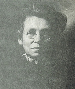
| Birth | : | 28 Mar 1837 Hamilton County, Illinois, USA |
| Death | : | 24 Dec 1865 Stockton, San Joaquin County, California, USA |
| Burial | : | Stockton State Hospital Cemetery, Stockton, San Joaquin County, USA |
| Coordinate | : | 37.9663110, -121.2846850 |
| Description | : | Merrill Lane. Committed by Ogden Squires Judge of El Dorado Co. November 30th 1864. Age thirty years; native of Illinois - single; was last from Salt Lake - has been in this State three years - occupation, miner. The evidence of his insanity is, his conduct habitually - is homicidal. It is not known when this attack first appeared - the case is not a recent one - disease increasing with no rational intervals. He is dangerous from a disposition to kill or injure others with anything he can get hold of from sudden passion - is not filthy or... Read More |
frequently asked questions (FAQ):
-
Where is Merrill Lane's memorial?
Merrill Lane's memorial is located at: Stockton State Hospital Cemetery, Stockton, San Joaquin County, USA.
-
When did Merrill Lane death?
Merrill Lane death on 24 Dec 1865 in Stockton, San Joaquin County, California, USA
-
Where are the coordinates of the Merrill Lane's memorial?
Latitude: 37.9663110
Longitude: -121.2846850
Family Members:
Parent
Siblings
Flowers:
Nearby Cemetories:
1. Stockton State Hospital Cemetery
Stockton, San Joaquin County, USA
Coordinate: 37.9663110, -121.2846850
2. San Joaquin Catholic Cemetery
Stockton, San Joaquin County, USA
Coordinate: 37.9707830, -121.2850190
3. Temple Israel Cemetery
Stockton, San Joaquin County, USA
Coordinate: 37.9640541, -121.2784348
4. Casa Bonita Mausoleum
Stockton, San Joaquin County, USA
Coordinate: 37.9752340, -121.2877800
5. Stockton Woodland Mausoleum
Stockton, San Joaquin County, USA
Coordinate: 37.9762400, -121.2878000
6. Thomas Lindsay Gravesite
San Joaquin County, USA
Coordinate: 37.9573110, -121.2918430
7. David Kelsey Gravesite
Stockton, San Joaquin County, USA
Coordinate: 37.9573110, -121.2918430
8. Citizens Cemetery
Stockton, San Joaquin County, USA
Coordinate: 37.9559410, -121.2769120
9. Stockton Rural Cemetery
Stockton, San Joaquin County, USA
Coordinate: 37.9794006, -121.2869034
10. Central United Methodist Church Columbarium
Stockton, San Joaquin County, USA
Coordinate: 37.9825710, -121.3078170
11. Chinese Cemetery
French Camp, San Joaquin County, USA
Coordinate: 37.8819962, -121.2805862
12. Congregation Adas Yeshuran of Stockton Cemetery
French Camp, San Joaquin County, USA
Coordinate: 37.8784065, -121.2740784
13. Congregation of Ahavas Achim Cemetery
French Camp, San Joaquin County, USA
Coordinate: 37.8778419, -121.2753067
14. Park View Cemetery
Manteca, San Joaquin County, USA
Coordinate: 37.8617249, -121.2238312
15. Live Oak Cemetery
Lodi, San Joaquin County, USA
Coordinate: 38.0868760, -121.2874780
16. Collegeville Cemetery
Collegeville, San Joaquin County, USA
Coordinate: 37.9044800, -121.1466141
17. Cherokee Memorial Park
Lodi, San Joaquin County, USA
Coordinate: 38.1017303, -121.2585983
18. Islamic Cemetery of California
Lodi, San Joaquin County, USA
Coordinate: 38.1091730, -121.2563590
19. Saint John The Baptist Episcopal Columbarium
Lodi, San Joaquin County, USA
Coordinate: 38.1213500, -121.3074400
20. East Union Cemetery
Manteca, San Joaquin County, USA
Coordinate: 37.8114014, -121.2350006
21. Linden Cemetery
Linden, San Joaquin County, USA
Coordinate: 38.0226707, -121.0889053
22. Lodi Memorial Park and Cemetery
Lodi, San Joaquin County, USA
Coordinate: 38.1319008, -121.2455978
23. Atlanta Cemetery
Five Corners, San Joaquin County, USA
Coordinate: 37.8270035, -121.1420135
24. Woodbridge Masonic Cemetery
Woodbridge, San Joaquin County, USA
Coordinate: 38.1496506, -121.3016663


