Michael Denson Keith
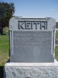
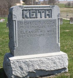
| Birth | : | 4 Apr 1818 Ohio, USA |
| Death | : | 8 Jan 1914 USA |
| Burial | : | Corvallis Cemetery, Corvallis, Ravalli County, USA |
| Coordinate | : | 46.2991982, -114.1003036 |
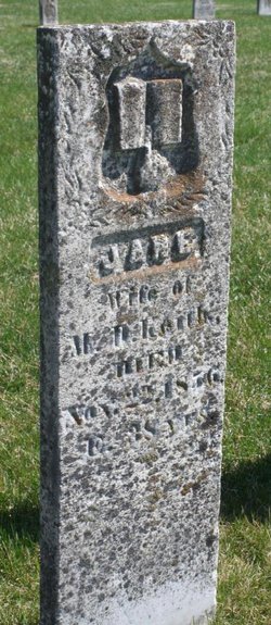
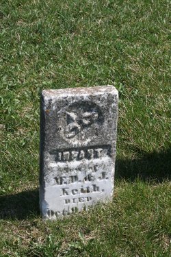
| Description | : | 1st wife Maria. 2nd wife Jane Simmons Keith (1828-1856) m. about 1849. 3rd wife Eleanor Walston Keith (1832-1880) m. about 1858. Father of infant son with Jane. Father of Steward Leo Keith and Helen Jennie Keith with Eleanor. |
frequently asked questions (FAQ):
-
Where is Michael Denson Keith's memorial?
Michael Denson Keith's memorial is located at: Corvallis Cemetery, Corvallis, Ravalli County, USA.
-
When did Michael Denson Keith death?
Michael Denson Keith death on 8 Jan 1914 in USA
-
Where are the coordinates of the Michael Denson Keith's memorial?
Latitude: 46.2991982
Longitude: -114.1003036
Family Members:
Parent
Spouse
Siblings
Children
Flowers:
Nearby Cemetories:
1. Corvallis Cemetery
Corvallis, Ravalli County, USA
Coordinate: 46.2991982, -114.1003036
2. Blodgett Cemetery
Ravalli County, USA
Coordinate: 46.2886009, -114.1868973
3. Riverview Cemetery
Hamilton, Ravalli County, USA
Coordinate: 46.2456017, -114.1803970
4. Pinesdale Cemetery
Pinesdale, Ravalli County, USA
Coordinate: 46.3255100, -114.2134000
5. Grantsdale Cemetery
Hamilton, Ravalli County, USA
Coordinate: 46.1819000, -114.1442032
6. Victor Cemetery
Victor, Ravalli County, USA
Coordinate: 46.4268610, -114.1568680
7. Riverside Cemetery
Stevensville, Ravalli County, USA
Coordinate: 46.4986000, -114.0982971
8. Maplewood Cemetery
Stevensville, Ravalli County, USA
Coordinate: 46.5042000, -114.0963974
9. Saint Marys Cemetery
Stevensville, Ravalli County, USA
Coordinate: 46.5093994, -114.0986023
10. Lone Pine Cemetery
Darby, Ravalli County, USA
Coordinate: 46.0289001, -114.1742020
11. Sunnyside Cemetery
Stevensville, Ravalli County, USA
Coordinate: 46.5657997, -113.9916992
12. Saint Josephs Cemetery
Florence, Ravalli County, USA
Coordinate: 46.6294000, -114.0861000
13. Carlton Cemetery
Lolo, Missoula County, USA
Coordinate: 46.6788880, -114.0791560
14. Sula Cemetery
Sula, Ravalli County, USA
Coordinate: 45.8591995, -113.9777985
15. Tolan Creek Cemetery
Sula, Ravalli County, USA
Coordinate: 45.8560318, -113.9134116
16. Woodman Pioneer Cemetery
Lolo, Missoula County, USA
Coordinate: 46.7675000, -114.2676000
17. Fort Missoula Cemetery
Missoula, Missoula County, USA
Coordinate: 46.8469009, -114.0570984
18. Brickley Cemetery
Darby, Ravalli County, USA
Coordinate: 45.7648000, -114.2786900
19. Western Montana State Veterans Cemetery
Missoula, Missoula County, USA
Coordinate: 46.8531100, -114.0563600
20. Philipsburg Cemetery
Philipsburg, Granite County, USA
Coordinate: 46.3408990, -113.2961010
21. Holy Spirit Episcopal Church Columbarium
Missoula, Missoula County, USA
Coordinate: 46.8642000, -113.9963000
22. Sunset Memorial Gardens
Missoula, Missoula County, USA
Coordinate: 46.8902779, -114.1001740
23. Saint Mary Cemetery
Missoula, Missoula County, USA
Coordinate: 46.8865070, -113.9995050
24. Missoula Cemetery
Missoula, Missoula County, USA
Coordinate: 46.8910904, -114.0185471

