Michael H Sullivan
| Birth | : | 20 Sep 1824 County Cork, Ireland |
| Death | : | 14 Jul 1881 Spalding, Greeley County, Nebraska, USA |
| Burial | : | St. Joseph's Cemetery, Fort Thompson, Buffalo County, USA |
| Coordinate | : | 44.0633011, -99.4642029 |
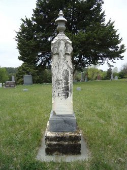
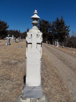
| Inscription | : | age 57 yrs 9 mon 15 da; husband of Anna Brennan |
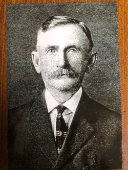
| Description | : | Family name may have originally been O'Sullivan. Married Anna Mary Brennan in 1851 at Boston, Mass. They had several children. The family had lived in several places including Ohio and Mauston, Juneau County, Wisconsin. Six of their children were born here. They then settling in Cedar Creek, Greeley County, Nebraska around 1876. Eventually moving to Spalding, Greeley County, Nebraska∼SULLIVAN--Michael Sullivan, one of the first settlers in Greeley county, died at his home, July 14th, aged 58 years. The Boone county Argus says: "He was conscious to the last, and after calling his family to his... Read More |
frequently asked questions (FAQ):
-
Where is Michael H Sullivan's memorial?
Michael H Sullivan's memorial is located at: St. Joseph's Cemetery, Fort Thompson, Buffalo County, USA.
-
When did Michael H Sullivan death?
Michael H Sullivan death on 14 Jul 1881 in Spalding, Greeley County, Nebraska, USA
-
Where are the coordinates of the Michael H Sullivan's memorial?
Latitude: 44.0633011
Longitude: -99.4642029
Family Members:
Spouse
Children
Flowers:
Nearby Cemetories:
1. St. Joseph's Cemetery
Fort Thompson, Buffalo County, USA
Coordinate: 44.0633011, -99.4642029
2. Lake View Cemetery
Fort Thompson, Buffalo County, USA
Coordinate: 44.0629979, -99.4640623
3. Christ Episcopal Cemetery
Fort Thompson, Buffalo County, USA
Coordinate: 44.0578800, -99.4418700
4. Presbyterian Cemetery
Crow Creek, Buffalo County, USA
Coordinate: 44.0477391, -99.3980935
5. Saint Marys Cemetery
Lower Brule, Lyman County, USA
Coordinate: 44.0722500, -99.5810100
6. Holy Comforter Episcopal Cemetery
Lower Brule, Lyman County, USA
Coordinate: 44.0781700, -99.5815200
7. Triple L Cemetery
Lower Brule, Lyman County, USA
Coordinate: 44.0743408, -99.5823467
8. Fort Hale Post Cemetery
Lyman County, USA
Coordinate: 43.9758250, -99.3642700
9. Saint Albans Episcopal Cemetery
Lower Brule, Lyman County, USA
Coordinate: 43.9501800, -99.3837100
10. Saint John the Baptist Catholic Cemetery
Onaka, Faulk County, USA
Coordinate: 44.1951100, -99.4703500
11. Saint John The Baptist Cemetery
Buffalo County, USA
Coordinate: 43.9688114, -99.2695074
12. Immaculate Conception Mission Cemetery
Stephan, Hyde County, USA
Coordinate: 44.2447100, -99.4566500
13. Saint Marys Catholic Cemetery
Reliance, Lyman County, USA
Coordinate: 43.8931007, -99.6046982
14. Reliance Cemetery
Reliance, Lyman County, USA
Coordinate: 43.8918991, -99.6042023
15. Elm Creek Cemetery
Buffalo County, USA
Coordinate: 44.1649290, -99.2261748
16. Messiah Episcopal Cemetery
Lower Brule, Lyman County, USA
Coordinate: 44.1011800, -99.7380800
17. Crow Creek Cemetery
Crow Creek, Buffalo County, USA
Coordinate: 43.9583015, -99.2118988
18. Moeller Cemetery
Oacoma, Lyman County, USA
Coordinate: 43.8169800, -99.3979500
19. Ascension Cemetery
Canning, Hughes County, USA
Coordinate: 44.1523700, -99.7927100
20. Graceland Cemetery
Oacoma, Lyman County, USA
Coordinate: 43.8040000, -99.3940000
21. Trinity Cemetery
Lyman County, USA
Coordinate: 43.8513985, -99.6860962
22. Saint Catherines Cemetery
Harrold, Hughes County, USA
Coordinate: 44.2091100, -99.7868200
23. Cedar Cemetery
Hand County, USA
Coordinate: 44.2775002, -99.2238998
24. Huffunugs Cemetery
Reliance, Lyman County, USA
Coordinate: 43.8254500, -99.6836800

