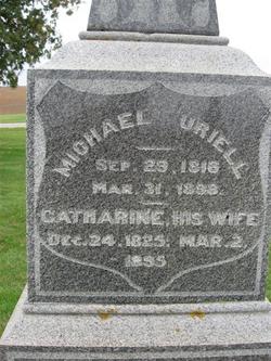
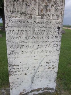
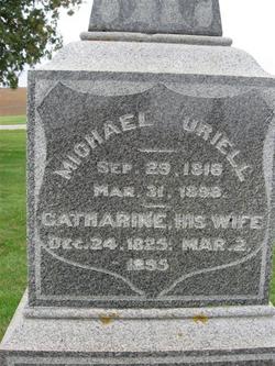
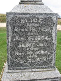
Michael Uriell
| Birth | : | 29 Sep 1816 County Tipperary, Ireland |
| Death | : | 31 Mar 1898 Clayton County, Iowa, USA |
| Burial | : | Eastern Cemetery, Invercargill, Invercargill City, New Zealand |
| Coordinate | : | -46.4070770, 168.3961480 |
| Description | : | Elkader Argus, IA, Thursday, March 31, 1898, pg. 5, col. 1 Michael Uriell of this city, an old and influential citizen, died this afternoon. +++ Elkader Register, IA, Thursday, April 7, 1898, pg. 8, col. 2 A number of people of this place attended the funeral of M. Uriell, of Read township, at Elkader on Saturday. Mr. Uriell was a pioneer of Clayton county, and one of the few early settlers to see the beginning of '98. +++ History of Clayton County, Iowa; from the earliest historical times down to the present: including a genealogical... Read More |
frequently asked questions (FAQ):
-
Where is Michael Uriell's memorial?
Michael Uriell's memorial is located at: Eastern Cemetery, Invercargill, Invercargill City, New Zealand.
-
When did Michael Uriell death?
Michael Uriell death on 31 Mar 1898 in Clayton County, Iowa, USA
-
Where are the coordinates of the Michael Uriell's memorial?
Latitude: -46.4070770
Longitude: 168.3961480
Family Members:
Parent
Spouse
Siblings
Children
Flowers:
Nearby Cemetories:
1. Eastern Cemetery
Invercargill, Invercargill City, New Zealand
Coordinate: -46.4070770, 168.3961480
2. Southland Crematorium
Invercargill, Invercargill City, New Zealand
Coordinate: -46.4109100, 168.3961330
3. Holy Trinity Anglican Church
Invercargill, Invercargill City, New Zealand
Coordinate: -46.3984736, 168.3660057
4. Te Hau Mutunga Urupā
Invercargill, Invercargill City, New Zealand
Coordinate: -46.4288704, 168.4148361
5. All Saints Anglican Church
Invercargill, Invercargill City, New Zealand
Coordinate: -46.3906042, 168.3476728
6. Saint Johns Cemetery
Invercargill, Invercargill City, New Zealand
Coordinate: -46.3748600, 168.3431480
7. Wallacetown New Cemetery
Wallacetown, Southland District, New Zealand
Coordinate: -46.3374900, 168.2835700
8. Wallacetown Old Cemetery
Wallacetown, Southland District, New Zealand
Coordinate: -46.3321840, 168.2861670
9. Woodlands Cemetery
Woodlands, Southland District, New Zealand
Coordinate: -46.3568800, 168.5463770
10. Ryal Bush
Ryal Bush, Southland District, New Zealand
Coordinate: -46.2836700, 168.3256000
11. Green Point Cemetery
Bluff, Invercargill City, New Zealand
Coordinate: -46.5739350, 168.3006450
12. Captain Stirling Grave
Bluff, Invercargill City, New Zealand
Coordinate: -46.6016466, 168.3691108
13. Bluff Cemetery
Bluff, Invercargill City, New Zealand
Coordinate: -46.6017310, 168.3248670
14. Forest Hill Cemetery
Southland District, New Zealand
Coordinate: -46.2049720, 168.3969970
15. Edendale Cemetery
Edendale, Southland District, New Zealand
Coordinate: -46.3080400, 168.7327360
16. Riverton Cemetery
Riverton, Southland District, New Zealand
Coordinate: -46.3316900, 168.0215500
17. East Winton Cemetery
Winton, Southland District, New Zealand
Coordinate: -46.1374640, 168.3557030
18. Calcium Cemetery
Isla Bank, Southland District, New Zealand
Coordinate: -46.2035710, 168.1279070
19. Winton Cemetery
Winton, Southland District, New Zealand
Coordinate: -46.1289300, 168.3250400
20. Fortrose Cemetery
Fortrose, Southland District, New Zealand
Coordinate: -46.5694400, 168.8088500
21. Wyndham Cemetery
Wyndham, Southland District, New Zealand
Coordinate: -46.3147020, 168.8823690
22. Colac Bay Cemetery
Colac Bay, Southland District, New Zealand
Coordinate: -46.3679806, 167.8798528
23. Otautau Old Cemetery
Otautau, Southland District, New Zealand
Coordinate: -46.1471300, 167.9940500
24. Otautau New Cemetery
Otautau, Southland District, New Zealand
Coordinate: -46.1307300, 168.0066400

