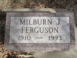
Milburn James “Red” Ferguson
| Birth | : | 15 Aug 1910 Wessington, Beadle County, South Dakota, USA |
| Death | : | 9 Jan 1993 Huron, Beadle County, South Dakota, USA |
| Burial | : | Hillside Cemetery, Platteville, Grant County, USA |
| Coordinate | : | 42.7257996, -90.4730988 |
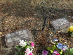
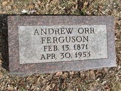
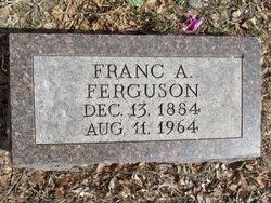
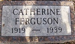
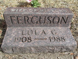
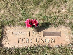
| Description | : | Researched and compiled by the Kartchner Brothers Milburn James Ferguson Milburn James Ferguson was born August 15, 1910, to Andrew and Franc (Hickman) Ferguson at Wessington, South Dakota. He attended Frye Country School. In 1938, he married Catherine Gainor. She preceded him in death in 1939. In 1976, he married Lola Davies, who died in 1988. He served in the United States Army during World War II. He was employed as a route salesman for Nehi Bottling co for many years. In later years he was a house painter with Imker Painting Service. |
frequently asked questions (FAQ):
-
Where is Milburn James “Red” Ferguson's memorial?
Milburn James “Red” Ferguson's memorial is located at: Hillside Cemetery, Platteville, Grant County, USA.
-
When did Milburn James “Red” Ferguson death?
Milburn James “Red” Ferguson death on 9 Jan 1993 in Huron, Beadle County, South Dakota, USA
-
Where are the coordinates of the Milburn James “Red” Ferguson's memorial?
Latitude: 42.7257996
Longitude: -90.4730988
Family Members:
Parent
Spouse
Siblings
Flowers:
Nearby Cemetories:
1. Hillside Cemetery
Platteville, Grant County, USA
Coordinate: 42.7257996, -90.4730988
2. Calvary Cemetery
Platteville, Grant County, USA
Coordinate: 42.7256012, -90.4710999
3. Indian Park
Platteville, Grant County, USA
Coordinate: 42.7391700, -90.4768100
4. Greenwood Cemetery
Platteville, Grant County, USA
Coordinate: 42.7313995, -90.4925003
5. Block House Cemetery
Platteville, Grant County, USA
Coordinate: 42.7038900, -90.4456100
6. Big Patch Cemetery
Platteville, Grant County, USA
Coordinate: 42.6676000, -90.4767000
7. Kaump Cemetery
Platteville, Grant County, USA
Coordinate: 42.7257996, -90.5622025
8. Coates Durley Cemetery
Cornelia, Grant County, USA
Coordinate: 42.6883710, -90.5497660
9. Churchill Family Cemetery
Platteville, Grant County, USA
Coordinate: 42.7911677, -90.5005626
10. Whig Cemetery
Platteville, Grant County, USA
Coordinate: 42.7611008, -90.5539017
11. Bashford Cemetery
Belmont, Lafayette County, USA
Coordinate: 42.7177000, -90.3639000
12. Harrison Cemetery
Platteville, Grant County, USA
Coordinate: 42.7257996, -90.5830994
13. Elk Grove Cemetery
Elk Grove, Lafayette County, USA
Coordinate: 42.6707950, -90.3919350
14. McNett East Cemetery
Elk Grove, Lafayette County, USA
Coordinate: 42.6601200, -90.4061500
15. McNett West Cemetery
Elk Grove, Lafayette County, USA
Coordinate: 42.6596985, -90.4060974
16. Mount Zion Cemetery
Cornelia, Grant County, USA
Coordinate: 42.6897200, -90.5829100
17. Willow Branch Mennonite Cemetery
Lancaster, Grant County, USA
Coordinate: 42.7986250, -90.5414980
18. Barber Rhea Cemetery
Belmont, Lafayette County, USA
Coordinate: 42.8064700, -90.4187100
19. Blakely Cemetery
British Hollow, Grant County, USA
Coordinate: 42.7224300, -90.5976100
20. Piddington Cemetery
Dickeyville, Grant County, USA
Coordinate: 42.6596985, -90.5616989
21. Smelser Cemetery
Georgetown, Grant County, USA
Coordinate: 42.6324997, -90.4749985
22. Strawberry Diggings Cemetery #2
Belmont, Lafayette County, USA
Coordinate: 42.6975770, -90.3482150
23. Strawberry Diggings Cemetery #1
Belmont, Lafayette County, USA
Coordinate: 42.6904020, -90.3470440
24. Belmont Cemetery
Belmont, Lafayette County, USA
Coordinate: 42.7328682, -90.3382187

