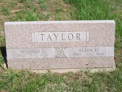
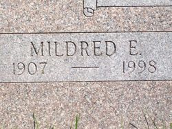
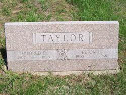
Mildred Eunice Phillips Taylor
| Birth | : | 23 Nov 1907 Oakland, Pottawattamie County, Iowa, USA |
| Death | : | 23 Jan 1998 Topeka, Shawnee County, Kansas, USA |
| Burial | : | St Mary the Virgin Churchyard, Pulham St Mary, South Norfolk District, England |
| Coordinate | : | 52.4205290, 1.2520380 |
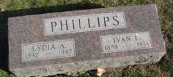
| Description | : | Mildred Eunice Phillips was born November 23, 1907, Oakland, Pottawattamie County, Iowa; the 6th child of 6 born to Robert Doren and Laura Jane (Ridlen) Phillips; her siblings being: Archer Earl 'Archie' Phillips, Louie Millicent Phillips, Ivan Lowell Phillips, Cecil Victor Phillips, and Olive Velma Phillips. She was united in marriage to Elton Lavern Taylor on December 27, 1927 in Pottawattamie County, Iowa. To this union 4 known children were born: Orval Doran Taylor, Ronald Elton Taylor, John Duane Taylor, and Keith Harley Taylor. Mildred answered the call to the spirit world on January 23, 1998 in Topeka, Shawnee County, Kansas at... Read More |
frequently asked questions (FAQ):
-
Where is Mildred Eunice Phillips Taylor's memorial?
Mildred Eunice Phillips Taylor's memorial is located at: St Mary the Virgin Churchyard, Pulham St Mary, South Norfolk District, England.
-
When did Mildred Eunice Phillips Taylor death?
Mildred Eunice Phillips Taylor death on 23 Jan 1998 in Topeka, Shawnee County, Kansas, USA
-
Where are the coordinates of the Mildred Eunice Phillips Taylor's memorial?
Latitude: 52.4205290
Longitude: 1.2520380
Family Members:
Parent
Spouse
Siblings
Children
Flowers:
Nearby Cemetories:
1. St Mary the Virgin Churchyard
Pulham St Mary, South Norfolk District, England
Coordinate: 52.4205290, 1.2520380
2. Saint Mary Magdalene Churchyard
Pulham Market, South Norfolk District, England
Coordinate: 52.4285200, 1.2301100
3. Pulham Market Cemetery
Pulham Market, South Norfolk District, England
Coordinate: 52.4281900, 1.2297700
4. St Mary Churchyard
Dickleburgh and Rushall, South Norfolk District, England
Coordinate: 52.3978750, 1.2290680
5. St Peter Churchyard
Needham, South Norfolk District, England
Coordinate: 52.3896320, 1.2773700
6. Saint Margaret's Churchyard
Hardwick, South Norfolk District, England
Coordinate: 52.4632800, 1.2712440
7. Church of the Assumption of the Blessed Virgin Mar
Redenhall, South Norfolk District, England
Coordinate: 52.4104780, 1.3272680
8. All Saints Churchyard
Dickleburgh and Rushall, South Norfolk District, England
Coordinate: 52.3968580, 1.1848010
9. St. Peter and St. Paul Churchyard
Brockdish, South Norfolk District, England
Coordinate: 52.3705240, 1.2366100
10. St. Mary's Churchyard
Shelton, South Norfolk District, England
Coordinate: 52.4720940, 1.2686120
11. All Saints Churchyard
Alburgh, South Norfolk District, England
Coordinate: 52.4362610, 1.3386490
12. St. George's Churchyard
Shimpling, Babergh District, England
Coordinate: 52.3994010, 1.1680910
13. Saint George Churchyard
Shimpling, South Norfolk District, England
Coordinate: 52.3993000, 1.1680000
14. All Saints Churchyard
Mendham, Mid Suffolk District, England
Coordinate: 52.3976310, 1.3349670
15. St. Margaret's Churchyard
Syleham, Mid Suffolk District, England
Coordinate: 52.3641870, 1.2372060
16. Saint Mary Churchyard
Gissing, South Norfolk District, England
Coordinate: 52.4235630, 1.1548260
17. Long Stratton Congregational Churchyard
Long Stratton, South Norfolk District, England
Coordinate: 52.4818890, 1.2324460
18. St Mary's Churchyard
Long Stratton, South Norfolk District, England
Coordinate: 52.4840800, 1.2339000
19. St. Michael's Churchyard
Great Moulton, South Norfolk District, England
Coordinate: 52.4718860, 1.1868760
20. Saint Mary Churchyard
Homersfield, Waveney District, England
Coordinate: 52.4191670, 1.3595410
21. Saint John the Baptist Churchyard
Morningthorpe, South Norfolk District, England
Coordinate: 52.4859170, 1.2654150
22. United Reformed Churchyard
Denton, South Norfolk District, England
Coordinate: 52.4465510, 1.3532090
23. St Leonard Churchyard
Billingford, South Norfolk District, England
Coordinate: 52.3666290, 1.1834260
24. St. Mary's Churchyard
Denton, South Norfolk District, England
Coordinate: 52.4364500, 1.3618770

