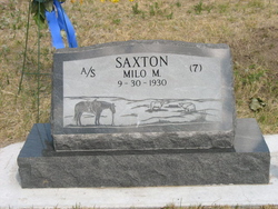
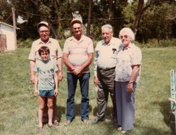
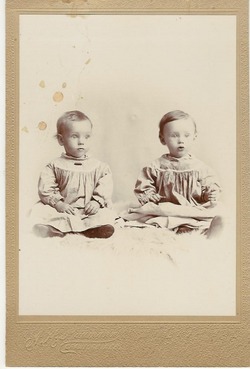
Milo Milford Saxton
| Birth | : | 30 Sep 1930 Crawford, Dawes County, Nebraska, USA |
| Death | : | 3 Jun 2006 Ajo, Pima County, Arizona, USA |
| Burial | : | Unity Cemetery, Fort Mill, York County, USA |
| Coordinate | : | 35.0076675, -80.9372864 |
| Description | : | September 30, 1930 - June 3, 2006 Milo Milford Saxton, lifelong resident of both Sioux and Dawes Counties, died at his home in Ajo, Ariz., on Saturday, June 3. Milo was born in Crawford, Neb., on Sept. 30 1930 to Milford G. Saxton and Gertrude Ferne Smith. Milo owned and operated the family farm/ranch surrounding the original Saxton homestead located northeast of Crawford. He was awarded the 'Century Farm Certificate' in 1991 at the Sioux County Fair. He attended school at the rural Cottonwood Elementary School. He served his country in the Korean War as a senior lineman in the Army from 1951 through 1953. Milo married... Read More |
frequently asked questions (FAQ):
-
Where is Milo Milford Saxton's memorial?
Milo Milford Saxton's memorial is located at: Unity Cemetery, Fort Mill, York County, USA.
-
When did Milo Milford Saxton death?
Milo Milford Saxton death on 3 Jun 2006 in Ajo, Pima County, Arizona, USA
-
Where are the coordinates of the Milo Milford Saxton's memorial?
Latitude: 35.0076675
Longitude: -80.9372864
Family Members:
Parent
Spouse
Siblings
Children
Flowers:
Nearby Cemetories:
1. Unity Presbyterian Church Columbarium
Fort Mill, York County, USA
Coordinate: 35.0080102, -80.9383740
2. Macedonia Presbyterian Cemetery
Fort Mill, York County, USA
Coordinate: 35.0120690, -80.9331190
3. Old Unity Cemetery
Fort Mill, York County, USA
Coordinate: 35.0155230, -80.9360810
4. Green Hill Cemetery
Fort Mill, York County, USA
Coordinate: 35.0130150, -80.9293700
5. Spratt Graveyard
Fort Mill, York County, USA
Coordinate: 34.9994621, -80.9523773
6. Church of God Cemetery
Fort Mill, York County, USA
Coordinate: 34.9934820, -80.9433610
7. Old Pleasant Valley Church Cemetery
Fort Mill, York County, USA
Coordinate: 34.9926280, -80.9181210
8. Saint Philip Neri Catholic Church Cemetery
Fort Mill, York County, USA
Coordinate: 35.0167610, -80.9671320
9. Saint James AME Zion Cemetery
Fort Mill, York County, USA
Coordinate: 35.0266010, -80.9642870
10. Philadelphia United Methodist Church Cemetery
Fort Mill, York County, USA
Coordinate: 35.0311270, -80.9685110
11. Cross Road Baptist Church Cemetery
Rock Hill, York County, USA
Coordinate: 34.9662410, -80.9803230
12. Indian Hill AME Zion Church Cemetery
Indian Land, Lancaster County, USA
Coordinate: 35.0318830, -80.8775660
13. Mount Zion AME Zion Church Cemetery
Fort Mill, York County, USA
Coordinate: 35.0658490, -80.9308020
14. Pleasant Hill United Methodist Church Cemetery
Indian Land, Lancaster County, USA
Coordinate: 35.0006960, -80.8620870
15. Old Pettus Cemetery
Fort Mill, York County, USA
Coordinate: 35.0709660, -80.9555100
16. Silver Run Cemetery
Lancaster County, USA
Coordinate: 35.0149994, -80.8561020
17. Silver Hill Cemetery
Indian Land, Lancaster County, USA
Coordinate: 35.0149280, -80.8557590
18. Harrison United Methodist Church Cemetery
Pineville, Mecklenburg County, USA
Coordinate: 35.0415450, -80.8637550
19. Edwards Cemetery
Indian Land, Lancaster County, USA
Coordinate: 34.9770010, -80.8607570
20. Lake Wylie Lutheran Church Columbarium
Fort Mill, York County, USA
Coordinate: 35.0622670, -80.9908030
21. Independent Bible Baptist Church Cemetery
Charlotte, Mecklenburg County, USA
Coordinate: 35.0179990, -80.8488210
22. Higher Ground Church Cemetery
Indian Land, Lancaster County, USA
Coordinate: 34.9713300, -80.8597020
23. Pleasant Valley Baptist Church Cemetery
Lancaster County, USA
Coordinate: 34.9931793, -80.8495407
24. Joseph Thomas Family Cemetery
Tega Cay, York County, USA
Coordinate: 35.0552420, -81.0061990


