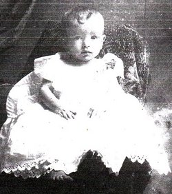
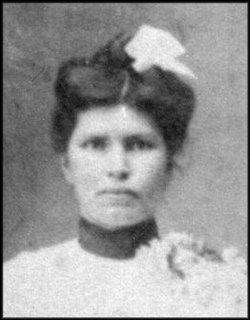
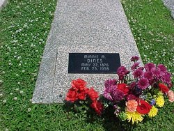
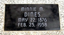
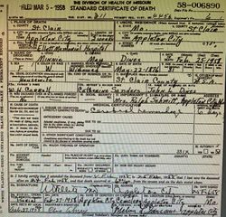
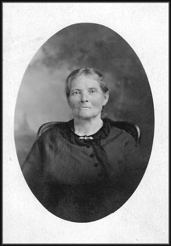
Minnie Mae Carroll Dines
| Birth | : | 22 May 1876 St. Clair County, Missouri, USA |
| Death | : | 25 Feb 1958 Appleton City, St. Clair County, Missouri, USA |
| Burial | : | Central Cemetery, Weston, Middlesex County, USA |
| Coordinate | : | 42.3665600, -71.3061900 |
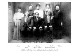
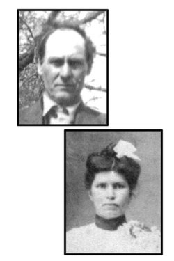
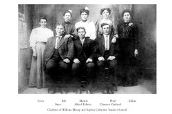
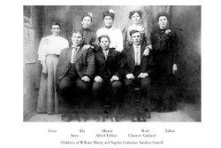
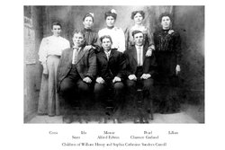
| Description | : | Minnie Carroll was born on May 22, 1876 in St Clair County, Missouri, the daughter of William Henry Carroll and Sophia Catherine Sanders Carroll. The family lived west of Johnson City in St Clair County where Minnie grew to womanhood. Minnie married John Logan Dines on October 14 1896. After living on several different farms, the couple finally retired to Appleton City. In 1943, John and Minnie sold the home in Johnson City and bought one in Appleton City in St Clair County. This property was purchased for $800. By this time the pension John was receiving... Read More |
frequently asked questions (FAQ):
-
Where is Minnie Mae Carroll Dines's memorial?
Minnie Mae Carroll Dines's memorial is located at: Central Cemetery, Weston, Middlesex County, USA.
-
When did Minnie Mae Carroll Dines death?
Minnie Mae Carroll Dines death on 25 Feb 1958 in Appleton City, St. Clair County, Missouri, USA
-
Where are the coordinates of the Minnie Mae Carroll Dines's memorial?
Latitude: 42.3665600
Longitude: -71.3061900
Family Members:
Parent
Spouse
Siblings
Children
Nearby Cemetories:
1. Central Cemetery
Weston, Middlesex County, USA
Coordinate: 42.3665600, -71.3061900
2. Farmers Burial Ground
Weston, Middlesex County, USA
Coordinate: 42.3667180, -71.3043040
3. First Parish Church Memorial Garden
Weston, Middlesex County, USA
Coordinate: 42.3666687, -71.3036118
4. Linwood Cemetery
Weston, Middlesex County, USA
Coordinate: 42.3642900, -71.3058500
5. Saint Peters Episcopal Church Memorial Garden
Weston, Middlesex County, USA
Coordinate: 42.3676670, -71.2931100
6. Jesuit Cemetery
Weston, Middlesex County, USA
Coordinate: 42.3813600, -71.3192500
7. South Burying Ground
Weston, Middlesex County, USA
Coordinate: 42.3430300, -71.3084500
8. Draper Burial Ground
Wayland, Middlesex County, USA
Coordinate: 42.3704660, -71.3417230
9. Church of the Holy Spirit Cemetery
Wayland, Middlesex County, USA
Coordinate: 42.3454700, -71.3337200
10. Sachar International Center
Waltham, Middlesex County, USA
Coordinate: 42.3645420, -71.2649490
11. South Cemetery
Wayland, Middlesex County, USA
Coordinate: 42.3588710, -71.3578000
12. Beit Olam East Cemetery
Wayland, Middlesex County, USA
Coordinate: 42.3705200, -71.3590500
13. Beth Israel Memorial Park
Waltham, Middlesex County, USA
Coordinate: 42.3685000, -71.2500600
14. Mount Feake Cemetery
Waltham, Middlesex County, USA
Coordinate: 42.3652992, -71.2485962
15. Beit Olam Cemetery
Wayland, Middlesex County, USA
Coordinate: 42.3705970, -71.3675360
16. North Cemetery
Wayland, Middlesex County, USA
Coordinate: 42.3708000, -71.3694000
17. Christ Church Memorial Garden
Waltham, Middlesex County, USA
Coordinate: 42.3761700, -71.2404000
18. Saint Marys Cemetery
Newton Lower Falls, Middlesex County, USA
Coordinate: 42.3264656, -71.2583466
19. Concord Men Slain By Indians
Wayland, Middlesex County, USA
Coordinate: 42.3753970, -71.3791820
20. West Parish Burying Ground
Newton, Middlesex County, USA
Coordinate: 42.3527000, -71.2298000
21. Calvary Cemetery and Mausoleum
Waltham, Middlesex County, USA
Coordinate: 42.3646736, -71.2268295
22. Arborvitae Cemetery
Lincoln, Middlesex County, USA
Coordinate: 42.4252800, -71.2992200
23. Town Hill Cemetery
Lincoln, Middlesex County, USA
Coordinate: 42.4273300, -71.3021400
24. Saint Zepherin's Cemetery
Wayland, Middlesex County, USA
Coordinate: 42.3255510, -71.3687490

