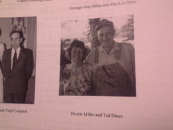
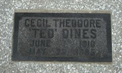
Cecil Theodore Dines
| Birth | : | 1 Jun 1910 St. Clair County, Missouri, USA |
| Death | : | 25 May 1985 Appleton City, St. Clair County, Missouri, USA |
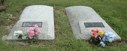
| Burial | : | West Lawn Memorial Gardens, Topeka, Shawnee County, USA |
| Coordinate | : | 39.0518112, -95.8167419 |
frequently asked questions (FAQ):
-
Where is Cecil Theodore Dines's memorial?
Cecil Theodore Dines's memorial is located at: West Lawn Memorial Gardens, Topeka, Shawnee County, USA.
-
When did Cecil Theodore Dines death?
Cecil Theodore Dines death on 25 May 1985 in Appleton City, St. Clair County, Missouri, USA
-
Where are the coordinates of the Cecil Theodore Dines's memorial?
Latitude: 39.0518112
Longitude: -95.8167419
Family Members:
Parent
Spouse
Siblings
Children
Flowers:

Left by Anonymous on 23 Sep 2009
Left by Anonymous on 06 Apr 2010

Left by Anonymous on 22 Jul 2010
I was born a month after this man passed away but it would have been nice to have known my great grandpa
Left by Anonymous on 16 Sep 2011
Left by Anonymous on 03 May 2015

Left by Anonymous on 04 Jul 2015

Left by Anonymous on 27 Jun 2017

Left by Anonymous on 18 May 2020

Left by Anonymous on 26 Jul 2020
Nearby Cemetories:
1. West Lawn Memorial Gardens
Topeka, Shawnee County, USA
Coordinate: 39.0518112, -95.8167419
2. Security Benefit Association Cemetery
Topeka, Shawnee County, USA
Coordinate: 39.0630989, -95.7606583
3. Mission Center Cemetery
Topeka, Shawnee County, USA
Coordinate: 39.0145493, -95.7819290
4. Valencia Cemetery
Valencia, Shawnee County, USA
Coordinate: 39.0586014, -95.8806000
5. Abram Burnett Burial Site
Topeka, Shawnee County, USA
Coordinate: 39.0102997, -95.7685776
6. Mount Hope Cemetery
Topeka, Shawnee County, USA
Coordinate: 39.0367393, -95.7386703
7. Mount Calvary Cemetery
Topeka, Shawnee County, USA
Coordinate: 39.0532990, -95.7360992
8. Saint Davids Episcopal Church Columbarium
Topeka, Shawnee County, USA
Coordinate: 39.0369860, -95.7259480
9. Memorial Park Cemetery
Topeka, Shawnee County, USA
Coordinate: 39.0619011, -95.7221985
10. Silver Lake Cemetery
Silver Lake, Shawnee County, USA
Coordinate: 39.1189003, -95.8617020
11. Prairie Home Cemetery
Topeka, Shawnee County, USA
Coordinate: 39.1077118, -95.7482910
12. Elevation Cemetery
Shawnee County, USA
Coordinate: 38.9832993, -95.7613983
13. Topeka State Hospital Cemetery
Topeka, Shawnee County, USA
Coordinate: 39.0671005, -95.7080994
14. Westminster Presbyterian Church Memorial Garden
Topeka, Shawnee County, USA
Coordinate: 39.0430400, -95.7021700
15. Carnegie Hall
Topeka, Shawnee County, USA
Coordinate: 39.0350600, -95.6999100
16. Ritchie Cemetery
Topeka, Shawnee County, USA
Coordinate: 39.0228010, -95.7027530
17. Uniontown Cemetery
Willard, Shawnee County, USA
Coordinate: 39.0847015, -95.9377136
18. Grace Episcopal Cathedral Columbarium
Topeka, Shawnee County, USA
Coordinate: 39.0511284, -95.6843719
19. Grace Episcopal Cathedral Sanctuary
Topeka, Shawnee County, USA
Coordinate: 39.0506925, -95.6839273
20. Foster Cemetery
Topeka, Shawnee County, USA
Coordinate: 38.9942017, -95.7061005
21. Hosack Grave
Wabaunsee County, USA
Coordinate: 39.0798080, -95.9510280
22. Bennie Lee Graham Memorial Cemetery
Shawnee County, USA
Coordinate: 39.1020584, -95.6836472
23. Curtis Family Cemetery
North Topeka, Shawnee County, USA
Coordinate: 39.0792870, -95.6702270
24. Rochester Cemetery
Topeka, Shawnee County, USA
Coordinate: 39.1044006, -95.6800003

