

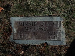
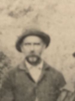
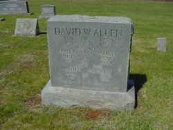
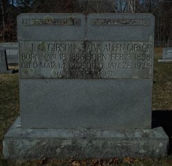
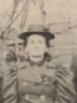
Minnie Missouri Allen Mallonee
| Birth | : | 4 Dec 1874 Macon County, North Carolina, USA |
| Death | : | 17 Oct 1931 Buncombe County, North Carolina, USA |
| Burial | : | Farnum Holt Columbarium, Glenwood Springs, Garfield County, USA |
| Coordinate | : | 39.5469640, -107.3299900 |
| Description | : | Wife of John Mallonee |
frequently asked questions (FAQ):
-
Where is Minnie Missouri Allen Mallonee's memorial?
Minnie Missouri Allen Mallonee's memorial is located at: Farnum Holt Columbarium, Glenwood Springs, Garfield County, USA.
-
When did Minnie Missouri Allen Mallonee death?
Minnie Missouri Allen Mallonee death on 17 Oct 1931 in Buncombe County, North Carolina, USA
-
Where are the coordinates of the Minnie Missouri Allen Mallonee's memorial?
Latitude: 39.5469640
Longitude: -107.3299900
Family Members:
Parent
Siblings
Flowers:


Nearby Cemetories:
1. Farnum Holt Columbarium
Glenwood Springs, Garfield County, USA
Coordinate: 39.5469640, -107.3299900
2. Pioneer Cemetery
Glenwood Springs, Garfield County, USA
Coordinate: 39.5392000, -107.3192000
3. Rosebud Cemetery
Glenwood Springs, Garfield County, USA
Coordinate: 39.5168991, -107.3189011
4. Fisher Cemetery
Carbondale, Garfield County, USA
Coordinate: 39.4791985, -107.1911011
5. Highland Cemetery
New Castle, Garfield County, USA
Coordinate: 39.5875015, -107.5192032
6. Evergreen Cemetery
Carbondale, Garfield County, USA
Coordinate: 39.4077988, -107.2155991
7. Marion Cemetery
Garfield County, USA
Coordinate: 39.3689003, -107.3047028
8. Hillcrest Cemetery
Carbondale, Garfield County, USA
Coordinate: 39.3922005, -107.1936035
9. Dotsero Cemetery
Dotsero, Eagle County, USA
Coordinate: 39.6477600, -107.0672200
10. Union Divide Creek Cemetery
Silt, Garfield County, USA
Coordinate: 39.4508018, -107.6200027
11. Skyline Cemetery
Silt, Garfield County, USA
Coordinate: 39.5520060, -107.6575300
12. Basalt Cemetery
Basalt, Eagle County, USA
Coordinate: 39.3646800, -107.0213100
13. Cedar Hill Memorial Cemetery
Gypsum, Eagle County, USA
Coordinate: 39.6445990, -106.9600620
14. Rose Hill Cemetery
Rifle, Garfield County, USA
Coordinate: 39.5381012, -107.7742004
15. Wheatley Cemetery
Pitkin County, USA
Coordinate: 39.3325720, -106.9807170
16. Hillside Cemetery
Redstone, Pitkin County, USA
Coordinate: 39.1843300, -107.2418900
17. Saint Benedicts Monastery Cemetery
Snowmass, Pitkin County, USA
Coordinate: 39.2617000, -107.0038000
18. Sunset View Cemetery
Eagle, Eagle County, USA
Coordinate: 39.6510500, -106.8254400
19. Hidden Valley Cemetery
Snowmass Village, Pitkin County, USA
Coordinate: 39.2200690, -106.9181890
20. Snowmass Village Community Cemetery
Snowmass Village, Pitkin County, USA
Coordinate: 39.2200000, -106.9181000
21. Prospect Mountain Ranch Cemetery
Marble, Gunnison County, USA
Coordinate: 39.0927230, -107.2395980
22. Collins Cemetery
Woody Creek, Pitkin County, USA
Coordinate: 39.2585040, -106.8480060
23. Rulison Cemetery
Rulison, Garfield County, USA
Coordinate: 39.4768000, -107.9357000
24. Marble Cemetery
Marble, Gunnison County, USA
Coordinate: 39.0797005, -107.2277985