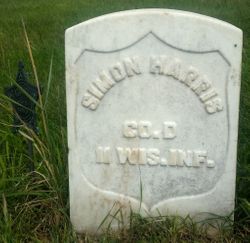
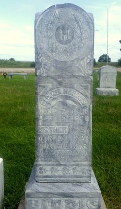
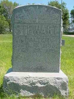
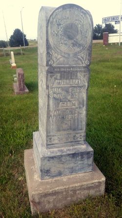
| Birth | : | Nov 1861 Richland County, Wisconsin, USA |
| Death | : | 20 May 1942 North Platte, Lincoln County, Nebraska, USA |
| Burial | : | East View Cemetery, Salem, Salem County, USA |
| Coordinate | : | 39.5627480, -75.4561081 |
| Inscription | : | No Marker |
| Description | : | Obituary: SERVICES HELD FOR MRS. MINTA STEWART-Tues. May 26, 1942 Funeral services for Mrs. Minta Stewart, who died Wednesday, were held at 5:30 Sunday afternoon at the Adams Funeral Home. Rev. H.J.Jensen of Lincoln officiated. Mrs. Earl Hunter and Mrs. H.F. Wright sang "Face to Face" and "Nearer My God To Thee" accompanied at the organ by Mrs. J. Buford Eaves. Pallbearers were Hugh Gaunt, John Dugan, Carroll Wilson and Charles Bartch. Burial was in the Paxton Cemetery. The daughters of Union Veterans of North Platte were in charge of services at the grave. MINTA STEWART DIES AT HOME OF... Read More |
frequently asked questions (FAQ):
-
Where is Minta B. Harris Stewart's memorial?
Minta B. Harris Stewart's memorial is located at: East View Cemetery, Salem, Salem County, USA.
-
When did Minta B. Harris Stewart death?
Minta B. Harris Stewart death on 20 May 1942 in North Platte, Lincoln County, Nebraska, USA
-
Where are the coordinates of the Minta B. Harris Stewart's memorial?
Latitude: 39.5627480
Longitude: -75.4561081
Family Members:
Parent
Spouse
Siblings
Flowers:
Nearby Cemetories:
1. East View Cemetery
Salem, Salem County, USA
Coordinate: 39.5627480, -75.4561081
2. Baptist Cemetery
Salem, Salem County, USA
Coordinate: 39.5621681, -75.4611053
3. Mount Hope United Methodist Church Cemetery
Salem, Salem County, USA
Coordinate: 39.5660667, -75.4606781
4. Saint Mary's Roman Catholic Cemetery
Salem, Salem County, USA
Coordinate: 39.5637856, -75.4684753
5. First United Methodist Church Cemetery
Salem, Salem County, USA
Coordinate: 39.5695496, -75.4670868
6. Mount Pisgah AME Cemetery
Salem County, USA
Coordinate: 39.5549700, -75.4663900
7. Evergreen Cemetery
Salem, Salem County, USA
Coordinate: 39.5540000, -75.4652000
8. First Presbyterian Cemetery
Salem, Salem County, USA
Coordinate: 39.5736351, -75.4648819
9. Saint John's Episcopal Churchyard
Salem, Salem County, USA
Coordinate: 39.5744705, -75.4655151
10. Salem Friends Burial Ground
Salem, Salem County, USA
Coordinate: 39.5732307, -75.4705963
11. Mill Hollow Cemetery
Quinton, Salem County, USA
Coordinate: 39.5563120, -75.4305770
12. Alloway Creek Old Quaker Burial Ground
Lower Alloways Creek Township, Salem County, USA
Coordinate: 39.5202900, -75.4597000
13. Hancocks Bridge United Methodist Church Cemetery
Harmersville, Salem County, USA
Coordinate: 39.5023537, -75.4411850
14. Cedar Hill Friends Cemetery
Harmersville, Salem County, USA
Coordinate: 39.5014720, -75.4387800
15. Alloway Baptist Church Cemetery
Alloway, Salem County, USA
Coordinate: 39.5606308, -75.3655090
16. Battle of Quintons Bridge Graveyard
Quinton, Salem County, USA
Coordinate: 39.5130650, -75.3884040
17. Dunham Family Cemetery
Pennsville, Salem County, USA
Coordinate: 39.6138890, -75.5268330
18. Alloway United Methodist Church Cemetery
Alloway, Salem County, USA
Coordinate: 39.5623207, -75.3586273
19. Little Bethel A.M.E Church Cemetery
Marshalltown, Salem County, USA
Coordinate: 39.6381190, -75.4537830
20. Berrys Chapel Cemetery
Quinton, Salem County, USA
Coordinate: 39.5137900, -75.3779510
21. Old Alloway Cemetery
Alloway, Salem County, USA
Coordinate: 39.5619545, -75.3549957
22. Mount Zion AUMP Church Cemetery
Marshalltown, Salem County, USA
Coordinate: 39.6410060, -75.4554070
23. Lower Penns Neck Methodist Episcopal Cemetery
Pennsville, Salem County, USA
Coordinate: 39.6383120, -75.5164490
24. Canton Baptist Church Cemetery
Canton, Salem County, USA
Coordinate: 39.4799385, -75.4120789

