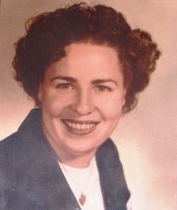
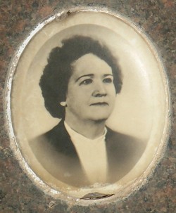
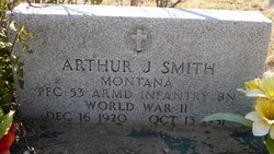
Mittie Mae Smith Carroll
| Birth | : | 2 Feb 1928 Radersburg, Broadwater County, Montana, USA |
| Death | : | 27 Jun 2014 Missoula, Missoula County, Montana, USA |
| Burial | : | Holy Cross Cemetery, Townsend, Broadwater County, USA |
| Coordinate | : | 46.3182983, -111.4831009 |
| Description | : | Mittie Mae Carroll, 86, passed away peacefully on Thursday, June 27, 2014, at home in Missoula, Montana of natural causes. She was born February 2, 1928 in Radersburg, Montana, to Eunice (Bomar) and Walter Smith. As a young girl she lived with her family in Radersburg. She was educated in Radersburg public school. On Oct 1, 1949 Mittie married Francis "Frank" Carroll; they lived 64 years together. She was a wonderful homemaker, she loved music, and would like to watch the Saturday night "Marty Stewart Show" Mittie enjoyed many things, working in the yard, gardening and celebrating life. She was a... Read More |
frequently asked questions (FAQ):
-
Where is Mittie Mae Smith Carroll's memorial?
Mittie Mae Smith Carroll's memorial is located at: Holy Cross Cemetery, Townsend, Broadwater County, USA.
-
When did Mittie Mae Smith Carroll death?
Mittie Mae Smith Carroll death on 27 Jun 2014 in Missoula, Missoula County, Montana, USA
-
Where are the coordinates of the Mittie Mae Smith Carroll's memorial?
Latitude: 46.3182983
Longitude: -111.4831009
Family Members:
Parent
Spouse
Siblings
Nearby Cemetories:
1. Holy Cross Cemetery
Townsend, Broadwater County, USA
Coordinate: 46.3182983, -111.4831009
2. Centerville Cemetery
Townsend, Broadwater County, USA
Coordinate: 46.3375140, -111.5142990
3. Deep Creek Cemetery
Townsend, Broadwater County, USA
Coordinate: 46.2832000, -111.4667000
4. Charity Jane Dillon Gravesite
Townsend, Broadwater County, USA
Coordinate: 46.2947200, -111.5875770
5. St. Joseph's Cemetery
Canton, Broadwater County, USA
Coordinate: 46.4073200, -111.4446150
6. Lavina Chapel Cemetery
Broadwater County, USA
Coordinate: 46.4555000, -111.5043000
7. Fairview Cemetery
Broadwater County, USA
Coordinate: 46.4570110, -111.5035380
8. Shull Cemetery
Broadwater County, USA
Coordinate: 46.1678760, -111.4242520
9. Macomber Field Cemetery
Radersburg, Broadwater County, USA
Coordinate: 46.1744100, -111.5986100
10. Radersburg Cemetery
Radersburg, Broadwater County, USA
Coordinate: 46.1765990, -111.6126290
11. Parker Cemetery
Broadwater County, USA
Coordinate: 46.1760000, -111.6130000
12. Beaver Creek Cemetery (Defunct)
Winston, Broadwater County, USA
Coordinate: 46.5152780, -111.5952780
13. Winston Cemetery
Winston, Broadwater County, USA
Coordinate: 46.5017014, -111.6714020
14. Diamond City Cemetery
Broadwater County, USA
Coordinate: 46.5883300, -111.4346900
15. Elkhorn Cemetery
Elkhorn, Jefferson County, USA
Coordinate: 46.2683450, -111.9480010
16. Turner Cemetery
Jefferson County, USA
Coordinate: 46.5306015, -111.8486023
17. Canyon Ferry Cemetery
Lewis and Clark County, USA
Coordinate: 46.6344330, -111.7059790
18. Saint John the Evangelist Catholic Church Cemetery
Boulder, Jefferson County, USA
Coordinate: 46.1234000, -111.9505000
19. Missouri Headwaters State Park Cemetery
Trident, Gallatin County, USA
Coordinate: 45.9346470, -111.4937960
20. Jefferson City Cemetery
Jefferson City, Jefferson County, USA
Coordinate: 46.3913000, -112.0308000
21. Saint Anns Cemetery
East Helena, Lewis and Clark County, USA
Coordinate: 46.5867004, -111.9013977
22. Morgan Cemetery
Springhill, Gallatin County, USA
Coordinate: 46.0092010, -111.1102982
23. East Helena City Cemetery
East Helena, Lewis and Clark County, USA
Coordinate: 46.5945220, -111.9146760
24. Kinyon Cemetery
Meagher County, USA
Coordinate: 46.6842003, -111.1667023


