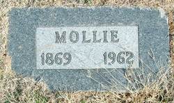
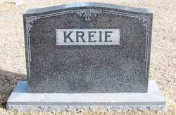
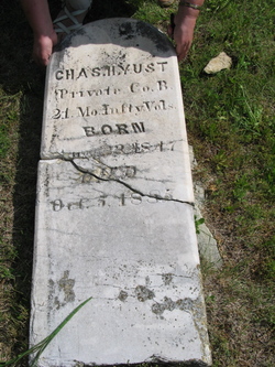
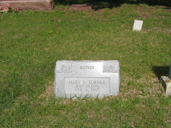
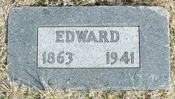
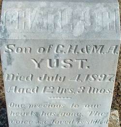
Mollie Jane Yust Kreie
| Birth | : | 29 Sep 1869 Canton, Lewis County, Missouri, USA |
| Death | : | 29 Apr 1962 Hutchinson, Reno County, Kansas, USA |
| Burial | : | Woodland Cemetery, Woodland, Yolo County, USA |
| Coordinate | : | 38.6711006, -121.7846985 |
| Description | : | Obituary from the Hutchinson News, 4/30/1962: Mrs. Mollie [Mary Jane] Kreie Mrs. Mollie Kreie, 92, 429 East 16th, died Sunday morning at her home. She was ill five years. She was born Sept. 29, 1869, in Canton, MO. She moved to the Peace Creek community as a child with her parents. She married Edward Kreie Oct. 15, 1883, and after the death of her husband in 1941 she moved to Hutchinson. She was a member of the Sylvia... Read More |
frequently asked questions (FAQ):
-
Where is Mollie Jane Yust Kreie's memorial?
Mollie Jane Yust Kreie's memorial is located at: Woodland Cemetery, Woodland, Yolo County, USA.
-
When did Mollie Jane Yust Kreie death?
Mollie Jane Yust Kreie death on 29 Apr 1962 in Hutchinson, Reno County, Kansas, USA
-
Where are the coordinates of the Mollie Jane Yust Kreie's memorial?
Latitude: 38.6711006
Longitude: -121.7846985
Family Members:
Parent
Spouse
Siblings
Children
Flowers:
Nearby Cemetories:
1. Woodland Cemetery
Woodland, Yolo County, USA
Coordinate: 38.6711006, -121.7846985
2. Saint Joseph Cemetery
Woodland, Yolo County, USA
Coordinate: 38.6694400, -121.7842120
3. Monument Hill Memorial Park
Woodland, Yolo County, USA
Coordinate: 38.6781020, -121.8566400
4. Cacheville Cemetery
Yolo, Yolo County, USA
Coordinate: 38.7378300, -121.8090200
5. Marys Cemetery
Yolo, Yolo County, USA
Coordinate: 38.7635994, -121.8032990
6. Gordon Family Cemetery
Esparto, Yolo County, USA
Coordinate: 38.6966060, -121.9151540
7. Episcopal Church of Saint Martin Columbarium
Davis, Yolo County, USA
Coordinate: 38.5488870, -121.7611850
8. Davis Cemetery
Davis, Yolo County, USA
Coordinate: 38.5550003, -121.7260971
9. Knights Landing Cemetery
Knights Landing, Yolo County, USA
Coordinate: 38.7904530, -121.7284190
10. Cottonwood Cemetery
Winters, Yolo County, USA
Coordinate: 38.6500015, -121.9677963
11. Corbin Cemetery
Esparto, Yolo County, USA
Coordinate: 38.6240710, -122.0105040
12. Tremont Cemetery
Dixon, Solano County, USA
Coordinate: 38.4940987, -121.7043991
13. Capay Cemetery
Esparto, Yolo County, USA
Coordinate: 38.6944008, -122.0447006
14. Winters Cemetery
Winters, Yolo County, USA
Coordinate: 38.5256004, -121.9777985
15. Dixon Cemetery
Dixon, Solano County, USA
Coordinate: 38.4354553, -121.8227005
16. National Shrine of Our Lady of Guadalupe Crypt
Sacramento, Sacramento County, USA
Coordinate: 38.5704800, -121.5014400
17. Holy Ascension Russian Orthodox Cemetery
Sacramento, Sacramento County, USA
Coordinate: 38.5846212, -121.4936736
18. Sunset Hill Cemetery
Sacramento, Sacramento County, USA
Coordinate: 38.5608000, -121.5037300
19. Masonic Lawn Cemetery
Sacramento, Sacramento County, USA
Coordinate: 38.5604720, -121.5032600
20. Sacramento City Cemetery
Sacramento, Sacramento County, USA
Coordinate: 38.5636864, -121.5009537
21. California State Capitol
Sacramento, Sacramento County, USA
Coordinate: 38.5760994, -121.4931488
22. Buddhist Church of Sacramento Nokotsudo
Sacramento, Sacramento County, USA
Coordinate: 38.5639300, -121.4978400
23. Odd Fellows Lawn Cemetery and Mausoleum
Sacramento, Sacramento County, USA
Coordinate: 38.5585000, -121.5011000
24. Pleasant Grove Cemetery
Pleasant Grove, Sutter County, USA
Coordinate: 38.8230000, -121.5206900

