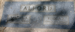
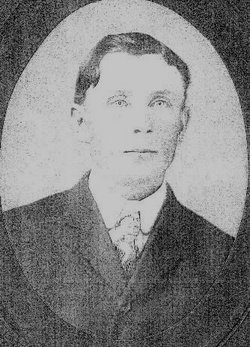
Mrs Rhoda Estella O'Brien Alford
| Birth | : | 24 Mar 1880 Golden, Jefferson County, Colorado, USA |
| Death | : | 5 Mar 1960 Loveland, Larimer County, Colorado, USA |
| Burial | : | Hilltop Cemetery, Raymond, Rice County, USA |
| Coordinate | : | 38.2886009, -98.4231033 |
| Plot | : | B38, L7, S3 |
| Description | : | MARRIED Alford-O'Brien At the home of the groom's parents, about one and one-half miles north of this city, Sunday aftrnoon at one o'clock, occured the marriage of Samuel A. Alford to Miss Rhoda O'Brien of Denver. Only immediate relatives witnessed the ceremony, which was performed by Rev. O.L. Brownson. Mr. Alford has a cozy home all furnished on a farm near that of his father's and they will go to housekeeping at once. Mrs. Alford has been teacher in this district for years and is well known to the people in that vicinity. The Reporter extends best wishes... Read More |
frequently asked questions (FAQ):
-
Where is Mrs Rhoda Estella O'Brien Alford's memorial?
Mrs Rhoda Estella O'Brien Alford's memorial is located at: Hilltop Cemetery, Raymond, Rice County, USA.
-
When did Mrs Rhoda Estella O'Brien Alford death?
Mrs Rhoda Estella O'Brien Alford death on 5 Mar 1960 in Loveland, Larimer County, Colorado, USA
-
Where are the coordinates of the Mrs Rhoda Estella O'Brien Alford's memorial?
Latitude: 38.2886009
Longitude: -98.4231033
Family Members:
Spouse
Flowers:
Nearby Cemetories:
1. Hilltop Cemetery
Raymond, Rice County, USA
Coordinate: 38.2886009, -98.4231033
2. Immanuel Cemetery
Rice County, USA
Coordinate: 38.3699989, -98.4421997
3. Saint Marys Cemetery
Chase, Rice County, USA
Coordinate: 38.3492012, -98.3507996
4. Emmanuel Lutheran Cemetery
Chase, Rice County, USA
Coordinate: 38.3702350, -98.4433800
5. Alden Valley Cemetery
Alden, Rice County, USA
Coordinate: 38.2461400, -98.3065900
6. Springdale Cemetery
Chase, Rice County, USA
Coordinate: 38.3630981, -98.3305969
7. Lakin Comanche Cemetery
Ellinwood, Barton County, USA
Coordinate: 38.3486000, -98.5736000
8. Ebenezer Church Cemetery
Rice County, USA
Coordinate: 38.3908900, -98.2759000
9. Rice County Poor Farm Cemetery
Rice County, USA
Coordinate: 38.3449410, -98.2387280
10. Peace Valley Cemetery
Reno County, USA
Coordinate: 38.1521988, -98.2882996
11. Wesley Chapel Cemetery
Lyons, Rice County, USA
Coordinate: 38.4494200, -98.3308300
12. Un-Named Cemetery
Lyons, Rice County, USA
Coordinate: 38.3478140, -98.2110390
13. Salem-Friedhof Cemetery
Bushton, Rice County, USA
Coordinate: 38.4655991, -98.4056015
14. Shumway Cemetery
Lyons, Rice County, USA
Coordinate: 38.3911018, -98.2356033
15. Saints Peter and Paul Cemetery
Ellinwood, Barton County, USA
Coordinate: 38.4344320, -98.5703900
16. Lyons Municipal Cemetery
Lyons, Rice County, USA
Coordinate: 38.3589940, -98.2020190
17. Sterling Cemetery
Sterling, Rice County, USA
Coordinate: 38.2182999, -98.1986008
18. Holy Name Catholic Cemetery
Bushton, Rice County, USA
Coordinate: 38.4929400, -98.4432900
19. Montgomery Cemetery
Barton County, USA
Coordinate: 38.4933014, -98.4805984
20. Salem Cemetery
Hudson, Stafford County, USA
Coordinate: 38.1514015, -98.6399994
21. Bushton-Farmer Township Cemetery
Bushton, Rice County, USA
Coordinate: 38.5078011, -98.3886032
22. Peace United Church of Christ Cemetery
Hudson, Stafford County, USA
Coordinate: 38.1591988, -98.6579971
23. Old Dunkard Cemetery
Rice County, USA
Coordinate: 38.3549200, -98.1455480
24. Peace Creek Cemetery
Stafford, Stafford County, USA
Coordinate: 38.0635986, -98.4725037


