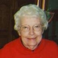
Myrtle Elizabeth McBride Hooker
| Birth | : | 17 Feb 1921 Primrose, Boone County, Nebraska, USA |
| Death | : | 30 Nov 2012 Albion, Boone County, Nebraska, USA |
| Burial | : | Saint Michael's Cemetery, Spalding, Greeley County, USA |
| Coordinate | : | 41.6674995, -98.3675003 |
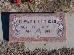
| Description | : | Myrtle E. Hooker, 91 of Spalding, NE passed away Friday, November 30, 2012 at the Boone County Health Center in Albion, NE. Myrtle was born February 17, 1921 to Thomas "T J" and Lillie (Topping) McBride near Primrose, NE. Myrtle received her education at the Red School. On November 20, 1948 Myrtle married Edward "Ned" Hooker in Bellevue, Nebraska. They farmed near Spalding where she worked as a homemaker, mother of three, and helped with the farming. Myrtle enjoyed gardening. They retired from the farm in 1978. Ned... Read More |
frequently asked questions (FAQ):
-
Where is Myrtle Elizabeth McBride Hooker's memorial?
Myrtle Elizabeth McBride Hooker's memorial is located at: Saint Michael's Cemetery, Spalding, Greeley County, USA.
-
When did Myrtle Elizabeth McBride Hooker death?
Myrtle Elizabeth McBride Hooker death on 30 Nov 2012 in Albion, Boone County, Nebraska, USA
-
Where are the coordinates of the Myrtle Elizabeth McBride Hooker's memorial?
Latitude: 41.6674995
Longitude: -98.3675003
Family Members:
Flowers:
Nearby Cemetories:
1. Saint Michael's Cemetery
Spalding, Greeley County, USA
Coordinate: 41.6674995, -98.3675003
2. Calvary Cemetery
Spalding, Greeley County, USA
Coordinate: 41.6958008, -98.3617020
3. Grand View Cemetery
Spalding, Greeley County, USA
Coordinate: 41.6974983, -98.3593979
4. Saint Marys Catholic Cemetery
Primrose, Boone County, USA
Coordinate: 41.6465900, -98.2532600
5. Dublin Cemetery
Primrose, Boone County, USA
Coordinate: 41.6463000, -98.2529900
6. Rosedale Cemetery
Bartlett, Wheeler County, USA
Coordinate: 41.7848000, -98.3574000
7. Bonanza-Akron Cemetery
Boone County, USA
Coordinate: 41.7482986, -98.2478027
8. Enfield Cemetery
Boone County, USA
Coordinate: 41.5391998, -98.2782974
9. Pibel Cemetery
Wheeler County, USA
Coordinate: 41.7621994, -98.5263977
10. Dennison Cemetery
Albion, Boone County, USA
Coordinate: 41.7182999, -98.1753006
11. Swedish Cemetery
Greeley, Greeley County, USA
Coordinate: 41.5525017, -98.5147018
12. Sacred Heart Cemetery
Greeley, Greeley County, USA
Coordinate: 41.5539017, -98.5381012
13. Greeley Cemetery
Greeley, Greeley County, USA
Coordinate: 41.5554000, -98.5400000
14. East O'Connor Cemetery
O'Connor, Greeley County, USA
Coordinate: 41.5106000, -98.4638000
15. O'Connor Cemetery
O'Connor, Greeley County, USA
Coordinate: 41.5101128, -98.4654999
16. Saint Anthony Cemetery
Cedar Rapids, Boone County, USA
Coordinate: 41.5607986, -98.1616974
17. Sunset Cemetery
Cedar Rapids, Boone County, USA
Coordinate: 41.5611000, -98.1605988
18. Sunrise Cemetery
Cedar Rapids, Boone County, USA
Coordinate: 41.5760994, -98.1278000
19. Pleasant Hill Cemetery
Belfast, Greeley County, USA
Coordinate: 41.6175003, -98.6352997
20. Orford Pioneer Cemetery
Loretto, Boone County, USA
Coordinate: 41.7953000, -98.0864300
21. Hillside Cemetery
Wolbach, Greeley County, USA
Coordinate: 41.4005089, -98.3921356
22. Bartlett Cemetery
Bartlett, Wheeler County, USA
Coordinate: 41.8972015, -98.5643997
23. Fish Creek Cemetery
Scotia, Greeley County, USA
Coordinate: 41.4663000, -98.6154000
24. Rose Hill Cemetery
Albion, Boone County, USA
Coordinate: 41.6762000, -98.0003900


