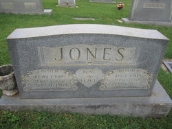
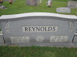
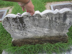
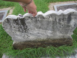
Nancy Ada Fulk Jones
| Birth | : | 15 Feb 1889 Surry County, North Carolina, USA |
| Death | : | 16 Jun 1958 Pilot Mountain, Surry County, North Carolina, USA |
| Burial | : | St. Edmund's Churchyard, Norwich, City of Norwich, England |
| Coordinate | : | 52.6342780, 1.2989640 |
| Description | : | Her parents were Jay Franklin Fulk & Laura Ellen McKinney, both buried at the Fulk-McKinney Cemetery in Surry. |
frequently asked questions (FAQ):
-
Where is Nancy Ada Fulk Jones's memorial?
Nancy Ada Fulk Jones's memorial is located at: St. Edmund's Churchyard, Norwich, City of Norwich, England.
-
When did Nancy Ada Fulk Jones death?
Nancy Ada Fulk Jones death on 16 Jun 1958 in Pilot Mountain, Surry County, North Carolina, USA
-
Where are the coordinates of the Nancy Ada Fulk Jones's memorial?
Latitude: 52.6342780
Longitude: 1.2989640
Family Members:
Parent
Spouse
Siblings
Children
Flowers:
Nearby Cemetories:
1. St. Edmund's Churchyard
Norwich, City of Norwich, England
Coordinate: 52.6342780, 1.2989640
2. Whitefriars
Norwich, City of Norwich, England
Coordinate: 52.6351750, 1.3006400
3. St. Julian Churchyard
Norwich, City of Norwich, England
Coordinate: 52.6336490, 1.3010100
4. St. Saviour Churchyard
Norwich, City of Norwich, England
Coordinate: 52.6351710, 1.2968890
5. St. Clement the Martyr Churchyard
Norwich, City of Norwich, England
Coordinate: 52.6332670, 1.2966570
6. St James with Pockthorpe Churchyard
Norwich, City of Norwich, England
Coordinate: 52.6359070, 1.3001060
7. St. Martin at Palace Church
Norwich, City of Norwich, England
Coordinate: 52.6335450, 1.3017730
8. Old Meeting House
Norwich, City of Norwich, England
Coordinate: 52.6338830, 1.2956790
9. St Simon & St Jude Church Cemetery
Norwich, City of Norwich, England
Coordinate: 52.6320630, 1.2976390
10. Norwich Cathedral
Norwich, City of Norwich, England
Coordinate: 52.6319420, 1.3016020
11. Saint George-Tombland Parish Church
Norwich, City of Norwich, England
Coordinate: 52.6312220, 1.2985100
12. St George Colegate Church
Norwich, City of Norwich, England
Coordinate: 52.6332060, 1.2940200
13. St. Peter's Hungate Churchyard
Norwich, City of Norwich, England
Coordinate: 52.6311100, 1.2970000
14. Princes Street Chapel
Norwich, City of Norwich, England
Coordinate: 52.6309470, 1.2969650
15. Black Friars
Norwich, City of Norwich, England
Coordinate: 52.6311800, 1.2959050
16. St. Helen's Churchyard
Norwich, City of Norwich, England
Coordinate: 52.6328420, 1.3044730
17. St. Mary The Less Church
Norwich, City of Norwich, England
Coordinate: 52.6305650, 1.2982900
18. St. Michael at Plea Cemetery
Norwich, City of Norwich, England
Coordinate: 52.6305230, 1.2972160
19. Saint Mary In The Marsh Churchyard
Norwich, City of Norwich, England
Coordinate: 52.6307240, 1.3025470
20. St. Andrew's Churchyard
Norwich, City of Norwich, England
Coordinate: 52.6304640, 1.2953880
21. St Mary Coslany Churchyard
Norwich, City of Norwich, England
Coordinate: 52.6341180, 1.2914040
22. St. Michael of Closany Churchyard
Norwich, City of Norwich, England
Coordinate: 52.6329950, 1.2914510
23. Saint Michael Coslany Parish Churchyard
Norwich, City of Norwich, England
Coordinate: 52.6329420, 1.2914110
24. St. Augustine's Churchyard
Norwich, City of Norwich, England
Coordinate: 52.6371000, 1.2925960

