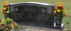
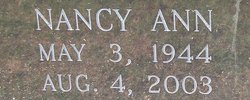
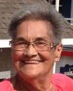
Nancy Ann Boyd Webb
| Birth | : | 3 May 1944 Leonard, Clay County, Arkansas, USA |
| Death | : | 4 Aug 2003 Cape Girardeau, Cape Girardeau County, Missouri, USA |
| Burial | : | Westlawn-Hillcrest Memorial Park, Omaha, Douglas County, USA |
| Coordinate | : | 41.2346992, -95.9966965 |
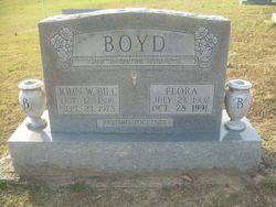
| Description | : | Nancy Ann Boyd Webb, 59, of Cape Girardeau, Mo., formerly of Rector, died Monday, Aug. 4, 2003, at St. Francis Medical Center in Cape Girardeau. She was born May 3, 1944, in Leonard, the daughter of the late John William "Bill" and Flora Jesse Elrod Boyd. She married James KennethWebb on June 2, 1962. She was a housewife and a member of the Methodist Church of Leonard. She was preceded in death by two brothers, John William "Bud" Boyd and Leslie Carl Boyd; one sister, Thelma "Jappy" Cole; and one grandson, Gregory Steel. She is survived by her husband, Kenneth; one son, James Kevin Webb... Read More |
frequently asked questions (FAQ):
-
Where is Nancy Ann Boyd Webb's memorial?
Nancy Ann Boyd Webb's memorial is located at: Westlawn-Hillcrest Memorial Park, Omaha, Douglas County, USA.
-
When did Nancy Ann Boyd Webb death?
Nancy Ann Boyd Webb death on 4 Aug 2003 in Cape Girardeau, Cape Girardeau County, Missouri, USA
-
Where are the coordinates of the Nancy Ann Boyd Webb's memorial?
Latitude: 41.2346992
Longitude: -95.9966965
Family Members:
Parent
Spouse
Siblings
Flowers:
Nearby Cemetories:
1. Westlawn-Hillcrest Memorial Park
Omaha, Douglas County, USA
Coordinate: 41.2346992, -95.9966965
2. Bohemian Cemetery
Omaha, Douglas County, USA
Coordinate: 41.2388992, -95.9955978
3. Ak-Sar-Ben Racetrack Grounds
Omaha, Douglas County, USA
Coordinate: 41.2414703, -96.0159607
4. Douglas County Poor Farm Cemetery
Omaha, Douglas County, USA
Coordinate: 41.2437240, -95.9723480
5. Holy Sepulchre Cemetery
Omaha, Douglas County, USA
Coordinate: 41.2543983, -95.9875031
6. Calvary Cemetery
Omaha, Douglas County, USA
Coordinate: 41.2364006, -96.0294037
7. Graceland Park Cemetery
Omaha, Douglas County, USA
Coordinate: 41.2113991, -95.9785995
8. Evergreen Memorial Park Cemetery
Omaha, Douglas County, USA
Coordinate: 41.2393990, -96.0355988
9. Resurrection Cemetery
Omaha, Douglas County, USA
Coordinate: 41.2344208, -96.0365448
10. First Central Congregational Columbarium
Omaha, Douglas County, USA
Coordinate: 41.2563456, -95.9658365
11. Saint Mary Magdalene Cemetery
Omaha, Douglas County, USA
Coordinate: 41.2039420, -95.9850610
12. Nash Chapel Crypt
Omaha, Douglas County, USA
Coordinate: 41.2665090, -95.9721790
13. Saint Andrews Episcopal Church Columbarium
Omaha, Douglas County, USA
Coordinate: 41.2492500, -96.0427500
14. Saint Mary's Cemetery
Omaha, Douglas County, USA
Coordinate: 41.2042007, -95.9646988
15. Beth El Cemetery
Ralston, Douglas County, USA
Coordinate: 41.2117004, -96.0428009
16. Countryside Community Church Columbarium
Omaha, Douglas County, USA
Coordinate: 41.2483660, -96.0500270
17. Trinity Cathedral Columbarium
Omaha, Douglas County, USA
Coordinate: 41.2603900, -95.9393660
18. Prospect Hill Cemetery
Omaha, Douglas County, USA
Coordinate: 41.2780991, -95.9593964
19. Saint Johns Cemetery
Bellevue, Sarpy County, USA
Coordinate: 41.1864014, -95.9682999
20. Laurel Hill Cemetery
Omaha, Douglas County, USA
Coordinate: 41.1918983, -95.9417038
21. All Saints Episcopal Church Columbarium
Omaha, Douglas County, USA
Coordinate: 41.2785000, -96.0579000
22. Fisher Farm Cemetery
Bellevue, Sarpy County, USA
Coordinate: 41.1727982, -95.9760971
23. Hrabik Cemetery
Bellevue, Sarpy County, USA
Coordinate: 41.1726540, -95.9768200
24. Papillion Cemetery
Papillion, Sarpy County, USA
Coordinate: 41.1758003, -96.0410995

