
| Birth | : | 1804 North Carolina, USA |
| Death | : | 1867 Rutherford County, North Carolina, USA |
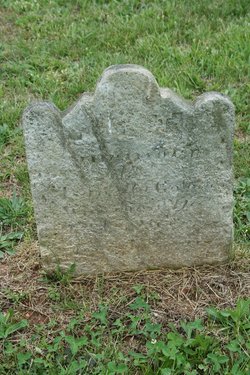
| Burial | : | Camp Creek Baptist Church Cemetery, Union Mills, Rutherford County, USA |
| Coordinate | : | 35.5141983, -81.9039001 |
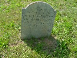
| Description | : | Daughter of John Preston Goforth & Isabella [Smart] Goforth Wife of Daniel Watson Married February 20, 1834 Rutherford Co., NC Mother of: William P. Watson Daniel Watson Death date: calculated Burial location unknown |
frequently asked questions (FAQ):
-
Where is Nancy Jane Goforth Watson's memorial?
Nancy Jane Goforth Watson's memorial is located at: Camp Creek Baptist Church Cemetery, Union Mills, Rutherford County, USA.
-
When did Nancy Jane Goforth Watson death?
Nancy Jane Goforth Watson death on 1867 in Rutherford County, North Carolina, USA
-
Where are the coordinates of the Nancy Jane Goforth Watson's memorial?
Latitude: 35.5141983
Longitude: -81.9039001
Family Members:
Parent

Siblings
Flowers:


Nearby Cemetories:
1. Camp Creek Baptist Church Cemetery
Union Mills, Rutherford County, USA
Coordinate: 35.5141983, -81.9039001
2. Fork Creek Baptist Church Cemetery
Rutherford County, USA
Coordinate: 35.5249710, -81.8802872
3. Pleasant Hill Cemetery
Rutherford County, USA
Coordinate: 35.5022011, -81.9441986
4. Brackettown Cemetery
McDowell County, USA
Coordinate: 35.5532990, -81.9207993
5. Pisgah United Methodist Church Cemetery
Rutherfordton, Rutherford County, USA
Coordinate: 35.4770130, -81.8799750
6. Cane Creek Baptist Church Cemetery
Union Mills, Rutherford County, USA
Coordinate: 35.5222250, -81.8530630
7. Union Mills Presbyterian Church Cemetery
Union Mills, Rutherford County, USA
Coordinate: 35.4824350, -81.9440390
8. Westminister Baptist Church Cemetery
Rutherfordton, Rutherford County, USA
Coordinate: 35.4647750, -81.8927880
9. Centennial Cemetery
Rutherford County, USA
Coordinate: 35.4655991, -81.9206009
10. Old Thermal City Church Cemetery
Thermal City, Rutherford County, USA
Coordinate: 35.5173120, -81.9706250
11. Mount Pleasant CME Church Cemetery
Union Mills, Rutherford County, USA
Coordinate: 35.4818800, -81.9592700
12. Round Hill Baptist Church Cemetery
Union Mills, Rutherford County, USA
Coordinate: 35.4934690, -81.9711200
13. Union Hill A.M.E. Zion Church Cemetery
Union Mills, Rutherford County, USA
Coordinate: 35.4850770, -81.9671190
14. Sprouse Cemetery
Dysartsville, McDowell County, USA
Coordinate: 35.5723570, -81.9297430
15. Brittain Cemetery
Rutherfordton, Rutherford County, USA
Coordinate: 35.4530983, -81.8861008
16. Grace Tabernacle Cemetery
Union Mills, Rutherford County, USA
Coordinate: 35.4957850, -81.9777540
17. Poteet Family Cemetery
McDowell County, USA
Coordinate: 35.5774040, -81.9125020
18. Epps Family Cemetery
McDowell County, USA
Coordinate: 35.5778020, -81.9016850
19. Macedonia Baptist Church Cemetery
McDowell County, USA
Coordinate: 35.5770190, -81.9369820
20. Sandy Level Baptist Cemetery
Bostic, Rutherford County, USA
Coordinate: 35.4591400, -81.8520440
21. Flack Family Cemetery
Union Mills, Rutherford County, USA
Coordinate: 35.4765400, -81.9784300
22. Piney Ridge C.M.E Cemetery
Rutherfordton, Rutherford County, USA
Coordinate: 35.4467490, -81.9382130
23. Liberty Hill Cemetery
Rutherford County, USA
Coordinate: 35.4791985, -81.9847031
24. Weast Cemetery
Sunshine, Rutherford County, USA
Coordinate: 35.5341320, -81.8145960