
| Birth | : | 1835 Grayson County, Virginia, USA |
| Death | : | unknown Grayson County, Virginia, USA |
| Burial | : | Chestnut Hill Cemetery, Independence, Grayson County, USA |
| Coordinate | : | 36.6506430, -81.1335430 |
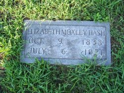
| Description | : | "The night that Nancy Moxley died of tuberculosis was during the Civil War, and there were no men present. Her sister Bettie (Elizabeth) and her nephew little Jeff Jones had to go about a half a mile through the woods by candlelight to a neighbor's house to get someone to come to her home." Jeff Jones was born in June 1861. So for him to go through the woods at night he had to be at least 3 years old. So Nancy must have died in Fall 1864/Spring 1865. Grave has no marker. |
frequently asked questions (FAQ):
-
Where is Nancy Moxley's memorial?
Nancy Moxley's memorial is located at: Chestnut Hill Cemetery, Independence, Grayson County, USA.
-
When did Nancy Moxley death?
Nancy Moxley death on unknown in Grayson County, Virginia, USA
-
Where are the coordinates of the Nancy Moxley's memorial?
Latitude: 36.6506430
Longitude: -81.1335430
Family Members:
Parent

Siblings
Flowers:


Nearby Cemetories:
1. Chestnut Hill Cemetery
Independence, Grayson County, USA
Coordinate: 36.6506430, -81.1335430
2. Lewis Bryant Cemetery
Grayson County, USA
Coordinate: 36.6550630, -81.1305770
3. Hale John L Cemetery
Grayson County, USA
Coordinate: 36.6430000, -81.1400000
4. Matthew Dickey Family Cemetery
Independence, Grayson County, USA
Coordinate: 36.6361220, -81.1381460
5. Bedwell - Wiley Cemetery
Independence, Grayson County, USA
Coordinate: 36.6598600, -81.1152200
6. Flat Rock Cemetery
Independence, Grayson County, USA
Coordinate: 36.6439670, -81.1096540
7. Dickey Cemetery
Independence, Grayson County, USA
Coordinate: 36.6427280, -81.1612680
8. Elbert Columbus Fulton Cemetery
Independence, Grayson County, USA
Coordinate: 36.6261000, -81.1358000
9. Hall Cemetery
Grayson County, USA
Coordinate: 36.6285830, -81.1168500
10. Davis Family Cemetery
Independence, Grayson County, USA
Coordinate: 36.6249170, -81.1506460
11. Rock Creek Primitive Baptist Church Cemetery
Independence, Grayson County, USA
Coordinate: 36.6311000, -81.1061900
12. Wyatt McBride Family Cemetery
Independence, Grayson County, USA
Coordinate: 36.6438770, -81.0972940
13. David Sexton Cemetery
Independence, Grayson County, USA
Coordinate: 36.6220000, -81.1510000
14. Independence Cemetery
Independence, Grayson County, USA
Coordinate: 36.6231660, -81.1546420
15. Independence Town Cemetery
Independence, Grayson County, USA
Coordinate: 36.6260790, -81.1603590
16. Fulton Family Cemetery
Independence, Grayson County, USA
Coordinate: 36.6484470, -81.0901500
17. Pilgrims Rest Primitive Baptist Church Cemetery
Independence, Grayson County, USA
Coordinate: 36.6658330, -81.0933970
18. Fleming S Thomas Cemetery
Independence, Grayson County, USA
Coordinate: 36.6158340, -81.1510190
19. Hackler Cemetery
Independence, Grayson County, USA
Coordinate: 36.6799500, -81.1036520
20. Boyer-Poe Cemetery
Independence, Grayson County, USA
Coordinate: 36.6213400, -81.1640800
21. Old Fulton Cemetery
Peach Bottom, Grayson County, USA
Coordinate: 36.6932930, -81.1172570
22. Churchwell Boyer Family Cemetery
Independence, Grayson County, USA
Coordinate: 36.6850490, -81.1750080
23. Brush Creek Baptist Church Cemetery
Independence, Grayson County, USA
Coordinate: 36.6023280, -81.1520450
24. Joshua Mack Cox Cemetery
Independence, Grayson County, USA
Coordinate: 36.6104650, -81.1721170