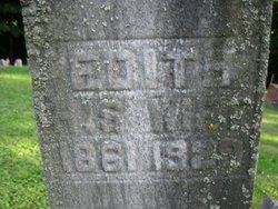
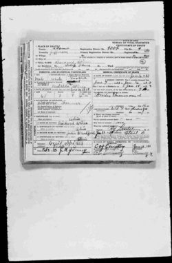
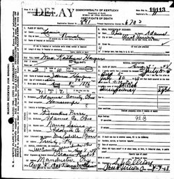
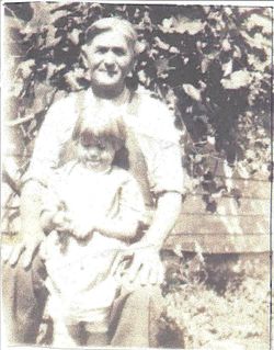
Nancy Spires Price
| Birth | : | 18 Jan 1853 Adams County, Ohio, USA |
| Death | : | 8 Feb 1909 Ohio, USA |
| Burial | : | St. Catherine's Churchyard, Barton-upon-Irwell, Metropolitan Borough of Salford, England |
| Coordinate | : | 53.4733160, -2.3542070 |
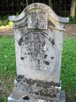
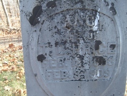
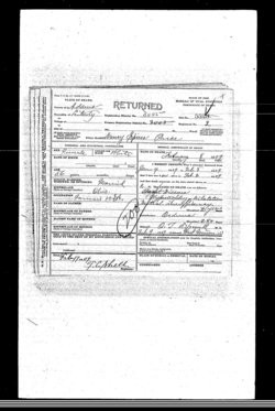
| Description | : | D/O Richard Spires and Julia Bradford W/O Thomas Duncan Price Daughter Julia Price married Virgil V. Pence -----------------------------------------------------------Obituary: People's Defender: The angel of death once more visited our home and took away the dear companion and mother, Nancy Price. She was born Feb. 18, 1853, departed this life Feb. 8, 1909, aged 55 years, 11 mo., and 21 days. The deceased was the daughter of Richard and Julia Spires, and was united in marriage to T.D. Price, Jan. 1, 1875. To this happy union were born twelve children of whom nine are living and a companion nine grandchildren and a host of friends and... Read More |
frequently asked questions (FAQ):
-
Where is Nancy Spires Price's memorial?
Nancy Spires Price's memorial is located at: St. Catherine's Churchyard, Barton-upon-Irwell, Metropolitan Borough of Salford, England.
-
When did Nancy Spires Price death?
Nancy Spires Price death on 8 Feb 1909 in Ohio, USA
-
Where are the coordinates of the Nancy Spires Price's memorial?
Latitude: 53.4733160
Longitude: -2.3542070
Family Members:
Parent
Spouse
Siblings
Children
Flowers:
Nearby Cemetories:
1. St. Catherine's Churchyard
Barton-upon-Irwell, Metropolitan Borough of Salford, England
Coordinate: 53.4733160, -2.3542070
2. Barton Upon Irwell Roman Catholic Graveyard
Metropolitan Borough of Salford, England
Coordinate: 53.4753010, -2.3554530
3. Barton Wesleyan Methodist Chapelyard
Eccles, Metropolitan Borough of Salford, England
Coordinate: 53.4763680, -2.3559280
4. Peel Green Cemetery
Eccles, Metropolitan Borough of Salford, England
Coordinate: 53.4759674, -2.3753860
5. St Mary the Virgin Churchyard
Eccles, Metropolitan Borough of Salford, England
Coordinate: 53.4843810, -2.3346810
6. Urmston Cemetery
Urmston, Metropolitan Borough of Trafford, England
Coordinate: 53.4419290, -2.3533890
7. Weaste Cemetery
Weaste, Metropolitan Borough of Salford, England
Coordinate: 53.4795227, -2.3017540
8. St Mark Churchyard
Worsley, Metropolitan Borough of Salford, England
Coordinate: 53.5024361, -2.3833430
9. St. Peter's Churchyard
Swinton, Metropolitan Borough of Salford, England
Coordinate: 53.5119130, -2.3413860
10. St Matthew Churchyard
Stretford, Metropolitan Borough of Trafford, England
Coordinate: 53.4437700, -2.3099900
11. St. Martin's Churchyard
Ashton upon Mersey, Metropolitan Borough of Trafford, England
Coordinate: 53.4332650, -2.3444220
12. St John The Evangelist Churchyard
Pendlebury, Metropolitan Borough of Salford, England
Coordinate: 53.5036200, -2.3088500
13. St. Paul's Wesleyan Methodist Churchyard
Swinton, Metropolitan Borough of Salford, England
Coordinate: 53.5133900, -2.3397500
14. Saint Augustine's Churchyard
Pendlebury, Metropolitan Borough of Salford, England
Coordinate: 53.5107070, -2.3223960
15. Stretford Cemetery
Stretford, Metropolitan Borough of Trafford, England
Coordinate: 53.4429660, -2.3046520
16. St Mary's Catholic Cemetery
Wardley, Metropolitan Borough of Salford, England
Coordinate: 53.5163700, -2.3645900
17. St. Thomas' Churchyard
Salford, Metropolitan Borough of Salford, England
Coordinate: 53.4921430, -2.2856130
18. Swinton Cemetery
Swinton, Metropolitan Borough of Salford, England
Coordinate: 53.5183372, -2.3457739
19. Friends Cemetery
Ashton upon Mersey, Metropolitan Borough of Trafford, England
Coordinate: 53.4272490, -2.3281035
20. Agecroft Cemetery and Crematorium
Salford, Metropolitan Borough of Salford, England
Coordinate: 53.5100250, -2.2940500
21. Agecroft Jewish Cemetery
Pendlebury, Metropolitan Borough of Salford, England
Coordinate: 53.5110302, -2.2955830
22. Saint George Churchyard
Carrington, Metropolitan Borough of Trafford, England
Coordinate: 53.4300760, -2.4109550
23. St Anne Churchyard
Clifton, Metropolitan Borough of Salford, England
Coordinate: 53.5277070, -2.3391650
24. Chorlton Green Cemetery
Chorlton-Cum-Hardy, Metropolitan Borough of Manchester, England
Coordinate: 53.4377780, -2.2830910

