
| Birth | : | 16 Jun 1840 Weld, Franklin County, Maine, USA |
| Death | : | 13 Jun 1910 Presque Isle, Aroostook County, Maine, USA |
| Burial | : | Fairmount Cemetery, Presque Isle, Aroostook County, USA |
| Coordinate | : | 46.6628075, -68.0077744 |
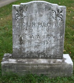
| Inscription | : | NATHAN PULCIFUR Co. A, Me Regt. June 16, 1840 - June 13, 1910 Rest soldier rest ALICE J. Wife of Nathan Pulcifur Dec. 13, 1847 - May 30, 1915 |
| Description | : | Member of Co. A, 8th Maine Regiment in the Civil War. According to the 1860 census, Nathan J. was 19 years old and living with his family in Weld, Maine. In the home were father Nathan (60), mother Betsy (53), and children Nathan J., Alexander W. (18), Fanny L. (16), Augusta M. (12), Annette E. (9), and Clara E. (6). Also living with the Pulcifurs were William H. Cutting (32), Sally E. Cutting (30), Ella J. Cutting (7), and Alura A. Cutting (2). U.S. Civil War Soldier Records and Profiles state that Nathan enlisted on September 7, 1861... Read More |
frequently asked questions (FAQ):
-
Where is Nathan Pulcifur's memorial?
Nathan Pulcifur's memorial is located at: Fairmount Cemetery, Presque Isle, Aroostook County, USA.
-
When did Nathan Pulcifur death?
Nathan Pulcifur death on 13 Jun 1910 in Presque Isle, Aroostook County, Maine, USA
-
Where are the coordinates of the Nathan Pulcifur's memorial?
Latitude: 46.6628075
Longitude: -68.0077744
Family Members:
Parent
Spouse

Children
Flowers:


Nearby Cemetories:
1. Fairmount Cemetery
Presque Isle, Aroostook County, USA
Coordinate: 46.6628075, -68.0077744
2. Saint Marys Chapman Street Cemetery
Presque Isle, Aroostook County, USA
Coordinate: 46.6754150, -68.0215990
3. Bartlett Cemetery
Presque Isle, Aroostook County, USA
Coordinate: 46.6765327, -67.9827118
4. Saint Marys Cemetery
Presque Isle, Aroostook County, USA
Coordinate: 46.6930930, -68.0104730
5. Johnson Cemetery
Presque Isle, Aroostook County, USA
Coordinate: 46.7078209, -68.0069733
6. Reuben Bean Family Cemetery
Aroostook County, USA
Coordinate: 46.7141610, -67.9514610
7. Estes Park Cemetery
Easton, Aroostook County, USA
Coordinate: 46.6418110, -67.9181820
8. Bean Family Cemetery
Aroostook County, USA
Coordinate: 46.7396440, -67.9542600
9. Grendell Cemetery
Chapman, Aroostook County, USA
Coordinate: 46.6364010, -68.1318340
10. Knight Cemetery
Fort Fairfield, Aroostook County, USA
Coordinate: 46.6876150, -67.8778140
11. Pine Tree Cemetery
Easton, Aroostook County, USA
Coordinate: 46.6774640, -67.8727940
12. Mount Shiloh Cemetery
Easton, Aroostook County, USA
Coordinate: 46.6362460, -67.8670810
13. Hillside Grove Cemetery
Crouseville, Aroostook County, USA
Coordinate: 46.7566760, -68.0765500
14. Crouseville Cemetery
Crouseville, Aroostook County, USA
Coordinate: 46.7574997, -68.0768967
15. Old Mill Town Cemetery
Mapleton, Aroostook County, USA
Coordinate: 46.6815700, -68.1609100
16. Southside Cemetery
Mapleton, Aroostook County, USA
Coordinate: 46.6622050, -68.1633620
17. Marshall Cemetery
Westfield, Aroostook County, USA
Coordinate: 46.5635986, -67.9464035
18. Haines Maple Grove Cemetery
Fort Fairfield, Aroostook County, USA
Coordinate: 46.7233160, -67.8699040
19. Ladner Cemetery
Easton, Aroostook County, USA
Coordinate: 46.6444170, -67.8149570
20. Union Cemetery
Fort Fairfield, Aroostook County, USA
Coordinate: 46.7566150, -67.8655240
21. Harvey Hill Cemetery
McShea, Aroostook County, USA
Coordinate: 46.7567099, -67.8652997
22. Castle Hill Cemetery
Castle Hill, Aroostook County, USA
Coordinate: 46.7346840, -68.1792210
23. Greenridge Cemetery
Caribou, Aroostook County, USA
Coordinate: 46.7923622, -67.9321976
24. Lyndon Center Cemetery
Caribou, Aroostook County, USA
Coordinate: 46.8022240, -67.9921920