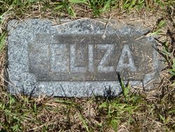
| Birth | : | 1798 Eaton, Carroll County, New Hampshire, USA |
| Death | : | 23 Mar 1855 Conway, Carroll County, New Hampshire, USA |
| Burial | : | Fowler Cemetery, Fowler, Otero County, USA |
| Coordinate | : | 38.1301000, -104.0076000 |
| Plot | : | 28 |
| Description | : | Nathaniel B. Drew was born in 1798 in Conway, New Hampshire, when his father, Thomas, was 27 and his mother, Mary, was 26. He and his brothers served in the war of 1812. He married Clarissa P. Willey on December 17, 1818, in Eaton, New Hampshire. In 1820 they traveled by ox cart with their first born to Glover, Vermont. Around 20 years later they moved back to Conway, New Hampshire. Nathaniel was a farmer. They had eight children in 21 years. All except the first and the last were born in Glover, Vermont. He died on March 23, 1855,... Read More |
frequently asked questions (FAQ):
-
Where is Nathaniel B Drew's memorial?
Nathaniel B Drew's memorial is located at: Fowler Cemetery, Fowler, Otero County, USA.
-
When did Nathaniel B Drew death?
Nathaniel B Drew death on 23 Mar 1855 in Conway, Carroll County, New Hampshire, USA
-
Where are the coordinates of the Nathaniel B Drew's memorial?
Latitude: 38.1301000
Longitude: -104.0076000
Family Members:
Parent
Spouse
Children
Flowers:
Nearby Cemetories:
1. Fowler Cemetery
Fowler, Otero County, USA
Coordinate: 38.1301000, -104.0076000
2. Barnard Burial Site
Elder, Otero County, USA
Coordinate: 38.1235554, -103.9665095
3. Olney Springs Cemetery
Olney Springs, Crowley County, USA
Coordinate: 38.1472282, -103.9310684
4. Manzanola Mountainview Cemetery
Manzanola, Otero County, USA
Coordinate: 38.0900002, -103.8764038
5. Nepesta Cemetery
Nepesta, Pueblo County, USA
Coordinate: 38.1672000, -104.1436000
6. Lucero Family Cemetery
Nepesta, Pueblo County, USA
Coordinate: 38.1677340, -104.1480540
7. San Jose Church Cemetery
Avondale, Pueblo County, USA
Coordinate: 38.1909300, -104.2949720
8. Saint Vrain Cemetery
Avondale, Pueblo County, USA
Coordinate: 38.2098000, -104.2878000
9. Valley View Cemetery
Ordway, Crowley County, USA
Coordinate: 38.2546997, -103.7489014
10. Valley View Cemetery
Rocky Ford, Otero County, USA
Coordinate: 38.0388985, -103.7093964
11. Hillcrest Cemetery
Rocky Ford, Otero County, USA
Coordinate: 38.0388985, -103.7071991
12. Lakeview Cemetery
Sugar City, Crowley County, USA
Coordinate: 38.2332993, -103.6725006
13. Finn Cemetery
Pueblo County, USA
Coordinate: 37.9986000, -104.3794022
14. Plaza Cemetery
Pueblo, Pueblo County, USA
Coordinate: 38.0566170, -104.4118500
15. Doyle Cemetery
Avondale, Pueblo County, USA
Coordinate: 38.0602989, -104.4167023
16. Chico Cemetery
Pueblo County, USA
Coordinate: 38.2782000, -104.4006000
17. Highland Cemetery
Pueblo County, USA
Coordinate: 38.4645000, -104.1486000
18. Holbrook Cemetery
Otero County, USA
Coordinate: 38.0842018, -103.5432968
19. Timpas Cemetery
Timpas, Otero County, USA
Coordinate: 37.8081000, -103.7681000
20. Ormega Cemetery
La Junta, Otero County, USA
Coordinate: 37.9684000, -103.5770000
21. Fairview Cemetery
La Junta, Otero County, USA
Coordinate: 37.9873000, -103.5607000
22. Calvary Cemetery
La Junta, Otero County, USA
Coordinate: 37.9832000, -103.5622000
23. Saint Andrews Episcopal Church Columbarium
La Junta, Otero County, USA
Coordinate: 37.9809000, -103.5455000
24. East Holbrook Mennonite Cemetery
Cheraw, Otero County, USA
Coordinate: 38.1101837, -103.4729767


