
| Memorials | : | 1194 |
| Location | : | La Junta, Otero County, USA |
| Coordinate | : | 37.9873000, -103.5607000 |
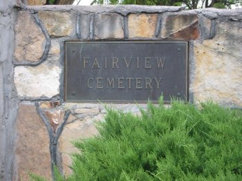
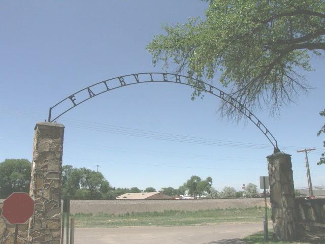
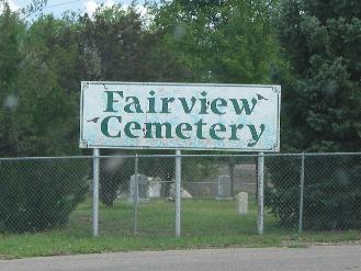
| Description | : | Lone Home Cemetery - “J.W. Vandiver filled a plat of Lone Home Cemetery in county clerks office 9 Mar 1901. The new burying ground adjoins Riverview in the west.” Source, The Junta Tribune; 16 Mar 1901, Saturday Fairview Cemetery - Fairview Cemetery Association articles of incorporation were filled the week of 15 June 1908. “The association has recently acquired title to all of the lands included in Lone Home and Riverview Cemeteries, and all lands adjoining embraced by the tract immediately west of the railroad track and surrounded by a county road on the north, south, and west, making... Read More |
frequently asked questions (FAQ):
-
Where is Fairview Cemetery?
Fairview Cemetery is located at La Junta, Otero County ,Colorado ,USA.
-
Fairview Cemetery cemetery's updated grave count on graveviews.com?
1192 memorials
-
Where are the coordinates of the Fairview Cemetery?
Latitude: 37.9873000
Longitude: -103.5607000

Nearby Cemetories:
1. Calvary Cemetery
La Junta, Otero County, USA
Coordinate: 37.9832000, -103.5622000
2. Saint Andrews Episcopal Church Columbarium
La Junta, Otero County, USA
Coordinate: 37.9809000, -103.5455000
3. Ormega Cemetery
La Junta, Otero County, USA
Coordinate: 37.9684000, -103.5770000
4. Saint Paul’s Lutheran Cemetery
Otero County, USA
Coordinate: 38.0342000, -103.4542000
5. Holbrook Cemetery
Otero County, USA
Coordinate: 38.0842018, -103.5432968
6. Bents Old Fort Cemetery
La Junta, Otero County, USA
Coordinate: 38.0416000, -103.4297000
7. Hillcrest Cemetery
Rocky Ford, Otero County, USA
Coordinate: 38.0388985, -103.7071991
8. Valley View Cemetery
Rocky Ford, Otero County, USA
Coordinate: 38.0388985, -103.7093964
9. East Holbrook Mennonite Cemetery
Cheraw, Otero County, USA
Coordinate: 38.1101837, -103.4729767
10. Higbee Cemetery
Higbee, Otero County, USA
Coordinate: 37.7630997, -103.4555969
11. Timpas Cemetery
Timpas, Otero County, USA
Coordinate: 37.8081000, -103.7681000
12. Lakeview Cemetery
Sugar City, Crowley County, USA
Coordinate: 38.2332993, -103.6725006
13. Martinez Cemetery
Otero County, USA
Coordinate: 37.7303009, -103.5002975
14. Manzanola Mountainview Cemetery
Manzanola, Otero County, USA
Coordinate: 38.0900002, -103.8764038
15. Las Animas Cemetery
Las Animas, Bent County, USA
Coordinate: 38.0424995, -103.2174988
16. Boggsville National Historic Site Grounds
Boggsville, Bent County, USA
Coordinate: 38.0425130, -103.2102730
17. Valley View Cemetery
Ordway, Crowley County, USA
Coordinate: 38.2546997, -103.7489014
18. Olney Springs Cemetery
Olney Springs, Crowley County, USA
Coordinate: 38.1472282, -103.9310684
19. Pruett Cemetery
Bent County, USA
Coordinate: 37.7172012, -103.2897034
20. Barnard Burial Site
Elder, Otero County, USA
Coordinate: 38.1235554, -103.9665095
21. Dolores Mission Cemetery
Kim, Las Animas County, USA
Coordinate: 37.6365200, -103.5854900
22. Fort Lyon National Cemetery
Fort Lyon, Bent County, USA
Coordinate: 38.0847015, -103.1288986
23. Arlington Cemetery
Arlington, Kiowa County, USA
Coordinate: 38.3232994, -103.3597031
24. Fowler Cemetery
Fowler, Otero County, USA
Coordinate: 38.1301000, -104.0076000