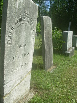
| Birth | : | 1800 New Hampshire, USA |
| Death | : | Jan 1828 Piermont, Grafton County, New Hampshire, USA |
| Burial | : | Clay Hollow Cemetery, Piermont, Grafton County, USA |
| Coordinate | : | 43.9597220, -72.0333330 |
| Description | : | Nathaniel Randall was born around 1800 in Piermont, Grafton County, NH as the second child of Jonathan Randall and Polly. He died in Jan 1828 in Piermont of typhus, on the same day his son Nathaniel was born. He married Lucy Towle, daughter of Nathan Towle Jr. and Elizabeth “Betty” Morrison, about 1820. Lucy Towle Randall died after 1870, probably in Nottingham, NH His estate was probated in 1828 in Grafton County. He owned 4th division #48, co-owner with Micajah Emerson. Nathaniel Randall and Lucy Towle had the following children: A daughter who died the winter... Read More |
frequently asked questions (FAQ):
-
Where is Nathaniel Randall's memorial?
Nathaniel Randall's memorial is located at: Clay Hollow Cemetery, Piermont, Grafton County, USA.
-
When did Nathaniel Randall death?
Nathaniel Randall death on Jan 1828 in Piermont, Grafton County, New Hampshire, USA
-
Where are the coordinates of the Nathaniel Randall's memorial?
Latitude: 43.9597220
Longitude: -72.0333330
Family Members:
Children
Flowers:
Nearby Cemetories:
1. Clay Hollow Cemetery
Piermont, Grafton County, USA
Coordinate: 43.9597220, -72.0333330
2. South Lawn Cemetery
Piermont, Grafton County, USA
Coordinate: 43.9667600, -72.0812500
3. Cedar Grove Cemetery
Piermont, Grafton County, USA
Coordinate: 43.9720300, -72.0813400
4. Rodimon-Cross Cemetery
Piermont, Grafton County, USA
Coordinate: 43.9901100, -71.9924500
5. East Piermont Cemetery
Piermont, Grafton County, USA
Coordinate: 43.9438890, -71.9689890
6. East Orford Cemetery
Orford, Grafton County, USA
Coordinate: 43.9096900, -72.0032600
7. Lund Cemetery
Warren, Grafton County, USA
Coordinate: 43.9882800, -71.9589200
8. River Road Cemetery
Piermont, Grafton County, USA
Coordinate: 44.0019500, -72.1013600
9. Upper Plain Cemetery
Bradford, Orange County, USA
Coordinate: 44.0084900, -72.1097200
10. Sawyer Cemetery
Bradford, Orange County, USA
Coordinate: 44.0085800, -72.1101000
11. Dame Hill Cemetery
Orford, Grafton County, USA
Coordinate: 43.8945370, -72.0833370
12. East Haverhill Cemetery
East Haverhill, Grafton County, USA
Coordinate: 44.0289688, -71.9889297
13. Fairlee Village Cemetery
Fairlee, Orange County, USA
Coordinate: 43.9154900, -72.1321900
14. Ladd Street Cemetery
Haverhill, Grafton County, USA
Coordinate: 44.0439600, -72.0532800
15. West Cemetery
Orford, Grafton County, USA
Coordinate: 43.9081970, -72.1312760
16. Oliverian Road Cemetery
Benton, Grafton County, USA
Coordinate: 43.9978145, -71.9209265
17. Brushwood Cemetery
Fairlee, Orange County, USA
Coordinate: 43.9628600, -72.1623700
18. Number 6 Cemetery
East Haverhill, Grafton County, USA
Coordinate: 44.0326400, -71.9518600
19. Pine Hill Cemetery
Warren, Grafton County, USA
Coordinate: 43.9370003, -71.8929977
20. High Street Cemetery
Glencliff, Grafton County, USA
Coordinate: 43.9851100, -71.8913900
21. Warren Village Cemetery
Warren, Grafton County, USA
Coordinate: 43.9326200, -71.8917600
22. Kidderhood Cemetery
West Fairlee, Orange County, USA
Coordinate: 43.9719034, -72.1869267
23. Goshen Cemetery (Defunct)
Bradford, Orange County, USA
Coordinate: 44.0402170, -72.1469029
24. Clough Cemetery
Warren, Grafton County, USA
Coordinate: 43.9090200, -71.8878800

