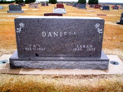
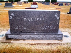
Nay Daniels
| Birth | : | 1 Dec 1885 Fordland, Webster County, Missouri, USA |
| Death | : | 8 May 1967 Saint Francis, Cheyenne County, Kansas, USA |
| Burial | : | Matamata Cemetery, Matamata, Matamata-Piako District, New Zealand |
| Coordinate | : | -37.8018000, 175.7535440 |
| Description | : | s/o Mathew Daniels and Rosa "Rosie" Bowman Daniels. Husband to Sarah Jane Tella -Daniels Married to Sarah Jane 20 Dec. 1908 at Tella Farm, Fordland, Webster Co., MO. Funeral Card; I will lit up mine eyes unto the hills from whence cometh my help. My help cometh from the Lord. Which made heaven and earth. The Lord is thy keeper; the Lord is thy shade upon thy right hand. the sun shall not smite thee by day, nor the moon by night. The Lord shall preserve thee from all evil; He shall preserve thy soul. The Lord shall preserve thy going out and thy coming in from this... Read More |
frequently asked questions (FAQ):
-
Where is Nay Daniels's memorial?
Nay Daniels's memorial is located at: Matamata Cemetery, Matamata, Matamata-Piako District, New Zealand.
-
When did Nay Daniels death?
Nay Daniels death on 8 May 1967 in Saint Francis, Cheyenne County, Kansas, USA
-
Where are the coordinates of the Nay Daniels's memorial?
Latitude: -37.8018000
Longitude: 175.7535440
Family Members:
Parent
Spouse
Siblings
Children
Flowers:
Nearby Cemetories:
1. Matamata Cemetery
Matamata, Matamata-Piako District, New Zealand
Coordinate: -37.8018000, 175.7535440
2. Waharoa Cemetery
Waharoa, Matamata-Piako District, New Zealand
Coordinate: -37.7486230, 175.7444230
3. Waharoa Māori Cemetery
Waharoa, Matamata-Piako District, New Zealand
Coordinate: -37.7473890, 175.7434760
4. Okauia Māori Cemetery
Okauia, Matamata-Piako District, New Zealand
Coordinate: -37.8015800, 175.8726300
5. Toatoaroa Urupā
Matamata, Matamata-Piako District, New Zealand
Coordinate: -37.9017870, 175.6996060
6. Kaimai Flight 441 Air Crash Memorial
Gordon, Matamata-Piako District, New Zealand
Coordinate: -37.6960470, 175.8260440
7. Tirau Cemetery
Tirau, South Waikato District, New Zealand
Coordinate: -37.9622060, 175.7796770
8. Rukumoana Urupā
Matamata, Matamata-Piako District, New Zealand
Coordinate: -37.6976740, 175.5572500
9. Morrinsville Old Cemetery
Morrinsville, Matamata-Piako District, New Zealand
Coordinate: -37.6531500, 175.5374260
10. Piako Cemetery
Morrinsville, Matamata-Piako District, New Zealand
Coordinate: -37.6484900, 175.5412240
11. Leamington Cemetery
Leamington, Waipa District, New Zealand
Coordinate: -37.9048020, 175.4868830
12. Tirau Sreet Cemetery
Putaruru, South Waikato District, New Zealand
Coordinate: -38.0431570, 175.7834490
13. Hautapu Cemetery
Hautapu, Waipa District, New Zealand
Coordinate: -37.8635550, 175.4547250
14. Te Aroha Cemetery
Te Aroha, Matamata-Piako District, New Zealand
Coordinate: -37.5561450, 175.7109550
15. Katikati Cemetery
Katikati, Western Bay of Plenty District, New Zealand
Coordinate: -37.5824500, 175.9061600
16. Domain Road Cemetery
Putaruru, South Waikato District, New Zealand
Coordinate: -38.0603810, 175.7952220
17. Te-Iti-O-Haua-Marae Urupā
Tauwhare, Waikato District, New Zealand
Coordinate: -37.7860000, 175.4208010
18. Pukerimu Cemetery
Cambridge, Waipa District, New Zealand
Coordinate: -37.9048160, 175.4297140
19. Pyes Pa Memorial Park
Tauranga, Tauranga City, New Zealand
Coordinate: -37.7689800, 176.1162770
20. Kutaroa Urupā
Tauranga City, New Zealand
Coordinate: -37.6186690, 176.0719430
21. St. Stephen's Cemetery
Tamahere, Waikato District, New Zealand
Coordinate: -37.8302500, 175.3575900
22. Pukeatua Cemetery
Te Awamutu, Waipa District, New Zealand
Coordinate: -38.0732500, 175.5530120
23. Hamilton Park Cemetery
Hamilton, Hamilton City, New Zealand
Coordinate: -37.7768210, 175.3562990
24. St. Joseph's Church Urupa
Tauranga, Tauranga City, New Zealand
Coordinate: -37.6077515, 176.0759161


