
Nell Bertha Smith Burnham
| Birth | : | 5 Jul 1916 Overbrook, Osage County, Kansas, USA |
| Death | : | 28 Jun 2014 Beloit, Mitchell County, Kansas, USA |
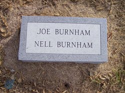
| Burial | : | Pleasant Prairie Cemetery, Randall, Jewell County, USA |
| Coordinate | : | 39.5896988, -98.0627975 |
| Description | : | Nella Bertha Smith was first married to Ralph L Wentworth in 1942. At the time they were living in Salina. Ralph L was a store employee at JC Penny and Nell worked at the drug store Woolworths as a waitress. Then got acquainted and it wasnt long before they were married. They had no children by that marrage and Ralph continued on to become the head manager of JC Pennys. Ralph had worked at several of the stores. By about 1960 that marriage had fallen on apart. Ralph moved to Grand Island Nebraska and enjoyed the area alot... Read More |
frequently asked questions (FAQ):
-
Where is Nell Bertha Smith Burnham's memorial?
Nell Bertha Smith Burnham's memorial is located at: Pleasant Prairie Cemetery, Randall, Jewell County, USA.
-
When did Nell Bertha Smith Burnham death?
Nell Bertha Smith Burnham death on 28 Jun 2014 in Beloit, Mitchell County, Kansas, USA
-
Where are the coordinates of the Nell Bertha Smith Burnham's memorial?
Latitude: 39.5896988
Longitude: -98.0627975
Family Members:


Flowers:


Nearby Cemetories:
1. Star Cemetery
Jewell, Jewell County, USA
Coordinate: 39.5882500, -98.1379400
2. Randall Cemetery
Randall, Jewell County, USA
Coordinate: 39.6465988, -98.0475006
3. West Hope Cemetery
Jewell County, USA
Coordinate: 39.5896988, -97.9871979
4. Lovseth Cemetery
Randall, Jewell County, USA
Coordinate: 39.6249000, -97.9685000
5. Wallace Cemetery
Jewell, Jewell County, USA
Coordinate: 39.6680984, -98.1046982
6. Atkins Union Cemetery
Jewell, Jewell County, USA
Coordinate: 39.5956000, -98.1733000
7. Glendale Cemetery
Solomon Rapids, Mitchell County, USA
Coordinate: 39.5537300, -98.1813000
8. Scottsville Cemetery
Scottsville, Mitchell County, USA
Coordinate: 39.5468102, -97.9474945
9. Alsdurf Cemetery
Randall, Jewell County, USA
Coordinate: 39.6828430, -97.9876620
10. Saint Lukes Cemetery
Randall, Jewell County, USA
Coordinate: 39.6390000, -97.9325000
11. Jewell City Cemetery
Jewell, Jewell County, USA
Coordinate: 39.6693993, -98.1671982
12. Beloit Industrial School Cemetery
Beloit, Mitchell County, USA
Coordinate: 39.4755000, -98.1105810
13. McBride Cemetery
Beloit, Mitchell County, USA
Coordinate: 39.4808006, -97.9907990
14. Elmwood Cemetery
Beloit, Mitchell County, USA
Coordinate: 39.4693985, -98.1014023
15. Union Cemetery
Burr Oak, Jewell County, USA
Coordinate: 39.6408005, -98.2127991
16. Couch Cemetery
Jewell, Jewell County, USA
Coordinate: 39.6401100, -98.2134094
17. Saint Johns Cemetery
Beloit, Mitchell County, USA
Coordinate: 39.4667015, -98.1018982
18. Summit Cemetery #3
Macyville, Cloud County, USA
Coordinate: 39.5258330, -97.9194440
19. West Asher Cemetery
Scottsville, Mitchell County, USA
Coordinate: 39.4815000, -97.9661600
20. Saint Mary's Cemetery
Jamestown, Cloud County, USA
Coordinate: 39.5964012, -97.8850021
21. Jamestown Cemetery
Jamestown, Cloud County, USA
Coordinate: 39.5964012, -97.8839035
22. Smith Cemetery
Asherville, Mitchell County, USA
Coordinate: 39.4516690, -98.0098850
23. Browns Creek Cemetery
Solomon Rapids, Mitchell County, USA
Coordinate: 39.5393982, -98.2463989
24. Pleasant Valley Cemetery
Beloit, Mitchell County, USA
Coordinate: 39.4555900, -98.1722200