
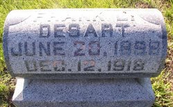
| Birth | : | 30 Nov 1886 Yetter, Calhoun County, Iowa, USA |
| Death | : | 28 Nov 1951 |
| Burial | : | Rosehill Cemetery, Rockwell City, Calhoun County, USA |
| Coordinate | : | 42.4042015, -94.6128006 |
frequently asked questions (FAQ):
-
Where is Nellie Adelaide De Sart Williams's memorial?
Nellie Adelaide De Sart Williams's memorial is located at: Rosehill Cemetery, Rockwell City, Calhoun County, USA.
-
When did Nellie Adelaide De Sart Williams death?
Nellie Adelaide De Sart Williams death on 28 Nov 1951 in
-
Where are the coordinates of the Nellie Adelaide De Sart Williams's memorial?
Latitude: 42.4042015
Longitude: -94.6128006
Family Members:
Parent
Spouse

Siblings
Children
Flowers:


Nearby Cemetories:
1. Rosehill Cemetery
Rockwell City, Calhoun County, USA
Coordinate: 42.4042015, -94.6128006
2. Saint Francis Cemetery
Rockwell City, Calhoun County, USA
Coordinate: 42.4055000, -94.6127000
3. Reformatory Cemetery
Rockwell City, Calhoun County, USA
Coordinate: 42.3952570, -94.6038660
4. Twin Lakes Cemetery
Jolley, Calhoun County, USA
Coordinate: 42.4427986, -94.6889038
5. Lake Creek Cemetery
Calhoun County, USA
Coordinate: 42.3394012, -94.6631012
6. Logan Township Cemetery
Logan Township, Calhoun County, USA
Coordinate: 42.3539009, -94.5330963
7. Leith Cemetery
Manson, Calhoun County, USA
Coordinate: 42.4878006, -94.5667038
8. Memorial Park Cemetery
Calhoun County, USA
Coordinate: 42.5189018, -94.6194000
9. Hope Cemetery
Manson, Calhoun County, USA
Coordinate: 42.4994011, -94.5199966
10. Crown Hill Cemetery
Jolley, Calhoun County, USA
Coordinate: 42.4808006, -94.7360992
11. Greenfield Cemetery
Knierim, Calhoun County, USA
Coordinate: 42.4495000, -94.4565000
12. Cedar Cemetery
Rinard, Calhoun County, USA
Coordinate: 42.3456001, -94.4644012
13. Saint Thomas Cemetery
Manson, Calhoun County, USA
Coordinate: 42.5208500, -94.5365000
14. Garfield Cemetery
Calhoun County, USA
Coordinate: 42.4275017, -94.7902985
15. Rose Hill Cemetery
Manson, Calhoun County, USA
Coordinate: 42.5228004, -94.5243988
16. Trinity Cemetery
Calhoun County, USA
Coordinate: 42.4747200, -94.4555588
17. Swedish Cemetery
Manson, Calhoun County, USA
Coordinate: 42.5426295, -94.5992013
18. Union Cemetery
Pomeroy, Calhoun County, USA
Coordinate: 42.5539017, -94.6789017
19. Saint Marys Catholic Cemetery
Pomeroy, Calhoun County, USA
Coordinate: 42.5558014, -94.6889038
20. Evergreen Cemetery
Lohrville, Calhoun County, USA
Coordinate: 42.2505989, -94.5330963
21. Saint Joseph Cemetery
Lohrville, Calhoun County, USA
Coordinate: 42.2569008, -94.5119019
22. Saint Paul Lutheran Cemetery
Pocahontas County, USA
Coordinate: 42.5610000, -94.5392000
23. Saint Marys Catholic Cemetery
Lake City, Calhoun County, USA
Coordinate: 42.2730000, -94.7567000
24. Lake City Cemetery
Lake City, Calhoun County, USA
Coordinate: 42.2719002, -94.7574997