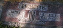
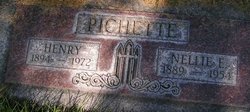
Nellie Ester Douglas Pichette
| Birth | : | 28 Aug 1889 Washington, USA |
| Death | : | 19 Nov 1954 Omak, Okanogan County, Washington, USA |
| Burial | : | Bronson Cemetery, Bronson, Branch County, USA |
| Coordinate | : | 41.8699340, -85.1858320 |
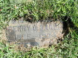
| Description | : | Idaho Marriages, 1842-1996 Name:Nellie E. Douglas Gender:Female Spouse:Perry O. Baker Spouse Gender:Male Marriage Date:Oct 13, 1904 Marriage Location:Lewiston, Nez Perce Co., Idaho Washington Death Certificate Name Nellie Ester Pichette Death date 19 Nov 1954 Death place Omak, Okanogan, Washington Gender Female Age at death 65 years Estimated birth year 1889 Father name Lorenzo Douglas Mother name Lesha Jackson Film number 2033438 Digital GS number 4224486 Image number 2089 Reference number 20293 |
frequently asked questions (FAQ):
-
Where is Nellie Ester Douglas Pichette's memorial?
Nellie Ester Douglas Pichette's memorial is located at: Bronson Cemetery, Bronson, Branch County, USA.
-
When did Nellie Ester Douglas Pichette death?
Nellie Ester Douglas Pichette death on 19 Nov 1954 in Omak, Okanogan County, Washington, USA
-
Where are the coordinates of the Nellie Ester Douglas Pichette's memorial?
Latitude: 41.8699340
Longitude: -85.1858320
Family Members:
Parent
Spouse
Siblings
Children
Flowers:
Nearby Cemetories:
1. Bronson Cemetery
Bronson, Branch County, USA
Coordinate: 41.8699340, -85.1858320
2. Saint Marys Cemetery
Bronson, Branch County, USA
Coordinate: 41.8582993, -85.1939011
3. Snow Prairie Cemetery
Bethel, Branch County, USA
Coordinate: 41.8699989, -85.1408005
4. York Cemetery
Batavia, Branch County, USA
Coordinate: 41.9009350, -85.1318550
5. Curtis Cemetery
Bronson, Branch County, USA
Coordinate: 41.8039017, -85.1956024
6. North Gilead Cemetery
Gilead Township, Branch County, USA
Coordinate: 41.8039017, -85.1557999
7. Matteson Cemetery
Matteson, Branch County, USA
Coordinate: 41.9406013, -85.2046967
8. Adams Cemetery
Bronson, Branch County, USA
Coordinate: 41.8405991, -85.2767029
9. Pleasant Hill Cemetery
Noble Township, Branch County, USA
Coordinate: 41.7961110, -85.2111110
10. Dutch Settlement Cemetery
Bronson, Branch County, USA
Coordinate: 41.8106003, -85.2632980
11. Batavia Cemetery
Batavia, Branch County, USA
Coordinate: 41.9202778, -85.0975000
12. Card Cemetery
Bethel Township, Branch County, USA
Coordinate: 41.8544006, -85.0693970
13. South Gilead Cemetery
Bronson, Branch County, USA
Coordinate: 41.7733330, -85.1566670
14. Ovid Cemetery
Ovid Township, Branch County, USA
Coordinate: 41.8688580, -85.0484920
15. South Colon Cemetery
Colon, St. Joseph County, USA
Coordinate: 41.9199982, -85.3114014
16. Sanborn Cemetery
Burr Oak, St. Joseph County, USA
Coordinate: 41.8708000, -85.3305969
17. Burr Oak Township Cemetery
Burr Oak, St. Joseph County, USA
Coordinate: 41.8472214, -85.3319473
18. Tripp Cemetery
Batavia, Branch County, USA
Coordinate: 41.9425000, -85.0694440
19. East Gilead Cemetery
East Gilead, Branch County, USA
Coordinate: 41.7858330, -85.0825000
20. Trayer Cemetery
Bronson, Branch County, USA
Coordinate: 41.7705550, -85.2677770
21. Branch Cemetery
Coldwater, Branch County, USA
Coordinate: 41.9368200, -85.0485990
22. Lockwood Cemetery
Coldwater, Branch County, USA
Coordinate: 41.8837250, -85.0145170
23. Eroh Cemetery
Fawn River Township, St. Joseph County, USA
Coordinate: 41.8081017, -85.3375015
24. Freedom Cemetery
Fawn River, St. Joseph County, USA
Coordinate: 41.8064003, -85.3371964

