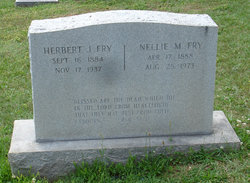
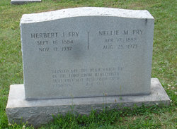
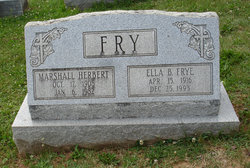
Nellie M. Harris Fry
| Birth | : | 17 Apr 1888 Loudoun County, Virginia, USA |
| Death | : | 25 Aug 1973 Leesburg, Loudoun County, Virginia, USA |
| Burial | : | Gresham Cemetery, Chester Township, Eaton County, USA |
| Coordinate | : | 42.6278000, -84.8938980 |
| Plot | : | C Lot 676 Site 6 |
frequently asked questions (FAQ):
-
Where is Nellie M. Harris Fry's memorial?
Nellie M. Harris Fry's memorial is located at: Gresham Cemetery, Chester Township, Eaton County, USA.
-
When did Nellie M. Harris Fry death?
Nellie M. Harris Fry death on 25 Aug 1973 in Leesburg, Loudoun County, Virginia, USA
-
Where are the coordinates of the Nellie M. Harris Fry's memorial?
Latitude: 42.6278000
Longitude: -84.8938980
Family Members:
Parent
Spouse
Children
Flowers:
Nearby Cemetories:
1. Gresham Cemetery
Chester Township, Eaton County, USA
Coordinate: 42.6278000, -84.8938980
2. Rest Haven Cemetery
Charlotte, Eaton County, USA
Coordinate: 42.6217420, -84.9563380
3. Millerburg Cemetery
Carmel Township, Eaton County, USA
Coordinate: 42.5783348, -84.8752213
4. Ames Cemetery
Vermontville, Eaton County, USA
Coordinate: 42.6411018, -84.9741974
5. Moyer Cemetery
Roxand Township, Eaton County, USA
Coordinate: 42.6919160, -84.8958020
6. Needmore Cemetery
Needmore, Eaton County, USA
Coordinate: 42.6829010, -84.8430130
7. Maple Hill Cemetery
Charlotte, Eaton County, USA
Coordinate: 42.5797005, -84.8218994
8. Cogsdill Cemetery
Kalamo, Eaton County, USA
Coordinate: 42.5817470, -84.9747850
9. West Carmel Cemetery
Charlotte, Eaton County, USA
Coordinate: 42.5540300, -84.9359900
10. Pinch Cemetery
Benton Township, Eaton County, USA
Coordinate: 42.6552770, -84.7877770
11. Vermontville Pioneer Cemetery
Vermontville, Eaton County, USA
Coordinate: 42.5980000, -84.7760000
12. Freemire Cemetery
Sunfield, Eaton County, USA
Coordinate: 42.6852989, -84.9961014
13. Benton Township Cemetery
Potterville, Eaton County, USA
Coordinate: 42.6263885, -84.7638855
14. Welch Cemetery
Sunfield, Eaton County, USA
Coordinate: 42.7174988, -84.9766998
15. Strange Cemetery
Grand Ledge, Eaton County, USA
Coordinate: 42.6952800, -84.7783300
16. Patterson Cemetery
Vermontville, Eaton County, USA
Coordinate: 42.6652985, -85.0327988
17. Center Eaton Cemetery
Charlotte, Eaton County, USA
Coordinate: 42.5349998, -84.7949982
18. Woodlawn Cemetery
Vermontville, Eaton County, USA
Coordinate: 42.6363983, -85.0547028
19. Hillside Cemetery
Kalamo, Eaton County, USA
Coordinate: 42.5462500, -85.0138100
20. Sunfield Cemetery
Sunfield, Eaton County, USA
Coordinate: 42.7277985, -84.9907990
21. Meadowbrook Cemetery
Mulliken, Eaton County, USA
Coordinate: 42.7550011, -84.9028015
22. Mason Cemetery
Kalamo Township, Eaton County, USA
Coordinate: 42.5669440, -85.0508330
23. Pioneer Cemetery
Grand Ledge, Eaton County, USA
Coordinate: 42.7043991, -84.7414017
24. Spaulding Cemetery
Bellevue Township, Eaton County, USA
Coordinate: 42.5056000, -84.9747009

