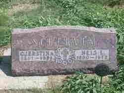
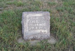
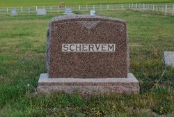
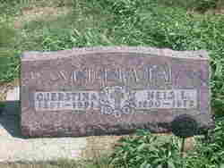
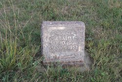
Nels Louis Schervem
| Birth | : | 22 Oct 1890 Minnesota, USA |
| Death | : | 29 May 1972 Pierre, Hughes County, South Dakota, USA |
| Burial | : | Medicine Creek Cemetery, Presho, Lyman County, USA |
| Coordinate | : | 43.9053001, -100.0952988 |
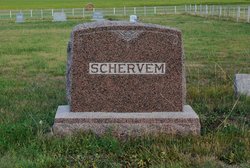
| Description | : | Nels Louis Schervem was born October 22, 1890 in Minnesota and died May 29, 1972 in Pierre. He married Cjerstina Hilmoe on August 30, 1923. Services were in the Vivian Lutheran Church with burial in the Medicine Creek Cemetery west of Presho. |
frequently asked questions (FAQ):
-
Where is Nels Louis Schervem's memorial?
Nels Louis Schervem's memorial is located at: Medicine Creek Cemetery, Presho, Lyman County, USA.
-
When did Nels Louis Schervem death?
Nels Louis Schervem death on 29 May 1972 in Pierre, Hughes County, South Dakota, USA
-
Where are the coordinates of the Nels Louis Schervem's memorial?
Latitude: 43.9053001
Longitude: -100.0952988
Family Members:
Parent
Spouse
Siblings
Children
Flowers:
Nearby Cemetories:
1. Medicine Creek Cemetery
Presho, Lyman County, USA
Coordinate: 43.9053001, -100.0952988
2. Presho Cemetery
Presho, Lyman County, USA
Coordinate: 43.9108658, -100.0631256
3. Holy Angels Cemetery
Presho, Lyman County, USA
Coordinate: 43.8911018, -100.0643997
4. Vivian Cemetery
Vivian, Lyman County, USA
Coordinate: 43.9233017, -100.2652969
5. Earling Cemetery
Lyman County, USA
Coordinate: 43.9206009, -99.9143982
6. Hilmoe Cemetery
Presho, Lyman County, USA
Coordinate: 43.7510986, -100.1793976
7. Prairie View Cemetery
Lyman County, USA
Coordinate: 43.7891998, -99.9032974
8. Saint Michaels Cemetery
Kennebec, Lyman County, USA
Coordinate: 43.9057999, -99.8431015
9. Kennebec Cemetery
Kennebec, Lyman County, USA
Coordinate: 43.9047012, -99.8427963
10. Hillsdale Cemetery
Kennebec, Lyman County, USA
Coordinate: 43.9056015, -99.8424988
11. Vera Cemetery
Draper, Jones County, USA
Coordinate: 43.8504130, -100.3753260
12. Holy Faith Cemetery
Lyman County, USA
Coordinate: 44.1356010, -99.9878006
13. Saint Catherine Cemetery
Wood, Mellette County, USA
Coordinate: 43.6666370, -100.2805800
14. Saint Georges Cemetery
Badnation, Mellette County, USA
Coordinate: 43.6633000, -100.2917000
15. Rosebud Cemetery
Mellette County, USA
Coordinate: 43.6632996, -100.2917023
16. Trinity Cemetery
Lyman County, USA
Coordinate: 43.8513985, -99.6860962
17. Red Hill Cemetery
Hamill, Tripp County, USA
Coordinate: 43.7066994, -99.7830963
18. Huffunugs Cemetery
Reliance, Lyman County, USA
Coordinate: 43.8254500, -99.6836800
19. Messiah Episcopal Cemetery
Lower Brule, Lyman County, USA
Coordinate: 44.1011800, -99.7380800
20. Draper Cemetery
Draper, Jones County, USA
Coordinate: 43.9322014, -100.5475006
21. Ascension Cemetery
Canning, Hughes County, USA
Coordinate: 44.1523700, -99.7927100
22. Rattlesnake Hill Cemetery
Badnation, Mellette County, USA
Coordinate: 43.6620120, -100.4439850
23. Koenig Cemetery
Ideal, Tripp County, USA
Coordinate: 43.6367000, -99.7786200
24. Saint Marys Catholic Cemetery
Reliance, Lyman County, USA
Coordinate: 43.8931007, -99.6046982

