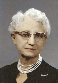
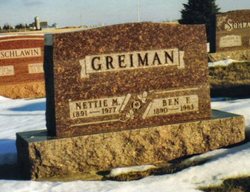
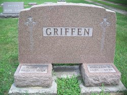
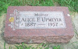
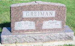
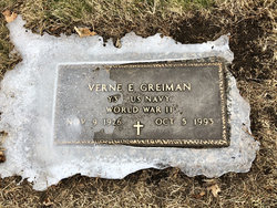
Nettie Mabel Griffen Greiman
| Birth | : | 26 Feb 1891 Hancock County, Iowa, USA |
| Death | : | 1 Apr 1977 Mason City, Cerro Gordo County, Iowa, USA |
| Burial | : | Riverside Cemetery, Farmington, Franklin County, USA |
| Coordinate | : | 44.6587900, -70.1432600 |
| Description | : | Nettie was a teacher in the rural public schools of Hancock County before her marriage. She is remembered for her kind heart and generous nature toward her family. She was interested in gardening and many of her descendants credit her for their love of flowers and gardening. She was an inspiration and created memories for many grandchildren of touring perennials garden, sharing the raspberry patch and ground cherries. The grape arbor was right outside the back door and the sight of it is a memory we hold when we think of grandmother. In 1965 Nettie moved... Read More |
frequently asked questions (FAQ):
-
Where is Nettie Mabel Griffen Greiman's memorial?
Nettie Mabel Griffen Greiman's memorial is located at: Riverside Cemetery, Farmington, Franklin County, USA.
-
When did Nettie Mabel Griffen Greiman death?
Nettie Mabel Griffen Greiman death on 1 Apr 1977 in Mason City, Cerro Gordo County, Iowa, USA
-
Where are the coordinates of the Nettie Mabel Griffen Greiman's memorial?
Latitude: 44.6587900
Longitude: -70.1432600
Family Members:
Parent
Spouse
Siblings
Children
Flowers:
Nearby Cemetories:
1. Riverside Cemetery
Farmington, Franklin County, USA
Coordinate: 44.6587900, -70.1432600
2. Fairview Cemetery
Farmington, Franklin County, USA
Coordinate: 44.6581001, -70.1382980
3. Butterfield Cemetery
Farmington, Franklin County, USA
Coordinate: 44.6520700, -70.1511140
4. Old Burying Ground
Farmington, Franklin County, USA
Coordinate: 44.6638660, -70.1567270
5. Center Burying Ground
Farmington, Franklin County, USA
Coordinate: 44.6712700, -70.1514400
6. Case Cemetery
Farmington, Franklin County, USA
Coordinate: 44.6518900, -70.1247900
7. Belcher Family Graveyard
Farmington, Franklin County, USA
Coordinate: 44.6739269, -70.1488538
8. Red Schoolhouse Cemetery
Franklin County, USA
Coordinate: 44.6314011, -70.1600037
9. Gower Cemetery
Franklin County, USA
Coordinate: 44.6380997, -70.1010971
10. Lowell Cemetery
Franklin County, USA
Coordinate: 44.6292000, -70.1102982
11. Russell Mills Cemetery
Farmington, Franklin County, USA
Coordinate: 44.6695862, -70.1945016
12. North Farmington Cemetery
Farmington, Franklin County, USA
Coordinate: 44.6981000, -70.1794000
13. Sewall Cemetery
Farmington, Franklin County, USA
Coordinate: 44.7001260, -70.0976010
14. Blake Cemetery
Farmington Falls, Franklin County, USA
Coordinate: 44.6258011, -70.0817032
15. East Wilton Cemetery
Wilton, Franklin County, USA
Coordinate: 44.6124700, -70.1878800
16. Holly Cemetery
Farmington, Franklin County, USA
Coordinate: 44.7178001, -70.1371994
17. Temple Village Cemetery
Temple, Franklin County, USA
Coordinate: 44.6831017, -70.2210999
18. Wendall Davis Cemetery
Farmington, Franklin County, USA
Coordinate: 44.7149000, -70.1110200
19. Orchard Hill Cemetery
Temple, Franklin County, USA
Coordinate: 44.6713680, -70.2318424
20. Webster Cemetery
Franklin County, USA
Coordinate: 44.5924988, -70.1241989
21. Zions Hill Cemetery
North Chesterville, Franklin County, USA
Coordinate: 44.5918999, -70.1085968
22. Weeks Mills Cemetery
New Sharon, Franklin County, USA
Coordinate: 44.6732600, -70.0429100
23. Chesterville Hill Cemetery
Chesterville, Franklin County, USA
Coordinate: 44.6060982, -70.0721970
24. Allens Mills Cemetery
Industry, Franklin County, USA
Coordinate: 44.7180800, -70.0780100

