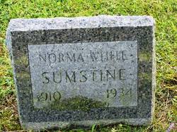
| Birth | : | Jul 1905 Boone County, Iowa, USA |
| Death | : | 9 Sep 1964 Boone, Boone County, Iowa, USA |
| Burial | : | East Shelburne Cemetery, Shelburne, Franklin County, USA |
| Coordinate | : | 42.6105995, -72.6694031 |
| Description | : | Married to Raymond H Mondt. |
frequently asked questions (FAQ):
-
Where is Nettie Marie White Mondt's memorial?
Nettie Marie White Mondt's memorial is located at: East Shelburne Cemetery, Shelburne, Franklin County, USA.
-
When did Nettie Marie White Mondt death?
Nettie Marie White Mondt death on 9 Sep 1964 in Boone, Boone County, Iowa, USA
-
Where are the coordinates of the Nettie Marie White Mondt's memorial?
Latitude: 42.6105995
Longitude: -72.6694031
Family Members:
Parent
Spouse
Siblings
Children
Flowers:
Nearby Cemetories:
1. Hill Cemetery
Shelburne, Franklin County, USA
Coordinate: 42.5984344, -72.6878815
2. North Meadows Cemetery
Greenfield, Franklin County, USA
Coordinate: 42.6171989, -72.6333008
3. South Cemetery
Shelburne, Franklin County, USA
Coordinate: 42.5819016, -72.6699982
4. Shelburne Center Cemetery
Shelburne, Franklin County, USA
Coordinate: 42.5830000, -72.6969600
5. Lower Meadow Cemetery
Greenfield, Franklin County, USA
Coordinate: 42.5945600, -72.6200300
6. Arms Cemetery
Shelburne Falls, Franklin County, USA
Coordinate: 42.6166992, -72.7332993
7. Country Farms Cemetery
Greenfield, Franklin County, USA
Coordinate: 42.6393900, -72.6165400
8. Mater Dolorosa Cemetery
Greenfield, Franklin County, USA
Coordinate: 42.5758000, -72.6165000
9. Calvary Cemetery
Greenfield, Franklin County, USA
Coordinate: 42.5764008, -72.6138992
10. Brick School Cemetery
Colrain, Franklin County, USA
Coordinate: 42.6641998, -72.6660995
11. Cosby Family Cemetery
Shelburne, Franklin County, USA
Coordinate: 42.5566400, -72.6702100
12. Federal Street Cemetery
Greenfield, Franklin County, USA
Coordinate: 42.5941400, -72.5977300
13. Hawks Cemetery
Deerfield, Franklin County, USA
Coordinate: 42.5555992, -72.6583023
14. Old Catholic Cemetery
Greenfield, Franklin County, USA
Coordinate: 42.5795753, -72.6064215
15. Green River Cemetery
Greenfield, Franklin County, USA
Coordinate: 42.5804400, -72.6052500
16. North Shirkshire Cemetery
Conway, Franklin County, USA
Coordinate: 42.5689011, -72.7210999
17. North Cemetery
Deerfield, Franklin County, USA
Coordinate: 42.5635100, -72.6249200
18. Chandler Hill Cemetery
Colrain, Franklin County, USA
Coordinate: 42.6683006, -72.6832962
19. Baptist Cemetery
Deerfield, Franklin County, USA
Coordinate: 42.5555992, -72.6258011
20. High Street Cemetery
Greenfield, Franklin County, USA
Coordinate: 42.6044840, -72.5806660
21. Colrain West Branch Cemetery
Colrain, Franklin County, USA
Coordinate: 42.6671982, -72.7221985
22. East Buckland Cemetery
Buckland, Franklin County, USA
Coordinate: 42.5962500, -72.7610600
23. Old East Buckland Cemetery
Buckland, Franklin County, USA
Coordinate: 42.5969400, -72.7677900
24. Burnham Cemetery
Montague, Franklin County, USA
Coordinate: 42.5875300, -72.5720140


