| Birth | : | 18 Aug 1927 Fairfield, Jefferson County, Iowa, USA |
| Death | : | 22 Feb 2021 Thornton, Adams County, Colorado, USA |
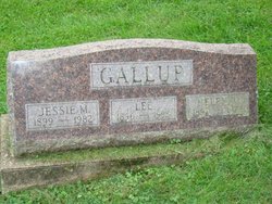
| Burial | : | Fell Cemetery, Libertyville, Jefferson County, USA |
| Coordinate | : | 40.9375000, -92.0772018 |
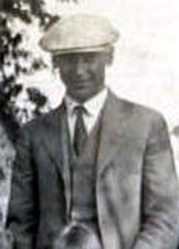
| Description | : | Norma Lee Boslough died peacefully, surrounded by family, on February 22, 2021 in her room at the Memory Care unit of Bonaventure of Thornton, Colorado, after a long, adventurous, and rewarding life filled with love and joy. She was born Norma Lee Gallup on August 18, 1927 in Fairfield, Iowa. She had a happy childhood growing up on a farm and walking every morning through pastures to the one-room Liberty School near Libertyville. Norma graduated from Fairfield High School in 1945 and stayed in touch with classmates throughout her life. She continued her education at Iowa State Teachers College (now... Read More |
frequently asked questions (FAQ):
-
Where is Norma Lee Gallup Boslough's memorial?
Norma Lee Gallup Boslough's memorial is located at: Fell Cemetery, Libertyville, Jefferson County, USA.
-
When did Norma Lee Gallup Boslough death?
Norma Lee Gallup Boslough death on 22 Feb 2021 in Thornton, Adams County, Colorado, USA
-
Where are the coordinates of the Norma Lee Gallup Boslough's memorial?
Latitude: 40.9375000
Longitude: -92.0772018
Family Members:
Parent
Spouse
Siblings
Flowers:
Nearby Cemetories:
1. Fell Cemetery
Libertyville, Jefferson County, USA
Coordinate: 40.9375000, -92.0772018
2. Winsell Cemetery
Fairfield, Jefferson County, USA
Coordinate: 40.9067001, -92.1247025
3. Morgan Burial Plot
Des Moines Township, Jefferson County, USA
Coordinate: 40.9837160, -92.0964340
4. McCleary Cemetery
Jefferson County, USA
Coordinate: 40.9892006, -92.0805969
5. Brethren Cemetery
Batavia, Jefferson County, USA
Coordinate: 40.9768000, -92.1240000
6. Rominger Cemetery
Batavia, Jefferson County, USA
Coordinate: 40.9379000, -92.1503000
7. Jefferson County Poor Farm Cemetery
Libertyville, Jefferson County, USA
Coordinate: 40.9416900, -91.9996200
8. Mount Moriah Cemetery
Douds, Van Buren County, USA
Coordinate: 40.8710000, -92.0860000
9. Cumberland Cemetery
Jefferson County, USA
Coordinate: 40.9248000, -91.9903000
10. Smith Family Cemetery
Libertyville, Jefferson County, USA
Coordinate: 40.9972416, -92.0362857
11. Bethel Cemetery
Birmingham, Van Buren County, USA
Coordinate: 40.8967018, -92.0056000
12. Gregg Cemetery
Jefferson County, USA
Coordinate: 41.0078011, -92.0811005
13. Thompson Cemetery
Jefferson County, USA
Coordinate: 40.9155998, -91.9772034
14. Zion Lutheran Cemetery
Douds, Van Buren County, USA
Coordinate: 40.8563000, -92.0664000
15. Iowaville Cemetery
Selma, Van Buren County, USA
Coordinate: 40.8861008, -92.1628036
16. Batavia Cemetery
Batavia, Jefferson County, USA
Coordinate: 40.9977080, -92.1661100
17. Koons Cemetery
Locust Grove Township, Jefferson County, USA
Coordinate: 41.0286410, -92.0948960
18. Roth Cemetery
Fairfield, Jefferson County, USA
Coordinate: 40.9589005, -91.9574966
19. Clinkinbeard Family Cemetery
Libertyville, Jefferson County, USA
Coordinate: 40.9083300, -91.9583300
20. Coon Cemetery
Jefferson County, USA
Coordinate: 41.0266991, -92.1243973
21. Des Moines River Cemetery
Wapello County, USA
Coordinate: 40.9463000, -92.2042000
22. Passmore Cemetery
Van Buren County, USA
Coordinate: 40.8608017, -92.1549988
23. Courtney Cemetery
Jefferson County, USA
Coordinate: 40.9997711, -92.1788559
24. Memorial Lawn Cemetery
Fairfield, Jefferson County, USA
Coordinate: 41.0068000, -91.9805000


