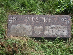
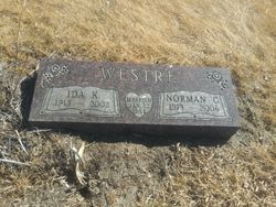
Norman C. Westre
| Birth | : | 24 Jun 1913 Wakonda, Clay County, South Dakota, USA |
| Death | : | 4 Nov 2006 Wakonda, Clay County, South Dakota, USA |
| Burial | : | Pleasant Valley Cemetery, Westerville, Clay County, USA |
| Coordinate | : | 42.9247017, -97.0124969 |
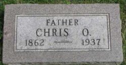
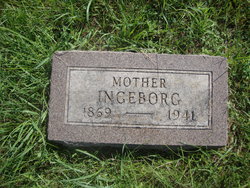
| Description | : | Norman C. Westre, 93, of Wakonda, SD died Saturday, November 4 at the Heritage Manor in Wakonda. Norman was born June 24, 1913 in Wakonda to Chris and Ingleberg Westre. He joined the Army in 1942 serving 31/2 years in Patent's armored division in England and Germany during WWII earning a purple heart. After the war, Norman returned home to the Lodi, SD community and married Ida Anderson in 1954, where they continued to farm until retiring and moving to Wakonda in 1988. Norman was a longtime member of the Pleasant Valley Lutheran Church rural Wakonda. He is survived by a... Read More |
frequently asked questions (FAQ):
-
Where is Norman C. Westre's memorial?
Norman C. Westre's memorial is located at: Pleasant Valley Cemetery, Westerville, Clay County, USA.
-
When did Norman C. Westre death?
Norman C. Westre death on 4 Nov 2006 in Wakonda, Clay County, South Dakota, USA
-
Where are the coordinates of the Norman C. Westre's memorial?
Latitude: 42.9247017
Longitude: -97.0124969
Family Members:
Parent
Spouse
Siblings
Flowers:
Nearby Cemetories:
1. Pleasant Valley Cemetery
Westerville, Clay County, USA
Coordinate: 42.9247017, -97.0124969
2. Mortvedt Cemetery
Clay County, USA
Coordinate: 42.9169006, -97.0028000
3. Bethel Baptist Cemetery
Wakonda, Clay County, USA
Coordinate: 42.9393570, -97.0433520
4. New Lodi Cemetery
Lodi, Clay County, USA
Coordinate: 42.9530983, -97.0417023
5. Saint Patricks Catholic Cemetery
Wakonda, Clay County, USA
Coordinate: 42.9672012, -97.0516968
6. Old Lodi Cemetery
Lodi, Clay County, USA
Coordinate: 42.9757996, -96.9907990
7. Spirit Mound Cemetery
Clay County, USA
Coordinate: 42.8885994, -96.9424973
8. Dalesburg Lutheran Cemetery
Vermillion, Clay County, USA
Coordinate: 42.9389424, -96.9242594
9. Clay Creek Cemetery
Clay County, USA
Coordinate: 42.8516998, -96.9788971
10. Clay Point Cemetery
Prairie Center Township, Clay County, USA
Coordinate: 42.8987700, -96.9065600
11. Union Cemetery
Wakonda, Clay County, USA
Coordinate: 42.9827995, -97.1222000
12. Taylor Cemetery
Clay County, USA
Coordinate: 42.8372002, -97.0785980
13. CJ Anderson Homestead
Riverside Township, Clay County, USA
Coordinate: 43.0214180, -96.9675540
14. Dalesburg Baptist Cemetery
Dalesburg, Clay County, USA
Coordinate: 42.9675102, -96.8850403
15. Meckling Cemetery
Meckling, Clay County, USA
Coordinate: 42.8252983, -97.0919037
16. Riverside-Barton Cemetery
Clay County, USA
Coordinate: 43.0402985, -96.9725037
17. Volin Cemetery
Volin, Yankton County, USA
Coordinate: 42.9672012, -97.1707993
18. Saint Peter Greenfield Cemetery
Vermillion, Clay County, USA
Coordinate: 42.8608017, -96.8644028
19. Gayville Community Cemetery
Gayville, Yankton County, USA
Coordinate: 42.8950005, -97.1800003
20. Rockfield Cemetery
Clay County, USA
Coordinate: 42.9397011, -96.8302994
21. Komstad Cemetery
Dalesburg, Clay County, USA
Coordinate: 43.0417938, -96.9058914
22. Evergreen Cemetery
Meckling, Clay County, USA
Coordinate: 42.7896996, -97.0903015
23. Saint Columbkill Cemetery
Wakonda, Clay County, USA
Coordinate: 43.0642014, -97.0828018
24. Trinity Danish Lutheran Church Cemetery
Gayville, Yankton County, USA
Coordinate: 42.8222008, -97.1605988

