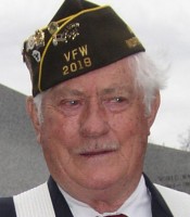
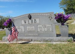
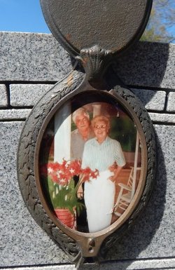
Norman Powell Webb
| Birth | : | 5 Sep 1921 Wilcoe, McDowell County, West Virginia, USA |
| Death | : | 17 Oct 2011 Surry County, North Carolina, USA |
| Burial | : | Rocky Ford Christian Church Cemetery, Cana, Carroll County, USA |
| Coordinate | : | 36.6080580, -80.6857110 |
| Description | : | America lost a defender of liberty and freedom when a true patriot, Norman Powell Webb, passed away on Monday, October 17, 2011. He was born to Robert Lawrence and Amanda Bowman Webb on September 5, 1921, in Wilco, WV, and grew up in Fancy Gap, VA. Norman helped construct the Blue Ridge Parkway Bridge at Fancy Gap and then Fairy Stone Park when he served in the Civilian Conservation Corp. He was very proud of his service to our country during World War II when he served as a Sergeant with the 4th Infantry. Norman and the 4th Infantry were... Read More |
frequently asked questions (FAQ):
-
Where is Norman Powell Webb's memorial?
Norman Powell Webb's memorial is located at: Rocky Ford Christian Church Cemetery, Cana, Carroll County, USA.
-
When did Norman Powell Webb death?
Norman Powell Webb death on 17 Oct 2011 in Surry County, North Carolina, USA
-
Where are the coordinates of the Norman Powell Webb's memorial?
Latitude: 36.6080580
Longitude: -80.6857110
Family Members:
Parent
Spouse
Siblings
Children
Flowers:
Nearby Cemetories:
1. Rocky Ford Christian Church Cemetery
Cana, Carroll County, USA
Coordinate: 36.6080580, -80.6857110
2. Edwards Cemetery
Cana, Carroll County, USA
Coordinate: 36.6154480, -80.6904890
3. Pauls Creek Baptist Church Cemetery
Cana, Carroll County, USA
Coordinate: 36.6072870, -80.6976360
4. Leftwich Family Cemetery
Cana, Carroll County, USA
Coordinate: 36.6211110, -80.6758350
5. Rigney Family Cemetery
Cana, Carroll County, USA
Coordinate: 36.6233650, -80.6806990
6. Wisler Cemetery
Cana, Carroll County, USA
Coordinate: 36.5933240, -80.6756550
7. King Family Cemetery
Cana, Carroll County, USA
Coordinate: 36.6211420, -80.7020900
8. Primitive Baptist Church Of Jesus Christ Cemetery
Cana, Carroll County, USA
Coordinate: 36.5917320, -80.6737210
9. King Cemetery
Cana, Carroll County, USA
Coordinate: 36.6170430, -80.7070900
10. Cana Baptist Church Cemetery
Cana, Carroll County, USA
Coordinate: 36.5920764, -80.6717347
11. Gray Cemetery
Cana, Carroll County, USA
Coordinate: 36.5943420, -80.7034040
12. King-Jones Cemetery
Cana, Carroll County, USA
Coordinate: 36.6224890, -80.7033540
13. Jones-Fleming Cemetery
Carroll County, USA
Coordinate: 36.6012360, -80.7114230
14. Sandy Ridge Primitive Baptist Church Cemetery
Cana, Carroll County, USA
Coordinate: 36.6089030, -80.7131890
15. Bear Trail Baptist Church Cemetery
Cana, Carroll County, USA
Coordinate: 36.6263910, -80.6655010
16. Nathaniel Samuel Jones Family Cemetery
Cana, Carroll County, USA
Coordinate: 36.6047060, -80.7186010
17. Frances Caroline Edwards Family Cemetery
Cana, Carroll County, USA
Coordinate: 36.6089000, -80.7193140
18. Fancy Gap Pentecostal Holiness Church Cemetery
Cana, Carroll County, USA
Coordinate: 36.6227090, -80.7150880
19. Claucy William Hawks Family Cemetery
Cana, Carroll County, USA
Coordinate: 36.6236190, -80.7151980
20. Christopher W Jones Cemetery
Cana, Carroll County, USA
Coordinate: 36.5819178, -80.7000292
21. Thomas Cemetery
Fancy Gap, Carroll County, USA
Coordinate: 36.6312940, -80.6592180
22. Marion Cemetery
Cana, Carroll County, USA
Coordinate: 36.6055090, -80.7284550
23. Oak Ridge Baptist Church Cemetery
Cana, Carroll County, USA
Coordinate: 36.5718760, -80.6800790
24. Vernon-Leonard Cemetery
Cana, Carroll County, USA
Coordinate: 36.5841200, -80.7217600


