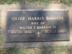
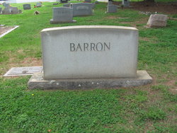
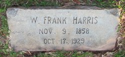
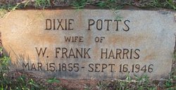
Olive Louisa Harris Barron
| Birth | : | 26 Jul 1896 Fort Mill, York County, South Carolina, USA |
| Death | : | 17 Oct 1985 Fort Mill, York County, South Carolina, USA |
| Burial | : | Waitara Cemetery, Waitara, New Plymouth District, New Zealand |
| Coordinate | : | -38.9953000, 174.2537000 |
| Inscription | : | Wife Of Walter T. Barron Sr |
frequently asked questions (FAQ):
-
Where is Olive Louisa Harris Barron's memorial?
Olive Louisa Harris Barron's memorial is located at: Waitara Cemetery, Waitara, New Plymouth District, New Zealand.
-
When did Olive Louisa Harris Barron death?
Olive Louisa Harris Barron death on 17 Oct 1985 in Fort Mill, York County, South Carolina, USA
-
Where are the coordinates of the Olive Louisa Harris Barron's memorial?
Latitude: -38.9953000
Longitude: 174.2537000
Family Members:
Parent
Spouse
Siblings
Children
Flowers:
Nearby Cemetories:
1. Waitara Cemetery
Waitara, New Plymouth District, New Zealand
Coordinate: -38.9953000, 174.2537000
2. Waipapa Māori Cemetery
Motunui, New Plymouth District, New Zealand
Coordinate: -38.9872800, 174.2702100
3. Tikorangi Cemetery
Tikorangi, New Plymouth District, New Zealand
Coordinate: -39.0291440, 174.2967880
4. O'Carroll Family Cemetery
New Plymouth District, New Zealand
Coordinate: -39.0465210, 174.2651080
5. Huirangi Cemetery
Huirangi, New Plymouth District, New Zealand
Coordinate: -39.0500060, 174.2513380
6. Lepperton Cemetery
Lepperton, New Plymouth District, New Zealand
Coordinate: -39.0575500, 174.2086000
7. Taumata Historic Reserve
Bell Block, New Plymouth District, New Zealand
Coordinate: -39.0478297, 174.1720073
8. St Lukes Churchyard
New Plymouth, New Plymouth District, New Zealand
Coordinate: -39.0332876, 174.1539411
9. St Luke's Methodist Church Cemetery
Bell Block, New Plymouth District, New Zealand
Coordinate: -39.0331650, 174.1537750
10. St. Luke's Cemetery Biblical Garden and Labyrinth
Bell Block, New Plymouth District, New Zealand
Coordinate: -39.0348800, 174.1475250
11. Urenui Cemetery
Urenui, New Plymouth District, New Zealand
Coordinate: -38.9988300, 174.3921800
12. Urenui Pa Urupā
Urenui, New Plymouth District, New Zealand
Coordinate: -38.9909130, 174.4058160
13. Henui Primitive Methodist Burial Ground
Fitzroy, New Plymouth District, New Zealand
Coordinate: -39.0502937, 174.0987132
14. Okoki Pa Urupā
Urenui, New Plymouth District, New Zealand
Coordinate: -38.9869340, 174.4261760
15. Te Henui Cemetery
New Plymouth, New Plymouth District, New Zealand
Coordinate: -39.0558000, 174.0910000
16. Awanui Cemetery
New Plymouth, New Plymouth District, New Zealand
Coordinate: -39.0670040, 174.0972140
17. St Mary's Anglican Churchyard
New Plymouth, New Plymouth District, New Zealand
Coordinate: -39.0601390, 174.0734240
18. Marsland Hill
New Plymouth, New Plymouth District, New Zealand
Coordinate: -39.0607490, 174.0733470
19. Inglewood Cemetery
Inglewood, New Plymouth District, New Zealand
Coordinate: -39.1554140, 174.2145930
20. Taranaki Crematorium
New Plymouth, New Plymouth District, New Zealand
Coordinate: -39.1216900, 174.1149500
21. Mangapouri Cemetery
Egmont Village, New Plymouth District, New Zealand
Coordinate: -39.1347278, 174.1282396
22. McClutchie Tomatu Urupā
New Plymouth District, New Zealand
Coordinate: -38.9600680, 174.4741370
23. Tarata Cemetery
Tarata, New Plymouth District, New Zealand
Coordinate: -39.1496000, 174.3658200
24. Port Taranaki
New Plymouth, New Plymouth District, New Zealand
Coordinate: -39.0615099, 174.0420725

