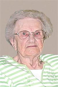
Onettie “Nettie” Mehlhaff Lippert
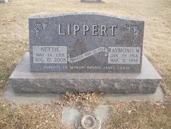
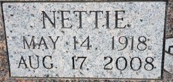
| Birth | : | 14 May 1918 Hutchinson County, South Dakota, USA |
| Death | : | 17 Aug 2008 Mitchell, Davison County, South Dakota, USA |
| Burial | : | Liberty Cemetery, Meriden, Cherokee County, USA |
| Coordinate | : | 42.8368988, -95.6361008 |
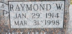
| Inscription | : | MARRIED MAR. 22, 1938 PARENTS OF MYRON, DENNIS, JANET, LARAE |
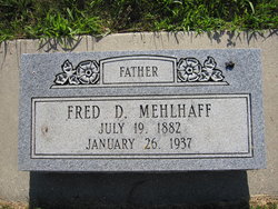
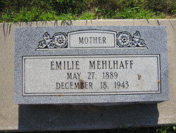
| Description | : | Nettie Lippert died on Sunday, August 17, 2008, at the Firesteel Healthcare Center in Mitchell, South Dakota, at the age of 90 years, 3 months, and 3 days. Nettie was born on May 14, 1918, on a farm northeast of Tripp, South Dakota, to Frederich and Emilie (Koth) Mehlhaff. Nettie married Raymond Lippert on March 22, 1938, in Parkston, South Dakota. They farmed northwest of Tripp until 1983, when they moved into town. She was originally a member of Tripp Baptist Church until 1967, when she joined Danzig Baptist Church. Survivors include four children, Myron Lippert and his friend, Pattie... Read More |
frequently asked questions (FAQ):
-
Where is Onettie “Nettie” Mehlhaff Lippert's memorial?
Onettie “Nettie” Mehlhaff Lippert's memorial is located at: Liberty Cemetery, Meriden, Cherokee County, USA.
-
When did Onettie “Nettie” Mehlhaff Lippert death?
Onettie “Nettie” Mehlhaff Lippert death on 17 Aug 2008 in Mitchell, Davison County, South Dakota, USA
-
Where are the coordinates of the Onettie “Nettie” Mehlhaff Lippert's memorial?
Latitude: 42.8368988
Longitude: -95.6361008
Family Members:
Parent
Spouse
Siblings
Children
Flowers:
Nearby Cemetories:
1. Liberty Cemetery
Meriden, Cherokee County, USA
Coordinate: 42.8368988, -95.6361008
2. Meriden Cemetery
Meriden, Cherokee County, USA
Coordinate: 42.7868996, -95.6425018
3. Cedar Cemetery
Larrabee, Cherokee County, USA
Coordinate: 42.8361015, -95.5346985
4. Mount Calvary Cemetery
Cherokee, Cherokee County, USA
Coordinate: 42.7639008, -95.5847015
5. Memory Gardens
Cherokee, Cherokee County, USA
Coordinate: 42.7778015, -95.5580978
6. Beacon Hollow Cemetery
Cherokee, Cherokee County, USA
Coordinate: 42.7572057, -95.5727856
7. Liberty Cemetery
Calumet, O'Brien County, USA
Coordinate: 42.9241982, -95.5932999
8. George Donohoe Grave Site
Cherokee, Cherokee County, USA
Coordinate: 42.7571850, -95.5704080
9. Oak Hill Cemetery
Cherokee, Cherokee County, USA
Coordinate: 42.7496986, -95.5796967
10. Cherokee County Pioneer Cemetery
Spring Township, Cherokee County, USA
Coordinate: 42.8502998, -95.4906006
11. Maryhill Visitation Church Cemetery
Cherokee, Cherokee County, USA
Coordinate: 42.7360000, -95.6895000
12. Afton Cemetery
Cherokee County, USA
Coordinate: 42.8064003, -95.4863968
13. Marcus-Amherst Cemetery
Marcus, Cherokee County, USA
Coordinate: 42.8161011, -95.8007965
14. Holy Name Cemetery
Marcus, Cherokee County, USA
Coordinate: 42.8163986, -95.8032990
15. Prairie View Cemetery
Paullina, O'Brien County, USA
Coordinate: 42.9688988, -95.7022018
16. West Prairie View Cemetery
Paullina, O'Brien County, USA
Coordinate: 42.9688988, -95.7039032
17. Saint John Cemetery
Germantown, O'Brien County, USA
Coordinate: 42.9566994, -95.7799988
18. Fred Feldman Grave
Waterman Township, O'Brien County, USA
Coordinate: 42.9178590, -95.4433340
19. Friends Cemetery
Mapleside, O'Brien County, USA
Coordinate: 43.0022000, -95.6225000
20. Trinity Lutheran Cemetery
Marcus, Cherokee County, USA
Coordinate: 42.7348000, -95.8208000
21. Waterman Cemetery
Sutherland, O'Brien County, USA
Coordinate: 42.9664001, -95.4847031
22. Calvary Cemetery
Sutherland, O'Brien County, USA
Coordinate: 42.9686012, -95.4858017
23. West Pilot Cemetery
Cherokee County, USA
Coordinate: 42.6674995, -95.5841980
24. Immanuel Lutheran Church Cemetery
Aurelia, Cherokee County, USA
Coordinate: 42.8165000, -95.3885000

