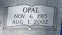
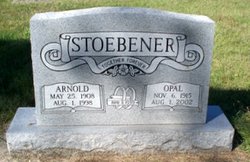
Opal Berniece Elm Stoebener
| Birth | : | 6 Nov 1915 Douglas County, Kansas, USA |
| Death | : | 1 Aug 2002 Lawrence, Douglas County, Kansas, USA |
| Burial | : | St. Andrew's Churchyard, Wiveliscombe, Taunton Deane Borough, England |
| Coordinate | : | 51.0410630, -3.3096850 |
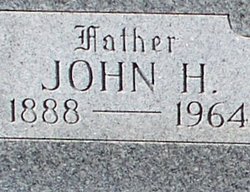
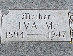
| Description | : | Opal Stoebener Published Saturday, August 03, 2002 'The Topeka Capital-Journal, Topeka KS' http://cjonline.com/stories/080302/obn_stoebener.shtml BALDWIN CITY -- Opal Stoebener, 86, Baldwin City, died Thursday, Aug. 1, 2002, at a Lawrence hospital. She was born Nov. 6, 1915, in rural Douglas County, the daughter of Iva Myrtle Vaughn and John Henry Elm. She was a lifelong resident of Douglas County and attended Range Line Rural School and graduated from Baldwin City High School in 1935. She lived in the Worden area before moving to Baldwin City in 1984. Mrs. Stoebener was a member of Worden United Methodist Church, the United Methodist Women, was formerly the church treasurer... Read More |
frequently asked questions (FAQ):
-
Where is Opal Berniece Elm Stoebener's memorial?
Opal Berniece Elm Stoebener's memorial is located at: St. Andrew's Churchyard, Wiveliscombe, Taunton Deane Borough, England.
-
When did Opal Berniece Elm Stoebener death?
Opal Berniece Elm Stoebener death on 1 Aug 2002 in Lawrence, Douglas County, Kansas, USA
-
Where are the coordinates of the Opal Berniece Elm Stoebener's memorial?
Latitude: 51.0410630
Longitude: -3.3096850
Family Members:
Parent
Spouse
Siblings
Flowers:
Nearby Cemetories:
1. St. Andrew's Churchyard
Wiveliscombe, Taunton Deane Borough, England
Coordinate: 51.0410630, -3.3096850
2. Friends' Burial Ground
Milverton, Taunton Deane Borough, England
Coordinate: 51.0267290, -3.2756778
3. St Bartholomew's Churchyard
Bathealton, Taunton Deane Borough, England
Coordinate: 51.0086320, -3.3130130
4. St. Peter's Churchyard Huish Champflower
Chipstable, Taunton Deane Borough, England
Coordinate: 51.0543700, -3.3580940
5. Saint James Churchyard
Fitzhead, Taunton Deane Borough, England
Coordinate: 51.0481000, -3.2571000
6. All Saints Cemetery
Chipstable, Taunton Deane Borough, England
Coordinate: 51.0354480, -3.3665950
7. St Michael Churchyard
Milverton, Taunton Deane Borough, England
Coordinate: 51.0255170, -3.2537660
8. Saint Mary Magdalene Churchyard
Clatworthy, West Somerset District, England
Coordinate: 51.0698450, -3.3534250
9. Blessed Virgin Mary Churchyard
Brompton Ralph, West Somerset District, England
Coordinate: 51.0830230, -3.3077060
10. St John The Baptist Churchyard
Tolland, Taunton Deane Borough, England
Coordinate: 51.0826570, -3.2856680
11. St Nicholas' Church
Kittisford, Taunton Deane Borough, England
Coordinate: 50.9930799, -3.3149354
12. Saint Peter's Churchyard
Langford Budville, Taunton Deane Borough, England
Coordinate: 50.9988720, -3.2673740
13. Saint James Churchyard
Halse, Taunton Deane Borough, England
Coordinate: 51.0425680, -3.2285430
14. Lydeard St Lawrence Churchyard
Lydeard St Lawrence, Taunton Deane Borough, England
Coordinate: 51.0818820, -3.2462470
15. St. Michael’s Churchyard
Chipstable, Taunton Deane Borough, England
Coordinate: 51.0251300, -3.3982400
16. St. Margaret's Churchyard
Thorne St Margaret, Taunton Deane Borough, England
Coordinate: 50.9821349, -3.2854411
17. St. John The Baptist Churchyard
Ashbrittle, Taunton Deane Borough, England
Coordinate: 50.9837300, -3.3520800
18. Holy Trinity Churchyard
Ash Priors, Taunton Deane Borough, England
Coordinate: 51.0584700, -3.2118200
19. St. Martin de Tours Churchyard
Elworthy, West Somerset District, England
Coordinate: 51.1066110, -3.3113586
20. All Saints Churchyard
Nynehead, Taunton Deane Borough, England
Coordinate: 50.9973924, -3.2298043
21. St. Bartholomew's Churchyard
Oake, Taunton Deane Borough, England
Coordinate: 51.0196440, -3.2094170
22. St. Peter's Churchyard
Wellington, Taunton Deane Borough, England
Coordinate: 50.9736319, -3.3136284
23. St Peter and St Paul Churchyard
Combe Florey, Taunton Deane Borough, England
Coordinate: 51.0735250, -3.2139050
24. Combe Florey Extension Cemetery
Combe Florey, Taunton Deane Borough, England
Coordinate: 51.0733900, -3.2120200

