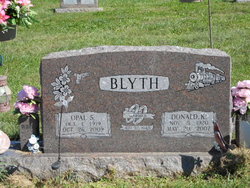
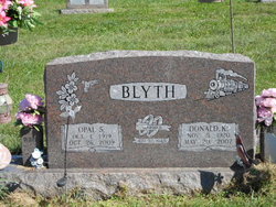
Opal Sharp Blyth
| Birth | : | 1 Oct 1919 Ray County, Missouri, USA |
| Death | : | 26 Oct 2009 Ray County, Missouri, USA |
| Burial | : | Saint Marys Cemetery, Clark, Union County, USA |
| Coordinate | : | 40.6111550, -74.3049710 |
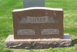
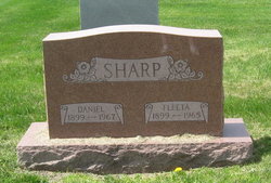
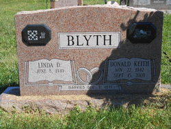
| Description | : | ~~OBITUARY~~ Opal Blyth, 90, of Orrick, passed away Monday, Oct 26. 2009, at her home. Opal was born Oct. 1, 1919 in Ray County, the daughter of Daniel T. Sharp and Fleta Mae (Mills) Sharp. She was a lifelong resident of the Orrick area. Opal married Donald Kent Blyth Nov. 30, 1940; he preceded her in death May 20, 2007. Opal was a self-employed custodian in the community, cleaning various homes and businesses. She was a member of Fleming Baptist Church. Opal was a devoted wife, mother grandmother, great-grandmother and great-great-grandmother. She especially enjoyed spending time... Read More |
frequently asked questions (FAQ):
-
Where is Opal Sharp Blyth's memorial?
Opal Sharp Blyth's memorial is located at: Saint Marys Cemetery, Clark, Union County, USA.
-
When did Opal Sharp Blyth death?
Opal Sharp Blyth death on 26 Oct 2009 in Ray County, Missouri, USA
-
Where are the coordinates of the Opal Sharp Blyth's memorial?
Latitude: 40.6111550
Longitude: -74.3049710
Family Members:
Parent
Spouse
Siblings
Children
Flowers:
Nearby Cemetories:
1. Saint Marys Cemetery
Clark, Union County, USA
Coordinate: 40.6111550, -74.3049710
2. Saint John the Baptist Russian Orthodox Cemetery
Clark, Union County, USA
Coordinate: 40.6105610, -74.3035280
3. Hazel Wood Cemetery
Colonia, Middlesex County, USA
Coordinate: 40.6085260, -74.3062890
4. Saint Gertrude Cemetery and Mausoleum
Colonia, Middlesex County, USA
Coordinate: 40.5978920, -74.3073420
5. Rahway Cemetery
Rahway, Union County, USA
Coordinate: 40.6175003, -74.2866974
6. New Dover Cemetery
Edison, Middlesex County, USA
Coordinate: 40.5854630, -74.3401660
7. Cranford United Methodist Church Memorial Garden
Cranford, Union County, USA
Coordinate: 40.6507190, -74.3039990
8. Clover Leaf Memorial Park
Woodbridge, Middlesex County, USA
Coordinate: 40.5698200, -74.2948700
9. Calvary Lutheran Church Memorial Garden
Cranford, Union County, USA
Coordinate: 40.6570380, -74.3067660
10. Mount Lebanon Cemetery
Iselin, Middlesex County, USA
Coordinate: 40.5630989, -74.3186035
11. Holy Trinity Churchyard
Westfield, Union County, USA
Coordinate: 40.6474500, -74.3490700
12. First United Methodist Church Memorial Garden
Westfield, Union County, USA
Coordinate: 40.6503330, -74.3506050
13. Saint Paul Episcopal Church Memorial Garden
Westfield, Union County, USA
Coordinate: 40.6540210, -74.3447450
14. Trinity Episcopal Church Cemetery
Woodbridge, Middlesex County, USA
Coordinate: 40.5636000, -74.2724800
15. Presbyterian Church Burial Grounds
Westfield, Union County, USA
Coordinate: 40.6537018, -74.3479004
16. Rosedale and Rosehill Cemetery
Linden, Union County, USA
Coordinate: 40.6315910, -74.2381270
17. First Presbyterian Churchyard
Woodbridge, Middlesex County, USA
Coordinate: 40.5620200, -74.2731500
18. Woodbridge Memorial Gardens Mausoleum
Woodbridge, Middlesex County, USA
Coordinate: 40.5546840, -74.3106110
19. Mount Calvary Cemetery
Linden, Union County, USA
Coordinate: 40.6335983, -74.2350006
20. Fairview Cemetery
Westfield, Union County, USA
Coordinate: 40.6674995, -74.3300018
21. Beth Israel Cemetery
Woodbridge, Middlesex County, USA
Coordinate: 40.5516357, -74.3113937
22. Little Quaker Churchyard
Woodbridge, Middlesex County, USA
Coordinate: 40.5541140, -74.2786500
23. Fanwood Presbyterian Church Memorial Garden
Fanwood, Union County, USA
Coordinate: 40.6394080, -74.3822010
24. Hillside Cemetery
Scotch Plains, Union County, USA
Coordinate: 40.6049995, -74.3930969

