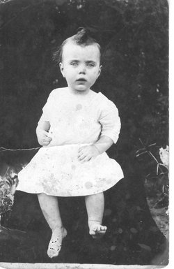
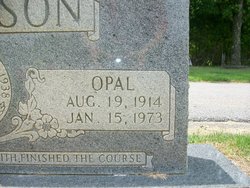
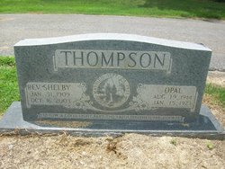
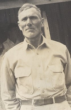
Opal Wylie Thompson
| Birth | : | 19 Aug 1914 Crockett County, Tennessee, USA |
| Death | : | 15 Jan 1973 Gibson County, Tennessee, USA |
| Burial | : | Oakdale Cemetery, Irvine, Estill County, USA |
| Coordinate | : | 37.6894000, -83.9566500 |
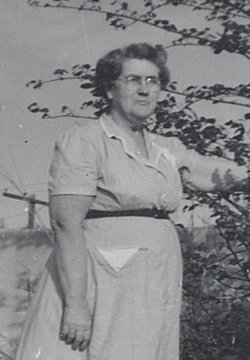
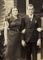
| Description | : | Opal Thompson Mrs. Opal Wylie Thompson, 58, died Monday morning at her residence at 197 High, Dyer. Funeral services were held Tuesday at 2 p.m. at the Greer Chapel Methodist Church. Internment followed in Bellvernon Cemetery in Friendship. Survivors include her husband, the Rev. Shelby Thompson; one daughter, Mrs. Kenneth McEwen; one son, Jimmy Thompson, all of Dyer; her mother, Mrs. Julia Wylie, Mylan; one sister, Mrs. Velma Stewart, Mylan; two brothers, Earl Wylie, Decaturville, Tennessee, and Burl Wylie, Mylan; and four grandchildren. Johnson Funeral Home of Newbern had charge of the arrangements. From the memory book of Mrs. Gladys Hassell Transcriber does not know the... Read More |
frequently asked questions (FAQ):
-
Where is Opal Wylie Thompson's memorial?
Opal Wylie Thompson's memorial is located at: Oakdale Cemetery, Irvine, Estill County, USA.
-
When did Opal Wylie Thompson death?
Opal Wylie Thompson death on 15 Jan 1973 in Gibson County, Tennessee, USA
-
Where are the coordinates of the Opal Wylie Thompson's memorial?
Latitude: 37.6894000
Longitude: -83.9566500
Family Members:
Parent
Spouse
Siblings
Children
Flowers:
Nearby Cemetories:
1. Oakdale Cemetery
Irvine, Estill County, USA
Coordinate: 37.6894000, -83.9566500
2. Pasley Cemetery
Irvine, Estill County, USA
Coordinate: 37.7005615, -83.9738922
3. South Irvine Cemetery
Irvine, Estill County, USA
Coordinate: 37.6833130, -83.9790330
4. Scholl Family Burial Grounds
Irvine, Estill County, USA
Coordinate: 37.7016600, -83.9770100
5. Old Irvine Cemetery
Irvine, Estill County, USA
Coordinate: 37.7024470, -83.9762410
6. Griffin Cemetery #1
Irvine, Estill County, USA
Coordinate: 37.7033005, -83.9332962
7. Miller Cemetery #1
Irvine, Estill County, USA
Coordinate: 37.7089005, -83.9325027
8. Miller Cemetery #2
Estill County, USA
Coordinate: 37.7094440, -83.9330560
9. West Irvine Cemetery
Irvine, Estill County, USA
Coordinate: 37.7017800, -83.9909200
10. Cow Creek Cemetery
Estill County, USA
Coordinate: 37.7066994, -83.9122009
11. Chestnut Stand Cemetery
Irvine, Estill County, USA
Coordinate: 37.7273700, -83.9432700
12. Brinegar Cemetery
Estill County, USA
Coordinate: 37.7192001, -83.9167023
13. Estill County Cemetery
Estill County, USA
Coordinate: 37.7327995, -83.9642029
14. McGeorge Cemetery
Estill County, USA
Coordinate: 37.6624985, -84.0010986
15. Lackey Cemetery
Estill County, USA
Coordinate: 37.7332993, -83.9681015
16. Barnes Cemetery #1
Estill County, USA
Coordinate: 37.6749992, -83.9028015
17. Marcum Cemetery #1
Irvine, Estill County, USA
Coordinate: 37.7347100, -83.9617300
18. Johnson Cemetery
Estill County, USA
Coordinate: 37.6869011, -84.0164032
19. Masters Cemetery
Estill County, USA
Coordinate: 37.7318993, -83.9858017
20. Cool Springs Cemetery
Estill County, USA
Coordinate: 37.7397003, -83.9580994
21. Pea Ridge Cemetery
Irvine, Estill County, USA
Coordinate: 37.6867460, -84.0213080
22. Hall Abney
Irvine, Estill County, USA
Coordinate: 37.6865120, -84.0215440
23. Hardy Cemetery
Irvine, Estill County, USA
Coordinate: 37.6897690, -84.0236120
24. Mount Tabor Cemetery
Millers Creek, Estill County, USA
Coordinate: 37.6691190, -83.8922250

