
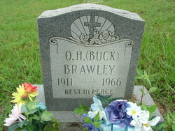
Otho Herbert Greer “Buck” Brawley
| Birth | : | 25 Jan 1911 Missouri, USA |
| Death | : | Jul 1966 Shannon County, Missouri, USA |
| Burial | : | Springfield Cemetery, Delta, Keokuk County, USA |
| Coordinate | : | 41.3386002, -92.3531036 |
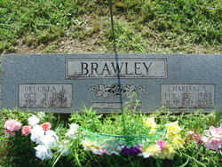
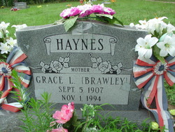
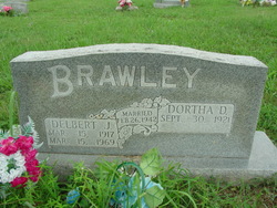
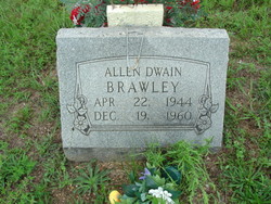
| Description | : | Father - Charles Newton Brawley (1883-1953) Mother - Drucilla Floyd Rook (1886-1984) He had married twice: MARRIAGE: M1 - Nora Faye Smith Marriage - 20 Aug 1937 in Carter County Missouri Child with Nora: Dale Brawley B 11 Feb 1938 in Missouri D 15 Feb 1938 in Missouri MARRIAGE: M2 - Maudie Lee Vaugh Marriage - 1939 Children: ( 3 ) Son Ronald Dean Brawley B 29 Mar 1942 in Shannon County Missouri D 7 Oct 2010 in Winona, Shannon, Missouri Allen Dwain 'Shorty' Brawley B 22 Apr 1944... Read More |
frequently asked questions (FAQ):
-
Where is Otho Herbert Greer “Buck” Brawley's memorial?
Otho Herbert Greer “Buck” Brawley's memorial is located at: Springfield Cemetery, Delta, Keokuk County, USA.
-
When did Otho Herbert Greer “Buck” Brawley death?
Otho Herbert Greer “Buck” Brawley death on Jul 1966 in Shannon County, Missouri, USA
-
Where are the coordinates of the Otho Herbert Greer “Buck” Brawley's memorial?
Latitude: 41.3386002
Longitude: -92.3531036
Family Members:
Parent

Spouse

Siblings
Children

Flowers:


Nearby Cemetories:
1. Springfield Cemetery
Delta, Keokuk County, USA
Coordinate: 41.3386002, -92.3531036
2. Garrett Cemetery
Delta, Keokuk County, USA
Coordinate: 41.3368988, -92.3277969
3. Hewitt Cemetery
Delta, Keokuk County, USA
Coordinate: 41.3277874, -92.3807409
4. Waddell Cemetery
Keokuk County, USA
Coordinate: 41.3574982, -92.3874969
5. Kensler Cemetery
Delta, Keokuk County, USA
Coordinate: 41.2994003, -92.3246994
6. Turner-Tinkerville-Wapalo Cemetery
Rose Hill, Mahaska County, USA
Coordinate: 41.3426130, -92.4177970
7. Rice Cemetery
What Cheer, Keokuk County, USA
Coordinate: 41.3793983, -92.3891983
8. Highland Cemetery
What Cheer, Keokuk County, USA
Coordinate: 41.3936005, -92.3407974
9. Saint Josephs Cemetery
What Cheer, Keokuk County, USA
Coordinate: 41.4007988, -92.3300018
10. Tioga Cemetery
Rose Hill, Mahaska County, USA
Coordinate: 41.2933006, -92.4156036
11. Bethel Cemetery
Delta, Keokuk County, USA
Coordinate: 41.2794000, -92.3107000
12. McFarlan Cemetery
What Cheer, Keokuk County, USA
Coordinate: 41.4085999, -92.3371964
13. Hopewell Cemetery
Rose Hill, Mahaska County, USA
Coordinate: 41.3502998, -92.4494019
14. Humes Cemetery
Thornburg, Keokuk County, USA
Coordinate: 41.4085999, -92.2968979
15. Saint Martin Evangelical Lutheran Cemetery
Keokuk County, USA
Coordinate: 41.4100075, -92.2971268
16. Bedwell Cemetery
Monroe Township, Mahaska County, USA
Coordinate: 41.3667400, -92.4637400
17. Johnson Cemetery
Sigourney, Keokuk County, USA
Coordinate: 41.3824997, -92.2485962
18. Indianapolis Cemetery
Rose Hill, Mahaska County, USA
Coordinate: 41.4053001, -92.4364014
19. Jackson Cemetery
Rose Hill, Mahaska County, USA
Coordinate: 41.3191986, -92.4730988
20. Conner Cemetery
Sigourney, Keokuk County, USA
Coordinate: 41.3050003, -92.2380981
21. Pleasant Grove Cemetery
Sigourney, Keokuk County, USA
Coordinate: 41.3405991, -92.2200012
22. Coal Creek Cemetery
What Cheer, Keokuk County, USA
Coordinate: 41.4392520, -92.3843340
23. Old Rose Hill Cemetery
Rose Hill, Mahaska County, USA
Coordinate: 41.3209991, -92.4929962
24. Tinsley Cemetery
Mahaska County, USA
Coordinate: 41.3941994, -92.4783020