
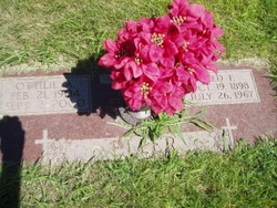
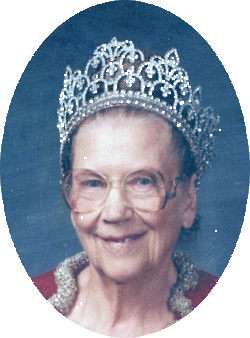
Ottillie A. Gondring Eller
| Birth | : | 21 Feb 1904 Richland, Colfax County, Nebraska, USA |
| Death | : | 2 Sep 2000 Columbus, Platte County, Nebraska, USA |
| Burial | : | Apostolic V Christian Cemetery, Kossuth County, USA |
| Coordinate | : | 42.9630870, -94.4238290 |
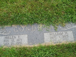
| Description | : | Daughter of William & Helen (Hoppe) Gondring. Married to Fred Eller on 5-14-1925. |
frequently asked questions (FAQ):
-
Where is Ottillie A. Gondring Eller's memorial?
Ottillie A. Gondring Eller's memorial is located at: Apostolic V Christian Cemetery, Kossuth County, USA.
-
When did Ottillie A. Gondring Eller death?
Ottillie A. Gondring Eller death on 2 Sep 2000 in Columbus, Platte County, Nebraska, USA
-
Where are the coordinates of the Ottillie A. Gondring Eller's memorial?
Latitude: 42.9630870
Longitude: -94.4238290
Family Members:
Parent

Spouse

Siblings
Flowers:


Nearby Cemetories:
1. Apostolic V Christian Cemetery
Kossuth County, USA
Coordinate: 42.9630870, -94.4238290
2. West Bend Cemetery
West Bend, Palo Alto County, USA
Coordinate: 42.9590000, -94.4548000
3. Garfield Township Cemetery
Kossuth County, USA
Coordinate: 42.9947000, -94.4080000
4. Riverside Cemetery
West Bend, Palo Alto County, USA
Coordinate: 42.9512000, -94.5120000
5. Union Cemetery
Ottosen, Humboldt County, USA
Coordinate: 42.8879128, -94.3792496
6. Omer-Thorsen Farm Cemetery
Ottosen, Humboldt County, USA
Coordinate: 42.8735742, -94.4085743
7. Saint Pauls Lutheran Cemetery
Whittemore, Kossuth County, USA
Coordinate: 43.0530014, -94.4135971
8. Riverside Cemetery
Fern Valley Township, Palo Alto County, USA
Coordinate: 43.0200000, -94.5220000
9. Lincoln Cemetery
West Bend, Palo Alto County, USA
Coordinate: 42.9596842, -94.5602466
10. McKnight Cemetery
Bode, Humboldt County, USA
Coordinate: 42.8635100, -94.4055600
11. Plainview Cemetery
Whittemore, Kossuth County, USA
Coordinate: 43.0667000, -94.4091720
12. Saint Michaels Catholic Cemetery
Whittemore, Kossuth County, USA
Coordinate: 43.0827000, -94.4322500
13. Old Rolfe Cemetery
Rolfe, Pocahontas County, USA
Coordinate: 42.8403511, -94.4764175
14. Saint Olaf Churchyard Cemetery
Bode, Humboldt County, USA
Coordinate: 42.8653600, -94.2858300
15. Saint Olaf Lutheran Cemetery
Bode, Humboldt County, USA
Coordinate: 42.8628000, -94.2773000
16. Ellington Cemetery
Ellington Township, Palo Alto County, USA
Coordinate: 42.9377000, -94.6240400
17. Saint Joseph Catholic Cemetery
Saint Joseph, Kossuth County, USA
Coordinate: 42.9119137, -94.2296852
18. Powhatan Cemetery
Plover, Pocahontas County, USA
Coordinate: 42.8557396, -94.5801773
19. Saint Margarets Cemetery
Rolfe, Pocahontas County, USA
Coordinate: 42.8164978, -94.5307465
20. Laurel Hill Cemetery
Irvington, Kossuth County, USA
Coordinate: 43.0017014, -94.1939011
21. Clinton-Garfield Cemetery
Rolfe, Pocahontas County, USA
Coordinate: 42.8055300, -94.5202500
22. Saint John's Lutheran Cemetery
Fairfield Township, Palo Alto County, USA
Coordinate: 43.1265000, -94.5017000
23. Union Cemetery
Livermore, Humboldt County, USA
Coordinate: 42.8778000, -94.2177963
24. East Lawn Cemetery
Algona, Kossuth County, USA
Coordinate: 43.0583000, -94.2249985