
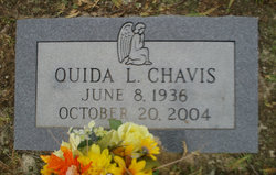
Ouida Long Chavis
| Birth | : | 8 Jun 1936 Lexington County, South Carolina, USA |
| Death | : | 20 Oct 2004 |
| Burial | : | Hillcrest Cemetery, Gallup, McKinley County, USA |
| Coordinate | : | 35.5214005, -108.7525024 |
| Description | : | Obituary on funeral come web site: West Columbia - Services for Ouida Long Chavis, 68, of West Columbia, will be held at 2pm Friday in Zion Lutheran Church, officiated by Rev. John Derrick and Rev. Alice D. Klatt. Burial at St. Paul Lutheran Church Cemetery, Gilbert, SC, immediately following the service. The family request that in lieu of flowers donations be made to Zion Lutheran Church Building Fund, 226 Corley Mill Road, Lexington, SC 29072. Thompson Funeral Home of Lexington is in charge. Mrs. Chavis died Wednesday, October 20, 2004. Born in Lexington, SC, she was the daughter of the... Read More |
frequently asked questions (FAQ):
-
Where is Ouida Long Chavis's memorial?
Ouida Long Chavis's memorial is located at: Hillcrest Cemetery, Gallup, McKinley County, USA.
-
When did Ouida Long Chavis death?
Ouida Long Chavis death on 20 Oct 2004 in
-
Where are the coordinates of the Ouida Long Chavis's memorial?
Latitude: 35.5214005
Longitude: -108.7525024
Family Members:
Parent
Spouse
Siblings
Flowers:


Nearby Cemetories:
1. Hillcrest Cemetery
Gallup, McKinley County, USA
Coordinate: 35.5214005, -108.7525024
2. Cathedral of the Sacred Heart Crypt
Gallup, McKinley County, USA
Coordinate: 35.5258450, -108.7357330
3. Gallup State Veterans Cemetery
Gallup, McKinley County, USA
Coordinate: 35.5358950, -108.7086870
4. Gallup City Cemetery
Gallup, McKinley County, USA
Coordinate: 35.5016320, -108.8400220
5. Sunset Memorial Park
Gallup, McKinley County, USA
Coordinate: 35.5028770, -108.8443640
6. Rehoboth Mission Cemetery
Rehoboth, McKinley County, USA
Coordinate: 35.5286640, -108.6540990
7. Pinehaven Cemetery
Pinehaven, McKinley County, USA
Coordinate: 35.3518982, -108.7268982
8. Torreon Cemetery
McKinley County, USA
Coordinate: 35.3722000, -108.5250015
9. McGaffey Cemetery
McGaffey, McKinley County, USA
Coordinate: 35.3703003, -108.5224991
10. Pine Tree Cemetery
Vanderwagen, McKinley County, USA
Coordinate: 35.2658410, -108.7540080
11. Pinedale Cemetery
Pinedale, McKinley County, USA
Coordinate: 35.6113860, -108.4498390
12. Family Cemeteries
Apache County, USA
Coordinate: 35.3595472, -109.0677722
13. Bowman Memorial Park
Apache County, USA
Coordinate: 35.4192009, -109.1072006
14. Saint Michaels Cemetery
Saint Michaels, Apache County, USA
Coordinate: 35.6431900, -109.0986900
15. Navajo Veterans Cemetery
Fort Defiance, Apache County, USA
Coordinate: 35.7226600, -109.0553390
16. Lone Pine Cemetery
Mexican Springs, McKinley County, USA
Coordinate: 35.8258018, -108.8771973
17. Good Shepherd Mission Cemetery
Fort Defiance, Apache County, USA
Coordinate: 35.7429100, -109.0705680
18. Tohatchi Cemetery
Tohatchi, McKinley County, USA
Coordinate: 35.8626080, -108.7582670
19. Mormon Colony Cemetery
Cibola County, USA
Coordinate: 35.1730995, -108.4661026
20. Standing Rock Cemetery
Standing Rock, McKinley County, USA
Coordinate: 35.8014560, -108.3614590
21. New Houck Veteran and Community Cemetery
Houck, Apache County, USA
Coordinate: 35.2791732, -109.1883917
22. Ramah Cemetery
Ramah, McKinley County, USA
Coordinate: 35.1258011, -108.4950027
23. Houck Community Cemetery
Houck, Apache County, USA
Coordinate: 35.2851790, -109.2333750
24. Thoreau Cemetery
Thoreau, McKinley County, USA
Coordinate: 35.4082450, -108.2066630