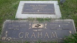
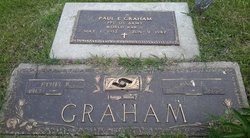
Paul Eldred Graham
| Birth | : | 1 May 1912 Lincoln Township, Ringgold County, Iowa, USA |
| Death | : | 9 Jun 1982 Dallas County, Texas, USA |
| Burial | : | St. Andrew's Churchyard, East Lexham, Breckland Borough, England |
| Coordinate | : | 52.7200190, 0.7522010 |
frequently asked questions (FAQ):
-
Where is Paul Eldred Graham's memorial?
Paul Eldred Graham's memorial is located at: St. Andrew's Churchyard, East Lexham, Breckland Borough, England.
-
When did Paul Eldred Graham death?
Paul Eldred Graham death on 9 Jun 1982 in Dallas County, Texas, USA
-
Where are the coordinates of the Paul Eldred Graham's memorial?
Latitude: 52.7200190
Longitude: 0.7522010
Family Members:
Parent
Spouse
Siblings
Flowers:
Nearby Cemetories:
1. St. Andrew's Churchyard
East Lexham, Breckland Borough, England
Coordinate: 52.7200190, 0.7522010
2. All Saints Churchyard
Litcham, Breckland Borough, England
Coordinate: 52.7234690, 0.7924000
3. St. Andrew's Churchyard
Great Dunham, Breckland Borough, England
Coordinate: 52.6976440, 0.7715910
4. St. Mary and All Saints Churchyard
Newton by Castle Acre, Breckland Borough, England
Coordinate: 52.7061570, 0.7085120
5. St. Mary the Virgin Churchyard
Beeston, Breckland Borough, England
Coordinate: 52.7024310, 0.8016150
6. St Mary's Churchyard
Beeston, Breckland Borough, England
Coordinate: 52.7021517, 0.8015756
7. St. Margaret's Churchyard
Little Dunham, Breckland Borough, England
Coordinate: 52.6822220, 0.7551140
8. St James The Great Churchyard
Castle Acre, Kings Lynn and West Norfolk Borough, England
Coordinate: 52.7023700, 0.6861000
9. All Saints Churchyard
Great Fransham, Breckland Borough, England
Coordinate: 52.6823000, 0.8077000
10. St George's Churchyard
Southacre, Breckland Borough, England
Coordinate: 52.6962700, 0.6769400
11. St. Mary's Churchyard
Sporle, Breckland Borough, England
Coordinate: 52.6694460, 0.7342630
12. St. Mary's Churchyard
Little Fransham, Breckland Borough, England
Coordinate: 52.6747700, 0.8118700
13. St. John the Baptist Churchyard
Mileham, Breckland Borough, England
Coordinate: 52.7397340, 0.8454250
14. St. Andrew and St. Peter Churchyard
Longham, Breckland Borough, England
Coordinate: 52.7085850, 0.8586910
15. All Saints Churchyard
Necton, Breckland Borough, England
Coordinate: 52.6530040, 0.7756430
16. All Saints Churchyard
West Acre, Kings Lynn and West Norfolk Borough, England
Coordinate: 52.7055420, 0.6339660
17. Exton Hall Roman Catholic Chapel
Exton, Rutland Unitary Authority, England
Coordinate: 52.6925000, 0.6382000
18. St Mary's Churchyard
Great Massingham, Kings Lynn and West Norfolk Borough, England
Coordinate: 52.7743160, 0.6652320
19. St Mary Churchyard
East Raynham, North Norfolk District, England
Coordinate: 52.7946530, 0.7864240
20. All Saint's Churchyard
Helhoughton, North Norfolk District, England
Coordinate: 52.8038639, 0.7713343
21. All Saints Churchyard
Oxwick, Breckland Borough, England
Coordinate: 52.7917630, 0.8316080
22. St Edmund Churchyard
Horningtoft, Breckland Borough, England
Coordinate: 52.7706250, 0.8681250
23. St. Andrew's Churchyard
Little Massingham, Kings Lynn and West Norfolk Borough, England
Coordinate: 52.7851360, 0.6566710
24. St. Mary's Churchyard
East Bilney, Breckland Borough, England
Coordinate: 52.7382920, 0.8961870


