
| Memorials | : | 0 |
| Location | : | Exton, Rutland Unitary Authority, England |
| Phone | : | 01572 812208 |
| Website | : | www.extonpark.co.uk/ |
| Coordinate | : | 52.6925000, 0.6382000 |
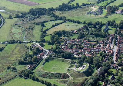
| Description | : | The private crypt is not open to the public. It is located in the Roman Catholic Chapel and attached to the Viscount Campden's estate in Exton Park. |
frequently asked questions (FAQ):
-
Where is Exton Hall Roman Catholic Chapel?
Exton Hall Roman Catholic Chapel is located at Cottesmore Road Exton, Rutland Unitary Authority ,Rutland , LE15 8ANEngland.
-
Exton Hall Roman Catholic Chapel cemetery's updated grave count on graveviews.com?
0 memorials
-
Where are the coordinates of the Exton Hall Roman Catholic Chapel?
Latitude: 52.6925000
Longitude: 0.6382000
Nearby Cemetories:
1. All Saints Churchyard
West Acre, Kings Lynn and West Norfolk Borough, England
Coordinate: 52.7055420, 0.6339660
2. St. Mary's Churchyard
Narford, Breckland Borough, England
Coordinate: 52.6928740, 0.6095600
3. St George's Churchyard
Southacre, Breckland Borough, England
Coordinate: 52.6962700, 0.6769400
4. St James The Great Churchyard
Castle Acre, Kings Lynn and West Norfolk Borough, England
Coordinate: 52.7023700, 0.6861000
5. All Saints Churchyard
Narborough, Breckland Borough, England
Coordinate: 52.6861790, 0.5825420
6. Saint Mary Churchyard
East Walton, Kings Lynn and West Norfolk Borough, England
Coordinate: 52.7146600, 0.5787130
7. St. Mary and All Saints Churchyard
Newton by Castle Acre, Breckland Borough, England
Coordinate: 52.7061570, 0.7085120
8. St. Mary's Churchyard
Gayton Thorpe, Kings Lynn and West Norfolk Borough, England
Coordinate: 52.7362310, 0.5832080
9. St. Mary Magdalene Churchyard
Pentney, Kings Lynn and West Norfolk Borough, England
Coordinate: 52.6950490, 0.5449550
10. St Cecilia's Churchyard
West Bilney, Kings Lynn and West Norfolk Borough, England
Coordinate: 52.7079810, 0.5395750
11. St. Mary's Churchyard
Sporle, Breckland Borough, England
Coordinate: 52.6694460, 0.7342630
12. St Nicholas Churchyard
Gayton, Kings Lynn and West Norfolk Borough, England
Coordinate: 52.7435700, 0.5615600
13. St. Margaret's Churchyard
Little Dunham, Breckland Borough, England
Coordinate: 52.6822220, 0.7551140
14. Marham Cemetery
Marham, Kings Lynn and West Norfolk Borough, England
Coordinate: 52.6622260, 0.5287110
15. St. Andrew's Churchyard
East Lexham, Breckland Borough, England
Coordinate: 52.7200190, 0.7522010
16. Pentney Priory
Pentney, Kings Lynn and West Norfolk Borough, England
Coordinate: 52.6803890, 0.5143830
17. Holy Trinity Churchyard
Marham, Kings Lynn and West Norfolk Borough, England
Coordinate: 52.6583800, 0.5236900
18. St. Andrew's Churchyard
Great Dunham, Breckland Borough, England
Coordinate: 52.6976440, 0.7715910
19. St. Mary the Virgin Churchyard
Beachamwell, Breckland Borough, England
Coordinate: 52.6178670, 0.5844730
20. St Mary's Churchyard
Great Massingham, Kings Lynn and West Norfolk Borough, England
Coordinate: 52.7743160, 0.6652320
21. All Saints Churchyard
East Winch, Kings Lynn and West Norfolk Borough, England
Coordinate: 52.7175790, 0.5025340
22. All Saints Churchyard
Cockley Cley, Breckland Borough, England
Coordinate: 52.6057860, 0.6446070
23. All Saints Churchyard
Ashwicken, Kings Lynn and West Norfolk Borough, England
Coordinate: 52.7404620, 0.5146680
24. Saint Botolphs Churchyard
Grimston, Kings Lynn and West Norfolk Borough, England
Coordinate: 52.7671870, 0.5509690