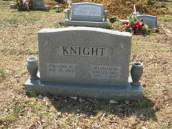
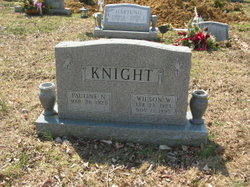
Pauline Nichols Knight
| Birth | : | 26 Mar 1925 |
| Death | : | 9 Sep 2013 |
| Burial | : | Saint Ignatius Cemetery, Hickory, Harford County, USA |
| Coordinate | : | 39.5736008, -76.3550034 |
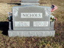
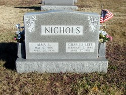
| Description | : | Pauline Nichols Knight 26 Mar 1925 – 9 Sep 2013 March 26, 1925 September 9, 2013 Resided in Forest Hill, MD Mass of Christian Burial Friday, September 13, 2013 12:00 PM Pauline Nichols Knight, age 88, of Forest Hill, MD, passed away on September 9, 2013 at her home. Born in Emmorton, MD, she was the daughter of the late Charles Leff Nichols Sr. and Alma Leota Owens Nichols, and wife of the late Wilson Walker Knight Sr. Born and raised in Harford County she was a graduate... Read More |
frequently asked questions (FAQ):
-
Where is Pauline Nichols Knight's memorial?
Pauline Nichols Knight's memorial is located at: Saint Ignatius Cemetery, Hickory, Harford County, USA.
-
When did Pauline Nichols Knight death?
Pauline Nichols Knight death on 9 Sep 2013 in
-
Where are the coordinates of the Pauline Nichols Knight's memorial?
Latitude: 39.5736008
Longitude: -76.3550034
Family Members:
Parent
Spouse
Siblings
Children
Flowers:
Nearby Cemetories:
1. Saint Ignatius Cemetery
Hickory, Harford County, USA
Coordinate: 39.5736008, -76.3550034
2. Hickory Baptist Church Cemetery
Forest Hill, Harford County, USA
Coordinate: 39.5779600, -76.3452000
3. Dallam-Webster Family Cemetery
Bel Air, Harford County, USA
Coordinate: 39.5722400, -76.3339100
4. Mount Tabor United Methodist Church Cemetery
Bel Air, Harford County, USA
Coordinate: 39.5863991, -76.3308029
5. Forest Friends Meeting Cemetery
Forest Hill, Harford County, USA
Coordinate: 39.5837212, -76.3816452
6. Welcome Home Freewill Baptist Church Cemetery
Bel Air, Harford County, USA
Coordinate: 39.5689000, -76.3244800
7. Christ Church Cemetery
Forest Hill, Harford County, USA
Coordinate: 39.5744019, -76.3874969
8. Bel Air Memorial Gardens
Bel Air, Harford County, USA
Coordinate: 39.5468000, -76.3617900
9. Southampton Farm Cemetery
Southampton, Harford County, USA
Coordinate: 39.5486600, -76.3344700
10. Emmanuel Episcopal Church Columbarium
Bel Air, Harford County, USA
Coordinate: 39.5396020, -76.3546890
11. Centre Cemetery
Forest Hill, Harford County, USA
Coordinate: 39.5963700, -76.3899500
12. Saint Matthews Lutheran Church Columbarium
Bel Air, Harford County, USA
Coordinate: 39.5440430, -76.3268720
13. Deer Creek United Methodist Church Cemetery
Forest Hill, Harford County, USA
Coordinate: 39.6130981, -76.3522034
14. Baptist View Regular Baptist Church Cemetery
Forest Hill, Harford County, USA
Coordinate: 39.6012900, -76.3964900
15. Mount Zion United Methodist Church Cemetery
Bel Air, Harford County, USA
Coordinate: 39.5475006, -76.3086014
16. Heavenly Waters Cemetery
Harford County, USA
Coordinate: 39.5293999, -76.3747025
17. David Lee Family Cemetery
Bel Air, Harford County, USA
Coordinate: 39.5319958, -76.3866033
18. Fairview Cemetery
Harford County, USA
Coordinate: 39.5805900, -76.4212600
19. Clarks United Methodist Church Cemetery
Bel Air, Harford County, USA
Coordinate: 39.6036100, -76.3004600
20. Thomas Run Church Cemetery
Churchville, Harford County, USA
Coordinate: 39.5935000, -76.2923300
21. Oak Grove Baptist Church Cemetery
Bel Air, Harford County, USA
Coordinate: 39.5548300, -76.2880200
22. Christ Our King Presbyterian Church
Bel Air, Harford County, USA
Coordinate: 39.5165851, -76.3313539
23. Asbury Cemetery
Churchville, Harford County, USA
Coordinate: 39.5505981, -76.2686005
24. William Watters United Methodist Church Cemetery
Coopstown, Harford County, USA
Coordinate: 39.6011009, -76.4408035

