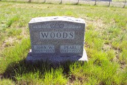
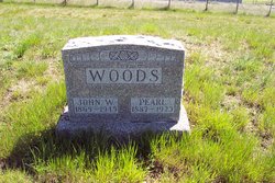
Pearl Marian McAllister Woods
| Birth | : | 20 Jun 1887 Carter County, Kentucky, USA |
| Death | : | 18 Jun 1925 Petroleum County, Montana, USA |
| Burial | : | Winnett City Cemetery, Petroleum County, USA |
| Coordinate | : | 47.0181900, -108.3558400 |
frequently asked questions (FAQ):
-
Where is Pearl Marian McAllister Woods's memorial?
Pearl Marian McAllister Woods's memorial is located at: Winnett City Cemetery, Petroleum County, USA.
-
When did Pearl Marian McAllister Woods death?
Pearl Marian McAllister Woods death on 18 Jun 1925 in Petroleum County, Montana, USA
-
Where are the coordinates of the Pearl Marian McAllister Woods's memorial?
Latitude: 47.0181900
Longitude: -108.3558400
Family Members:
Parent
Spouse
Siblings
Children
Flowers:
Nearby Cemetories:
1. Winnett City Cemetery
Petroleum County, USA
Coordinate: 47.0181900, -108.3558400
2. Cat Creek Cemetery
Winnett, Petroleum County, USA
Coordinate: 47.0816394, -108.1663116
3. Ashley Cemetery
Winnett, Petroleum County, USA
Coordinate: 47.1666775, -108.2810059
4. Flatwillow Cemetery
Flatwillow, Petroleum County, USA
Coordinate: 46.8288640, -108.4004060
5. Wallview Cemetery
Flatwillow, Petroleum County, USA
Coordinate: 46.7644970, -108.4732787
6. Flat Willow Hutterite Colony Cemetery
Flatwillow Colony, Musselshell County, USA
Coordinate: 46.7236654, -108.4919070
7. Grass Range Cemetery
Grass Range, Fergus County, USA
Coordinate: 47.0229190, -108.8119200
8. Gilfeather Cemetery
Benzien, Garfield County, USA
Coordinate: 47.2348310, -107.9476920
9. Ford's Creek Colony
Grass Range, Fergus County, USA
Coordinate: 47.1306882, -108.9208610
10. Ayers Ranch Hutterite Cemetery
Grass Range, Fergus County, USA
Coordinate: 47.0507550, -108.9514013
11. Ayers Ranch Colony Cemetery
Ayers Ranch Colony, Fergus County, USA
Coordinate: 47.0508000, -108.9514000
12. Coon Cemetery
Garfield County, USA
Coordinate: 47.3263790, -107.9323320
13. Forest Grove Cemetery
Fergus County, USA
Coordinate: 46.9909000, -109.0752000
14. Roy Cemetery
Roy, Fergus County, USA
Coordinate: 47.3404680, -108.9571450
15. Minerva Creek Cemetery
Roundup, Musselshell County, USA
Coordinate: 46.7216370, -108.9834300
16. Wolf Cemetery
Garfield County, USA
Coordinate: 47.1528015, -107.5924988
17. Melstone Cemetery
Melstone, Musselshell County, USA
Coordinate: 46.6068993, -107.8507996
18. Kilby Butte Hutterite Cemetery
Musselshell County, USA
Coordinate: 46.4746694, -108.3626017
19. Musselshell Cemetery
Musselshell County, USA
Coordinate: 46.4989014, -108.0888977
20. Fort Maginnis Cemetery
Giltedge, Fergus County, USA
Coordinate: 47.1869011, -109.1461029
21. Roundup Cemetery
Roundup, Musselshell County, USA
Coordinate: 46.4558560, -108.5060570
22. Great Divide Cemetery
Piper, Fergus County, USA
Coordinate: 46.9978000, -109.2046000
23. Giltedge Cemetery
Giltedge, Fergus County, USA
Coordinate: 47.1323800, -109.2033700
24. Miracle Lodge Number 84 Cemetery
Klein, Musselshell County, USA
Coordinate: 46.4185220, -108.5611120

