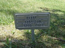
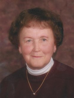
Perry Garrison
| Birth | : | 8 Feb 1935 Noble Township, Wabash County, Indiana, USA |
| Death | : | 29 May 2007 Fort Wayne, Allen County, Indiana, USA |
| Burial | : | Saint Pauls Baptist Church Cemetery, Kearneysville, Jefferson County, USA |
| Coordinate | : | 39.3798904, -77.8862839 |
| Plot | : | Sec 200, lot 707, sp 2 |
| Description | : | OBITUARY - Plain Dealer, Wabash (IN) Perry Garrison, 72, rural Wabash, died at 9:05 a.m. Tuesday, May 29, 2007, at Lutheran Hospital here. He was born Feb. 8, 1935, in Wabash to Walter and Alice (Overman) Garrison. He married Joyce French in Wabash on June 17, 1969, and she survives. Perry was a 1953 Noble High School graduate, and owned and operated Model Machine and Tool in Wabash 20 years. He was a member of College Corner Brethren Church and enjoyed assembling and flying model airplanes. He also was a U.S. Army veteran. He is also survived by a daughter, Jennifer Garrison, Wabash; two... Read More |
frequently asked questions (FAQ):
-
Where is Perry Garrison's memorial?
Perry Garrison's memorial is located at: Saint Pauls Baptist Church Cemetery, Kearneysville, Jefferson County, USA.
-
When did Perry Garrison death?
Perry Garrison death on 29 May 2007 in Fort Wayne, Allen County, Indiana, USA
-
Where are the coordinates of the Perry Garrison's memorial?
Latitude: 39.3798904
Longitude: -77.8862839
Family Members:
Parent
Spouse
Siblings
Nearby Cemetories:
1. Saint Pauls Baptist Church Cemetery
Kearneysville, Jefferson County, USA
Coordinate: 39.3798904, -77.8862839
2. Hart-Lucas Cemetery
Kearneysville, Jefferson County, USA
Coordinate: 39.3783640, -77.8875400
3. Kearneysville Methodist Cemetery
Kearneysville, Jefferson County, USA
Coordinate: 39.3768294, -77.8817933
4. Kearneysville Presbyterian Church Cemetery
Kearneysville, Jefferson County, USA
Coordinate: 39.3885155, -77.8876572
5. Border Gibbons Cemetery
Kearneysville, Jefferson County, USA
Coordinate: 39.3908923, -77.8800182
6. White Rocks / Lemen Farm Cemetery
Kearneysville, Jefferson County, USA
Coordinate: 39.3940000, -77.8790000
7. White Rocks / Lemen Farm Cemetery
Kearneysville, Jefferson County, USA
Coordinate: 39.3940000, -77.8790000
8. Willow View Blackford Slave Cemetery
Kearneysville, Jefferson County, USA
Coordinate: 39.3607854, -77.8725668
9. VanMetre Cemetery
Baker Heights, Berkeley County, USA
Coordinate: 39.3962631, -77.9160690
10. Snyder-Hendricks Graveyard
Shepherdstown, Jefferson County, USA
Coordinate: 39.3764000, -77.8490000
11. New Hopewell Cemetery
Kearneysville, Jefferson County, USA
Coordinate: 39.3520000, -77.8990000
12. Mount Zion Baptist Church Cemetery
Martinsburg, Berkeley County, USA
Coordinate: 39.3889000, -77.9237700
13. Glenburnie - Lafferty Graveyard
Shenandoah Junction, Jefferson County, USA
Coordinate: 39.3890610, -77.8461530
14. John Burns Cemetery
Baker Heights, Berkeley County, USA
Coordinate: 39.4137639, -77.8947583
15. Johnsontown Cemetery
Johnsontown, Jefferson County, USA
Coordinate: 39.3404200, -77.8910700
16. Pleasant View Memory Gardens
Martinsburg, Berkeley County, USA
Coordinate: 39.4121000, -77.9163000
17. Saint Bartholomews Episcopal Church Cemetery
Leetown, Jefferson County, USA
Coordinate: 39.3553800, -77.9269900
18. Elk Branch Presbyterian Church Cemetery
Duffields, Jefferson County, USA
Coordinate: 39.3647614, -77.8279190
19. Ridenour Cemetery
Duffields, Jefferson County, USA
Coordinate: 39.3644414, -77.8280193
20. Poor Farm Cemetery
Kearneysville, Jefferson County, USA
Coordinate: 39.3345590, -77.9094350
21. Beth Haven Baptist Church Cemetery
Berkeley County, USA
Coordinate: 39.4278800, -77.8983400
22. Darke-Engle-Ronemous Cemetery
Shenandoah Junction, Jefferson County, USA
Coordinate: 39.3544250, -77.8314400
23. Lucas Family Cemetery at Elmwood
Shepherdstown, Jefferson County, USA
Coordinate: 39.3957200, -77.8149300
24. Shepherd Family Cemetery
Douglas Grove, Berkeley County, USA
Coordinate: 39.4180940, -77.9543920


